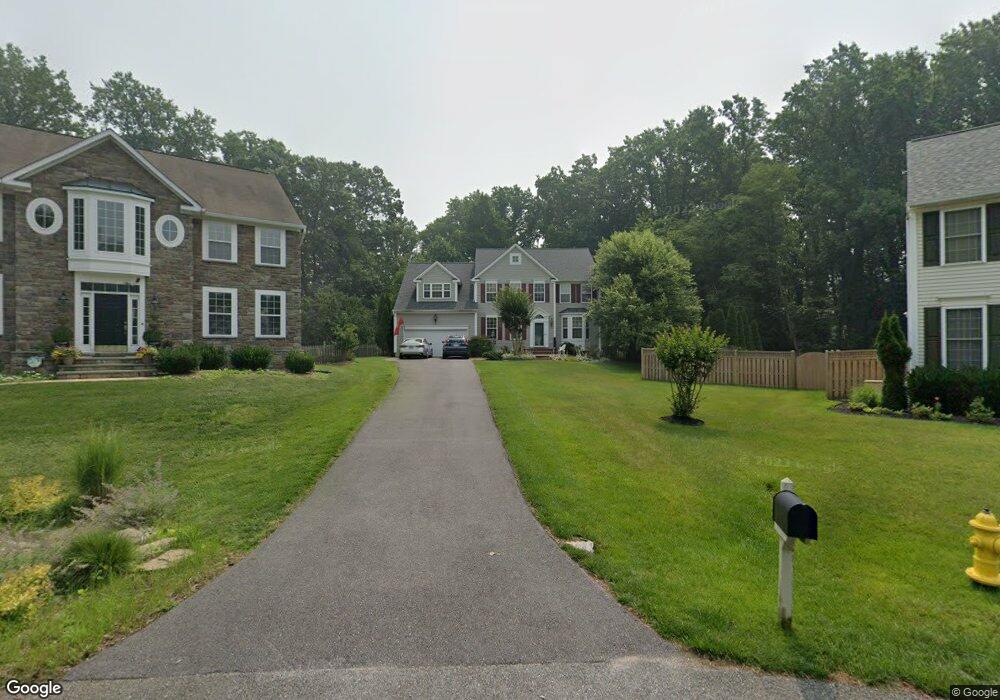
601 St Mulberry Ct Annapolis, MD 21401
Parole NeighborhoodEstimated Value: $866,160 - $1,098,000
--
Bed
3
Baths
3,341
Sq Ft
$286/Sq Ft
Est. Value
About This Home
This home is located at 601 St Mulberry Ct, Annapolis, MD 21401 and is currently estimated at $955,540, approximately $286 per square foot. 601 St Mulberry Ct is a home located in Anne Arundel County with nearby schools including Rolling Knolls Elementary School, Wiley H. Bates Middle School, and Annapolis High School.
Ownership History
Date
Name
Owned For
Owner Type
Purchase Details
Closed on
Dec 9, 2020
Sold by
Rosacker Ralph C and Rosacker Amy S
Bought by
Rosacker Ralph C and Rosacker Amy S
Current Estimated Value
Home Financials for this Owner
Home Financials are based on the most recent Mortgage that was taken out on this home.
Original Mortgage
$470,000
Outstanding Balance
$418,440
Interest Rate
2.7%
Mortgage Type
New Conventional
Estimated Equity
$537,100
Purchase Details
Closed on
Jul 19, 2000
Sold by
Wynstone Development Llc
Bought by
Rosacker Amy S and Rosacker Ii Ralph C
Create a Home Valuation Report for This Property
The Home Valuation Report is an in-depth analysis detailing your home's value as well as a comparison with similar homes in the area
Home Values in the Area
Average Home Value in this Area
Purchase History
| Date | Buyer | Sale Price | Title Company |
|---|---|---|---|
| Rosacker Ralph C | -- | Freestate Ttl Svcs Of Annapo | |
| Rosacker Amy S | $398,080 | -- |
Source: Public Records
Mortgage History
| Date | Status | Borrower | Loan Amount |
|---|---|---|---|
| Open | Rosacker Ralph C | $470,000 |
Source: Public Records
Tax History Compared to Growth
Tax History
| Year | Tax Paid | Tax Assessment Tax Assessment Total Assessment is a certain percentage of the fair market value that is determined by local assessors to be the total taxable value of land and additions on the property. | Land | Improvement |
|---|---|---|---|---|
| 2025 | $6,566 | $689,100 | $248,700 | $440,400 |
| 2024 | $6,566 | $649,067 | $0 | $0 |
| 2023 | $6,372 | $609,033 | $0 | $0 |
| 2022 | $5,936 | $569,000 | $248,700 | $320,300 |
| 2021 | $11,681 | $569,000 | $248,700 | $320,300 |
| 2020 | $5,709 | $569,000 | $248,700 | $320,300 |
| 2019 | $11,053 | $588,100 | $268,700 | $319,400 |
| 2018 | $5,963 | $588,100 | $268,700 | $319,400 |
| 2017 | $5,330 | $588,100 | $0 | $0 |
| 2016 | -- | $631,900 | $0 | $0 |
| 2015 | -- | $593,100 | $0 | $0 |
| 2014 | -- | $554,300 | $0 | $0 |
Source: Public Records
Map
Nearby Homes
- 2000 Phillips Terrace Unit 4
- 668 N Bestgate Rd
- 2075 Old Admiral Ct
- 345 Dubois Rd
- 343 Dubois Rd
- 341 Dubois Rd
- 2026 Gov Thomas Bladen Way Unit 102
- 2026 Gov Thomas Bladen Way Unit 203
- 2000 Monticello Dr
- 228 Dubois Rd
- 553 Choptank Cove Ct
- 1715 Porters Hill Rd
- 173 Williams Dr
- 1860 Lindamoor Ln
- 319 Epping Way
- 522 Epping Forest Rd
- 29 Collison Rd
- 8 Dorsey Ave
- 27 Dorsey Ave
- 349 Dewey Dr
- 600 St Mulberry Ct
- 603 St Mulberry Ct
- 31 Lincoln Pkwy
- 605 St Mulberry Ct
- 602 St Mulberry Ct
- 604 St Mulberry Ct
- 32 Lincoln Pkwy
- 29 Lincoln Pkwy
- 30 Lincoln Pkwy
- 606 St Mulberry Ct
- 33 Lincoln Pkwy
- 609 St Mulberry Ct
- 24 Lincoln Pkwy
- 34 Lincoln Pkwy
- 610 St Mulberry Ct
- 28 Lincoln Pkwy
- 13 Lincoln Pkwy
- 25 Lincoln Pkwy
- 714 Bestgate Rd
- 601 Silkwood Ct