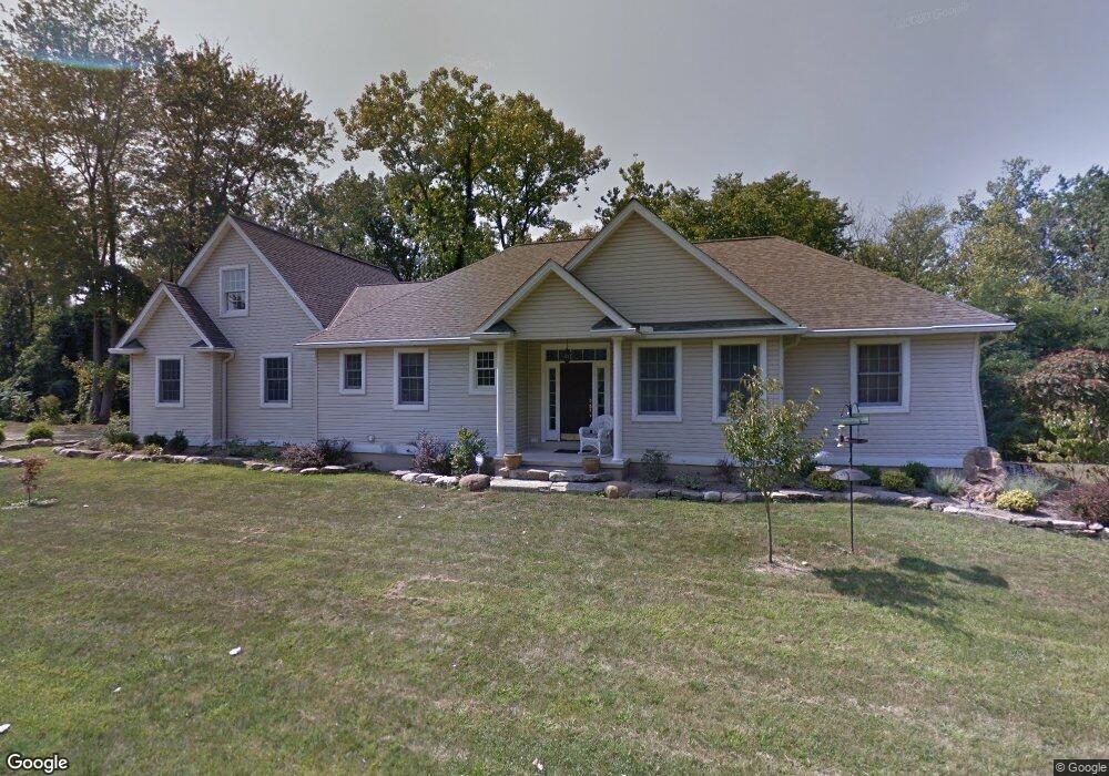
6014 N Dewey Rd Amherst, OH 44001
Estimated Value: $287,000 - $324,832
3
Beds
3
Baths
1,770
Sq Ft
$170/Sq Ft
Est. Value
About This Home
This home is located at 6014 N Dewey Rd, Amherst, OH 44001 and is currently estimated at $300,208, approximately $169 per square foot. 6014 N Dewey Rd is a home located in Lorain County with nearby schools including Powers Elementary School, Walter G. Nord Middle School, and Amherst Junior High School.
Ownership History
Date
Name
Owned For
Owner Type
Purchase Details
Closed on
Mar 27, 2004
Sold by
Thompson Eleanor G
Bought by
Thomas Christopher S and Thomas Cynthia L
Current Estimated Value
Home Financials for this Owner
Home Financials are based on the most recent Mortgage that was taken out on this home.
Original Mortgage
$212,700
Interest Rate
5.74%
Mortgage Type
Purchase Money Mortgage
Create a Home Valuation Report for This Property
The Home Valuation Report is an in-depth analysis detailing your home's value as well as a comparison with similar homes in the area
Home Values in the Area
Average Home Value in this Area
Purchase History
| Date | Buyer | Sale Price | Title Company |
|---|---|---|---|
| Thomas Christopher S | $46,000 | Homescore Title |
Source: Public Records
Mortgage History
| Date | Status | Borrower | Loan Amount |
|---|---|---|---|
| Closed | Thomas Christopher S | $212,700 |
Source: Public Records
Tax History Compared to Growth
Tax History
| Year | Tax Paid | Tax Assessment Tax Assessment Total Assessment is a certain percentage of the fair market value that is determined by local assessors to be the total taxable value of land and additions on the property. | Land | Improvement |
|---|---|---|---|---|
| 2024 | $3,863 | $95,564 | $21,543 | $74,022 |
| 2023 | $4,453 | $92,894 | $19,380 | $73,514 |
| 2022 | $4,269 | $92,894 | $19,380 | $73,514 |
| 2021 | $4,280 | $92,894 | $19,380 | $73,514 |
| 2020 | $4,197 | $80,850 | $16,870 | $63,980 |
| 2019 | $4,113 | $80,850 | $16,870 | $63,980 |
| 2018 | $4,157 | $80,850 | $16,870 | $63,980 |
| 2017 | $4,180 | $76,730 | $14,460 | $62,270 |
| 2016 | $4,213 | $76,730 | $14,460 | $62,270 |
| 2015 | $4,190 | $76,730 | $14,460 | $62,270 |
| 2014 | $3,935 | $71,720 | $13,520 | $58,200 |
| 2013 | $3,948 | $71,720 | $13,520 | $58,200 |
Source: Public Records
Map
Nearby Homes
- Pine w/ Full Basement Plan at Quarry Creek
- Poplar Plan at Quarry Creek
- 1273 Spruce Tree Ln
- 127 Tropicana Ave
- 60 Flamingo Ave
- 117 Caesars Cir
- 351 Rockridge Dr
- 41 Flamingo Ave
- 8 Riviera Ave
- 6394 Balsam Dr
- 922 Sharondale Dr
- 135 Ridgeland Dr
- 45305 N Ridge Rd
- 1819 Gloucester Dr
- 5614 S Nantucket Dr
- 707 Greenlawn Dr
- 105 N Woodhill Dr
- 726 Sunrise Dr
- 0 Cooper Foster Park Rd Unit 5129838
- 1423 Narragansett Blvd
- 1278 Spruce Tree Ln
- 488 Rock Creek Run
- 486 Rock Creek Run
- 484 Rock Creek Run
- 6024 N Dewey Rd
- 1274 Spruce Tree Ln
- 490 Rock Creek Run
- 490 Rock Creek Run
- Rockridge Dr
- 109 Rockridge Dr
- 1270 Spruce Tree Ln
- 1281 Spruce Tree Ln
- 437 Quarry Creek Dr Unit 36142099
- 472 Rock Creek Run
- 483 Rock Creek Run
- 1260 Spruce Tree Ln
- 6050 N Dewey Rd
- 1250 Spruce Tree Ln
- 477 Rock Creek Run
- 489 Rock Creek Run