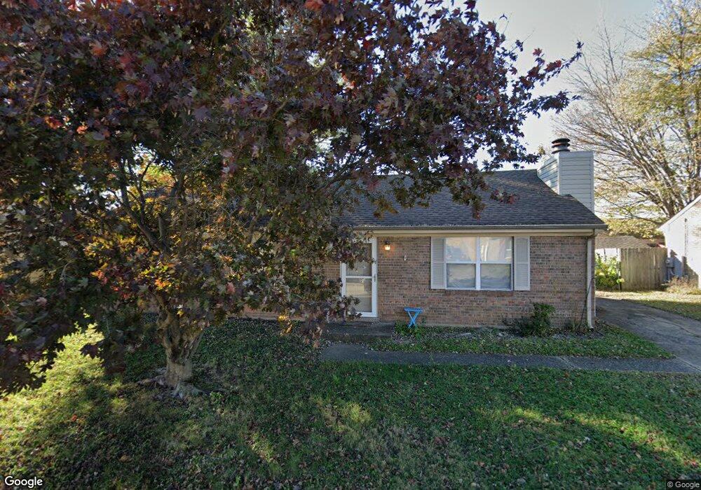
6016 Highgrade Dr Louisville, KY 40291
Estimated Value: $212,000 - $227,907
3
Beds
1
Bath
1,125
Sq Ft
$196/Sq Ft
Est. Value
About This Home
This home is located at 6016 Highgrade Dr, Louisville, KY 40291 and is currently estimated at $220,477, approximately $195 per square foot. 6016 Highgrade Dr is a home located in Jefferson County with nearby schools including Wilt Elementary School, Fern Creek Elementary School, and Wheeler Elementary School.
Ownership History
Date
Name
Owned For
Owner Type
Purchase Details
Closed on
Apr 22, 2005
Sold by
Brown Penny G and Brown Daniel H
Bought by
Thorne Diane L
Current Estimated Value
Home Financials for this Owner
Home Financials are based on the most recent Mortgage that was taken out on this home.
Original Mortgage
$97,650
Outstanding Balance
$48,780
Interest Rate
5.29%
Mortgage Type
Unknown
Estimated Equity
$171,697
Purchase Details
Closed on
Oct 10, 2002
Sold by
Tucker Philip Lee and Tucker Kristen
Bought by
Crozier Penny G
Create a Home Valuation Report for This Property
The Home Valuation Report is an in-depth analysis detailing your home's value as well as a comparison with similar homes in the area
Home Values in the Area
Average Home Value in this Area
Purchase History
| Date | Buyer | Sale Price | Title Company |
|---|---|---|---|
| Thorne Diane L | $108,500 | None Available | |
| Crozier Penny G | $95,000 | -- |
Source: Public Records
Mortgage History
| Date | Status | Borrower | Loan Amount |
|---|---|---|---|
| Open | Thorne Diane L | $97,650 |
Source: Public Records
Tax History Compared to Growth
Tax History
| Year | Tax Paid | Tax Assessment Tax Assessment Total Assessment is a certain percentage of the fair market value that is determined by local assessors to be the total taxable value of land and additions on the property. | Land | Improvement |
|---|---|---|---|---|
| 2024 | $1,421 | $124,070 | $33,000 | $91,070 |
| 2023 | $1,462 | $124,070 | $33,000 | $91,070 |
| 2022 | $1,467 | $102,060 | $22,000 | $80,060 |
| 2021 | $1,291 | $102,060 | $22,000 | $80,060 |
| 2020 | $1,201 | $102,060 | $22,000 | $80,060 |
| 2019 | $1,106 | $102,060 | $22,000 | $80,060 |
| 2018 | $1,093 | $102,060 | $22,000 | $80,060 |
| 2017 | $1,071 | $102,060 | $22,000 | $80,060 |
| 2013 | $1,085 | $108,500 | $17,000 | $91,500 |
Source: Public Records
Map
Nearby Homes
- 8016 Edsel Ln
- 7912 Edsel Ln
- 5901 S Watterson Trail
- 5609 Braulio Ct
- 5812 Lake Erie Dr
- Aspire Plan at The Trails at Belmond
- Mitchell Plan at The Trails at Belmond
- Mercer Plan at The Trails at Belmond
- Hampton Plan at The Trails at Belmond
- 8308 Lake Superior Dr
- 8408 Lake Superior Dr
- 6216 Hudson Creek Dr
- 6312 Big Ben Dr
- 5807 Hudson Lake Dr
- 7814 Fern Gardens Way Unit 20
- 4815 Hames Trace Unit 37
- 6305 Labor Ln
- 6243 Hudson Creek Dr
- 6106 Hudson Creek Dr
- 4801 Hames Trace Unit 43
- 6018 Highgrade Dr
- 6014 Highgrade Dr
- 6019 Highliner Dr
- 6021 Highliner Dr
- 6015 Highgrade Dr
- 6017 Highliner Dr
- 6013 Highgrade Dr
- 6017 Highgrade Dr
- 6020 Highgrade Dr
- 6012 Highgrade Dr
- 6011 Highgrade Dr
- 6023 Highliner Dr
- 6015 Highliner Dr
- 6020 Highliner Dr
- 6010 Highplace Dr
- 6019 Highgrade Dr
- 6008 Highplace Dr
- 6022 Highliner Dr
- 6018 Highliner Dr
- 6012 Highplace Dr