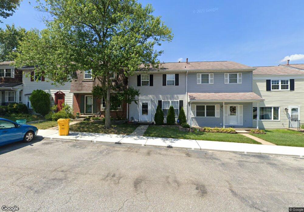
602 Millshire Dr Millersville, MD 21108
Estimated Value: $232,000 - $299,000
--
Bed
2
Baths
816
Sq Ft
$329/Sq Ft
Est. Value
About This Home
This home is located at 602 Millshire Dr, Millersville, MD 21108 and is currently estimated at $268,088, approximately $328 per square foot. 602 Millshire Dr is a home located in Anne Arundel County with nearby schools including Rippling Woods Elementary School, Old Mill Middle School North, and Old Mill High School.
Ownership History
Date
Name
Owned For
Owner Type
Purchase Details
Closed on
Aug 1, 2016
Bought by
Mccarthy Rosemary
Current Estimated Value
Home Financials for this Owner
Home Financials are based on the most recent Mortgage that was taken out on this home.
Original Mortgage
$171,914
Outstanding Balance
$137,167
Interest Rate
3.48%
Estimated Equity
$130,921
Purchase Details
Closed on
Mar 6, 1992
Sold by
Buckreis Robert E 3Rd
Bought by
Mccarthy Michael J
Home Financials for this Owner
Home Financials are based on the most recent Mortgage that was taken out on this home.
Original Mortgage
$87,500
Interest Rate
8.85%
Purchase Details
Closed on
Sep 20, 1989
Sold by
Shilow Phillis C
Bought by
Buckreis Robert E 3Rd
Home Financials for this Owner
Home Financials are based on the most recent Mortgage that was taken out on this home.
Original Mortgage
$77,450
Interest Rate
10.05%
Create a Home Valuation Report for This Property
The Home Valuation Report is an in-depth analysis detailing your home's value as well as a comparison with similar homes in the area
Home Values in the Area
Average Home Value in this Area
Purchase History
| Date | Buyer | Sale Price | Title Company |
|---|---|---|---|
| Mccarthy Rosemary | -- | -- | |
| Mccarthy Michael J | $89,900 | -- | |
| Buckreis Robert E 3Rd | $78,000 | -- |
Source: Public Records
Mortgage History
| Date | Status | Borrower | Loan Amount |
|---|---|---|---|
| Open | Mccarthy Rosemary | $171,914 | |
| Closed | Mccarthy Rosemary | -- | |
| Previous Owner | Mccarthy Michael J | $87,500 | |
| Previous Owner | Buckreis Robert E 3Rd | $77,450 |
Source: Public Records
Tax History Compared to Growth
Tax History
| Year | Tax Paid | Tax Assessment Tax Assessment Total Assessment is a certain percentage of the fair market value that is determined by local assessors to be the total taxable value of land and additions on the property. | Land | Improvement |
|---|---|---|---|---|
| 2025 | $1,939 | $224,733 | -- | -- |
| 2024 | $1,939 | $201,900 | $115,000 | $86,900 |
| 2023 | $1,878 | $195,600 | $0 | $0 |
| 2022 | $1,978 | $189,300 | $0 | $0 |
| 2021 | $3,434 | $183,000 | $100,000 | $83,000 |
| 2020 | $1,648 | $179,133 | $0 | $0 |
| 2019 | $3,246 | $175,267 | $0 | $0 |
| 2018 | $1,738 | $171,400 | $85,000 | $86,400 |
| 2017 | $1,519 | $161,300 | $0 | $0 |
| 2016 | -- | $151,200 | $0 | $0 |
| 2015 | -- | $141,100 | $0 | $0 |
| 2014 | -- | $141,100 | $0 | $0 |
Source: Public Records
Map
Nearby Homes
- 2664 Carver Rd
- 584 Brightview Dr
- 8253 Rupert Rd S
- 8251 Rupert Rd S
- 8224 Bernard Dr N
- 529 Chalet Dr W
- 525 Old Mill Rd
- 15 Tremont Dr
- 565 Belmawr Place
- 518 Kenora Dr
- 8218 Sherbrooke Ct
- 8297 Kippis Rd
- 8333 Kippis Rd
- 8421 Norwood Dr
- 8262 Kippis Rd
- 460 Marianna Dr
- 8011 Horicon Point Dr
- 601 Brightwood Rd
- 0 Connors Ln
- 266 Nathan Way
- 604 Millshire Dr
- 606 Millshire Dr
- 610 Millshire Dr
- 456 Worthington Rd
- 458 Worthington Rd
- 454 Worthington Rd
- 612 Millshire Dr
- 452 Worthington Rd
- 460 Worthington Rd
- 450 Worthington Rd
- 448 Worthington Rd
- 462 Worthington Rd
- 616 Millshire Dr
- 464 Worthington Rd
- 598 Millshire Dr
- 596 Millshire Dr
- 594 Millshire Dr
- 592 Millshire Dr
- 466 Worthington Rd
- 590 Millshire Dr