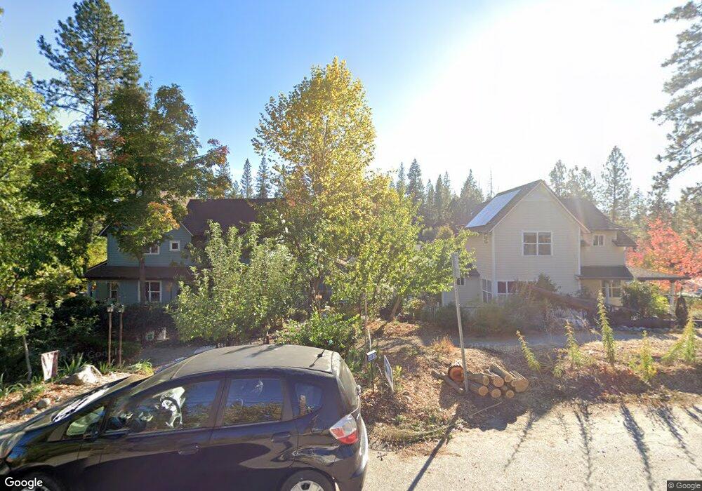
602 Redbud Way Unit 16 Nevada City, CA 95959
Estimated Value: $488,000 - $583,000
3
Beds
2
Baths
1,440
Sq Ft
$370/Sq Ft
Est. Value
About This Home
This home is located at 602 Redbud Way Unit 16, Nevada City, CA 95959 and is currently estimated at $533,444, approximately $370 per square foot. 602 Redbud Way Unit 16 is a home located in Nevada County with nearby schools including Deer Creek Elementary School, Seven Hills Intermediate School, and Forest Charter School.
Ownership History
Date
Name
Owned For
Owner Type
Purchase Details
Closed on
Oct 15, 2015
Sold by
Dion Gerald A and Brown Sheryl C
Bought by
Dion Gerald A and Brown Sheryl C
Current Estimated Value
Home Financials for this Owner
Home Financials are based on the most recent Mortgage that was taken out on this home.
Original Mortgage
$240,000
Outstanding Balance
$188,637
Interest Rate
3.85%
Mortgage Type
New Conventional
Estimated Equity
$344,807
Purchase Details
Closed on
Jul 7, 2009
Sold by
Hellwig John W and Peterson Mary P
Bought by
Dion Gerald A and Brown Sheryl C
Home Financials for this Owner
Home Financials are based on the most recent Mortgage that was taken out on this home.
Original Mortgage
$320,000
Interest Rate
5.37%
Mortgage Type
Purchase Money Mortgage
Purchase Details
Closed on
Dec 14, 2005
Sold by
Broad Street Developments Llc
Bought by
Hellwig John W and Peterson Mary P
Create a Home Valuation Report for This Property
The Home Valuation Report is an in-depth analysis detailing your home's value as well as a comparison with similar homes in the area
Home Values in the Area
Average Home Value in this Area
Purchase History
| Date | Buyer | Sale Price | Title Company |
|---|---|---|---|
| Dion Gerald A | -- | Fidelity National Title | |
| Dion Gerald A | $470,000 | California Land Title Co Of | |
| Hellwig John W | $390,500 | California Land Title Co |
Source: Public Records
Mortgage History
| Date | Status | Borrower | Loan Amount |
|---|---|---|---|
| Open | Dion Gerald A | $240,000 | |
| Closed | Dion Gerald A | $320,000 |
Source: Public Records
Tax History Compared to Growth
Tax History
| Year | Tax Paid | Tax Assessment Tax Assessment Total Assessment is a certain percentage of the fair market value that is determined by local assessors to be the total taxable value of land and additions on the property. | Land | Improvement |
|---|---|---|---|---|
| 2025 | $6,245 | $613,073 | $258,155 | $354,918 |
| 2024 | $6,129 | $601,053 | $253,094 | $347,959 |
| 2023 | $6,129 | $589,269 | $248,132 | $341,137 |
| 2022 | $6,003 | $577,716 | $243,267 | $334,449 |
| 2021 | $5,849 | $566,390 | $238,498 | $327,892 |
| 2020 | $5,840 | $560,583 | $236,053 | $324,530 |
| 2019 | $5,721 | $549,592 | $231,425 | $318,167 |
| 2018 | $5,609 | $538,817 | $226,888 | $311,929 |
| 2017 | $5,502 | $528,254 | $222,440 | $305,814 |
| 2016 | $5,298 | $517,897 | $218,079 | $299,818 |
| 2015 | $4,798 | $469,000 | $155,000 | $314,000 |
| 2014 | -- | $500,128 | $210,597 | $289,531 |
Source: Public Records
Map
Nearby Homes
- 140 Redbud Way
- 660 Chief Kelly Dr
- 520 Lost Hill Ct
- 708 W Broad St
- 661 Chief Kelly Dr
- 651 Chief Kelly Dr
- 631 Chief Kelly Dr
- 327 Drummond St
- 500 Factory St
- 214 Mill St
- 210 Mill St
- 421 Broad St
- 16970 Old Downieville Hwy
- 447 Zion St
- 439 Washington St
- 134 Boulder St
- 342 Bridge Way
- 327 Bridge Way
- 336 Bridge Way
- 11356 Constitution Ct
- 604 Redbud Way Unit 17
- 606 Redbud Way
- 601 Redbud Way Unit 10
- 605 Redbud Way
- 603 Redbud Way
- 607 Redbud Way
- 609 Redbud Way Unit 13
- 611 Redbud Way Unit 15
- 503 Redbud Way Unit 28
- 507 Redbud Way Unit 30
- 401 Redbud Way Unit 22
- 403 Redbud Way
- 502 Redbud Way Unit 31
- 502 Redbud Way
- 504 Redbud Way
- 302 Redbud Way Unit 9
- 506 Redbud Way
- 12360 Redbud Way
- 405 Redbud Way Unit 20