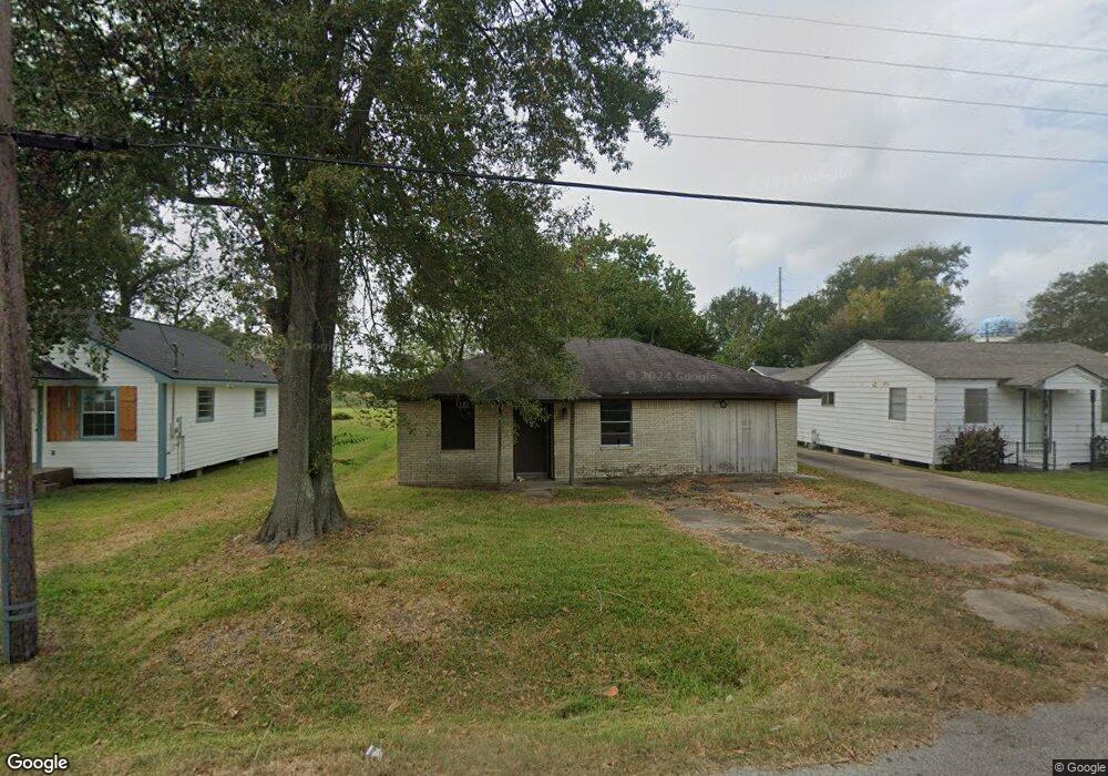
6025 Pine Ave Port Arthur, TX 77640
Estimated Value: $127,196 - $158,000
--
Bed
--
Bath
1,300
Sq Ft
$110/Sq Ft
Est. Value
About This Home
This home is located at 6025 Pine Ave, Port Arthur, TX 77640 and is currently estimated at $142,399, approximately $109 per square foot. 6025 Pine Ave is a home located in Jefferson County with nearby schools including Port Acres Elementary School, Abraham Lincoln Middle School, and Memorial High School.
Ownership History
Date
Name
Owned For
Owner Type
Purchase Details
Closed on
Aug 5, 2025
Sold by
Sheriff Of Jefferson County
Bought by
Bertrand Aaron
Current Estimated Value
Purchase Details
Closed on
Dec 3, 2024
Sold by
Sheriff Jefferson County Texas
Bought by
Jefferson County
Purchase Details
Closed on
Apr 10, 2018
Sold by
Joseph Ray and Joseph Alcede
Bought by
Nelson Sandra J Johnson
Purchase Details
Closed on
Apr 29, 2005
Sold by
Joseph Roy and Joseph Corliss
Bought by
Nelson Charles Ray and Nelson Sandra
Home Financials for this Owner
Home Financials are based on the most recent Mortgage that was taken out on this home.
Original Mortgage
$28,500
Interest Rate
6.06%
Mortgage Type
Seller Take Back
Create a Home Valuation Report for This Property
The Home Valuation Report is an in-depth analysis detailing your home's value as well as a comparison with similar homes in the area
Home Values in the Area
Average Home Value in this Area
Purchase History
| Date | Buyer | Sale Price | Title Company |
|---|---|---|---|
| Bertrand Aaron | $18,000 | None Listed On Document | |
| Jefferson County | $34,866 | None Listed On Document | |
| Nelson Sandra J Johnson | -- | None Available | |
| Nelson Charles Ray | -- | -- |
Source: Public Records
Mortgage History
| Date | Status | Borrower | Loan Amount |
|---|---|---|---|
| Previous Owner | Nelson Charles Ray | $28,500 |
Source: Public Records
Tax History Compared to Growth
Tax History
| Year | Tax Paid | Tax Assessment Tax Assessment Total Assessment is a certain percentage of the fair market value that is determined by local assessors to be the total taxable value of land and additions on the property. | Land | Improvement |
|---|---|---|---|---|
| 2025 | $3,529 | $125,492 | $8,450 | $117,042 |
| 2024 | $3,529 | $123,215 | $1,838 | $121,377 |
| 2023 | $3,529 | $131,887 | $1,838 | $130,049 |
| 2022 | $2,714 | $85,441 | $1,838 | $83,603 |
| 2021 | $2,524 | $76,152 | $1,838 | $74,314 |
| 2020 | $1,291 | $38,948 | $1,838 | $37,110 |
| 2019 | $1,241 | $38,950 | $1,840 | $37,110 |
| 2018 | $354 | $11,120 | $1,840 | $9,280 |
| 2017 | $1,303 | $42,040 | $1,840 | $40,200 |
| 2016 | $1,231 | $42,040 | $1,840 | $40,200 |
| 2015 | $1,163 | $38,950 | $1,840 | $37,110 |
| 2014 | $1,163 | $38,950 | $1,840 | $37,110 |
Source: Public Records
Map
Nearby Homes
- 6017 Pine Ave
- 5745 W Port Arthur Rd
- TBD Waverly Cir
- 5727 Charles Ave
- 2149 Birch St
- 2155 Birch St
- 2130 Canal St
- 2217 Cashmere Ave
- 2228 Cashmere Ave
- 5541 Cambridge St
- 2310 Cox St
- TBD Montclair Dr
- 0000 Montclair Dr
- 2339 Shirley St
- 5410 Marian Anderson Ave
- 0000 Ray Ave
- 2354 Mimosa St
- 2427 62nd St
- 4800 Fort Worth Ave
- 4728 Fort Worth Ave