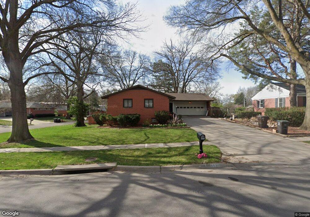
6035 Sumner St Lincoln, NE 68506
Central Lincoln NeighborhoodEstimated Value: $296,508 - $335,000
3
Beds
3
Baths
2,185
Sq Ft
$143/Sq Ft
Est. Value
About This Home
This home is located at 6035 Sumner St, Lincoln, NE 68506 and is currently estimated at $312,377, approximately $142 per square foot. 6035 Sumner St is a home located in Lancaster County with nearby schools including Holmes Elementary School, Lefler Middle School, and Lincoln Southeast High School.
Ownership History
Date
Name
Owned For
Owner Type
Purchase Details
Closed on
Aug 23, 2007
Sold by
Peterson Robert E and Peterson Joan D
Bought by
Frese Derek and Frese Karla
Current Estimated Value
Home Financials for this Owner
Home Financials are based on the most recent Mortgage that was taken out on this home.
Original Mortgage
$143,863
Outstanding Balance
$91,226
Interest Rate
6.69%
Mortgage Type
Purchase Money Mortgage
Estimated Equity
$221,151
Purchase Details
Closed on
Jun 14, 1999
Sold by
Cathcart Rodney P
Bought by
Peterson Robert E and Peterson Joan D
Home Financials for this Owner
Home Financials are based on the most recent Mortgage that was taken out on this home.
Original Mortgage
$80,000
Interest Rate
7.02%
Create a Home Valuation Report for This Property
The Home Valuation Report is an in-depth analysis detailing your home's value as well as a comparison with similar homes in the area
Home Values in the Area
Average Home Value in this Area
Purchase History
| Date | Buyer | Sale Price | Title Company |
|---|---|---|---|
| Frese Derek | $145,000 | Ct | |
| Peterson Robert E | $125,000 | -- |
Source: Public Records
Mortgage History
| Date | Status | Borrower | Loan Amount |
|---|---|---|---|
| Open | Frese Derek | $143,863 | |
| Previous Owner | Peterson Robert E | $80,000 | |
| Closed | Peterson Robert E | $37,325 |
Source: Public Records
Tax History Compared to Growth
Tax History
| Year | Tax Paid | Tax Assessment Tax Assessment Total Assessment is a certain percentage of the fair market value that is determined by local assessors to be the total taxable value of land and additions on the property. | Land | Improvement |
|---|---|---|---|---|
| 2025 | $3,843 | $262,600 | $69,000 | $193,600 |
| 2024 | $3,843 | $274,800 | $57,500 | $217,300 |
| 2023 | $4,321 | $257,800 | $57,500 | $200,300 |
| 2022 | $3,950 | $198,200 | $40,000 | $158,200 |
| 2021 | $3,737 | $198,200 | $40,000 | $158,200 |
| 2020 | $3,395 | $177,700 | $40,000 | $137,700 |
| 2019 | $3,396 | $177,700 | $40,000 | $137,700 |
| 2018 | $3,246 | $169,100 | $40,000 | $129,100 |
| 2017 | $3,276 | $169,100 | $40,000 | $129,100 |
| 2016 | $2,860 | $146,900 | $35,000 | $111,900 |
| 2015 | $2,841 | $146,900 | $35,000 | $111,900 |
| 2014 | $2,878 | $148,000 | $40,000 | $108,000 |
| 2013 | -- | $148,000 | $40,000 | $108,000 |
Source: Public Records
Map
Nearby Homes
- 1731 E Manor Dr
- 6220 Sumner St
- 1920 Riviera Dr
- 1610 Circle Dr
- 2001 Morningside Dr
- 1401 S 58th St
- 6123 A St
- 6301 Newton St
- 5505 Sumner St
- 6341 Rainier Dr
- 6545 Flint Ridge Place
- 5300 Franklin St
- 1210 Eastridge Dr
- 1830 E Bermuda Dr
- 1850 E Bermuda Dr
- 5530 Normal Blvd
- 1521 Kingston Rd
- 933 Moraine Dr
- 1725 S 50th St
- 2533 S 55th St
- 6015 Sumner St
- 1715 Crestline Dr
- 6001 Sumner St
- 1710 Crestline Dr
- 1700 Crestline Dr
- 1720 Crestline Dr
- 1735 Crestline Dr
- 6040 Cullen Dr
- 1730 Crestline Dr
- 6000 Sumner St
- 6100 Sumner St
- 1740 Crestline Dr
- 6030 Cullen Dr
- 1630 W Manor Dr
- 1721 Brookhaven Dr
- 1621 Crestline Dr
- 6121 Sumner St
- 1709 Brookhaven Dr
- 1715 Brookhaven Dr
- 1731 Brookhaven Dr