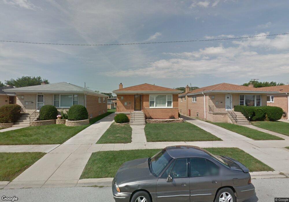
604 Bensley Ave Calumet City, IL 60409
Estimated Value: $150,000 - $248,000
3
Beds
2
Baths
1,252
Sq Ft
$160/Sq Ft
Est. Value
About This Home
This home is located at 604 Bensley Ave, Calumet City, IL 60409 and is currently estimated at $200,669, approximately $160 per square foot. 604 Bensley Ave is a home located in Cook County with nearby schools including Diekman Elementary School, Carol Moseley Braun School, and School Of Fine Arts Academy.
Ownership History
Date
Name
Owned For
Owner Type
Purchase Details
Closed on
May 26, 1999
Sold by
Zagorac Mirko and Zagorac Steven
Bought by
Washington Tyrone P and Washington Santa R
Current Estimated Value
Home Financials for this Owner
Home Financials are based on the most recent Mortgage that was taken out on this home.
Original Mortgage
$107,832
Outstanding Balance
$28,116
Interest Rate
7.15%
Mortgage Type
FHA
Estimated Equity
$172,553
Create a Home Valuation Report for This Property
The Home Valuation Report is an in-depth analysis detailing your home's value as well as a comparison with similar homes in the area
Home Values in the Area
Average Home Value in this Area
Purchase History
| Date | Buyer | Sale Price | Title Company |
|---|---|---|---|
| Washington Tyrone P | $108,000 | -- |
Source: Public Records
Mortgage History
| Date | Status | Borrower | Loan Amount |
|---|---|---|---|
| Open | Washington Tyrone P | $107,832 |
Source: Public Records
Tax History Compared to Growth
Tax History
| Year | Tax Paid | Tax Assessment Tax Assessment Total Assessment is a certain percentage of the fair market value that is determined by local assessors to be the total taxable value of land and additions on the property. | Land | Improvement |
|---|---|---|---|---|
| 2024 | $7,297 | $15,000 | $2,772 | $12,228 |
| 2023 | $6,754 | $15,000 | $2,772 | $12,228 |
| 2022 | $6,754 | $11,953 | $2,394 | $9,559 |
| 2021 | $6,428 | $11,952 | $2,394 | $9,558 |
| 2020 | $6,015 | $11,952 | $2,394 | $9,558 |
| 2019 | $4,491 | $9,513 | $2,016 | $7,497 |
| 2018 | $4,468 | $9,513 | $2,016 | $7,497 |
| 2017 | $4,325 | $9,513 | $2,016 | $7,497 |
| 2016 | $4,063 | $8,588 | $1,890 | $6,698 |
| 2015 | $3,886 | $8,588 | $1,890 | $6,698 |
| 2014 | $3,817 | $8,588 | $1,890 | $6,698 |
| 2013 | $5,063 | $11,154 | $1,890 | $9,264 |
Source: Public Records
Map
Nearby Homes
- 605 Hoxie Ave
- 615 Hoxie Ave
- 1758 Memorial Dr
- 508 Hoxie Ave
- 627 Paxton Ave
- 518 Crandon Ave
- 605 Saginaw Ave
- 618 Marquette Ave
- 519 Paxton Ave
- 602 Merrill Ave
- 452 Yates Ave
- 453 Hoxie Ave
- 513 Merrill Ave
- 1225 Memorial Dr
- 1863 Michigan City Rd Unit 1W
- 558 Muskegon Ave
- 648 Muskegon Ave
- 1918 Stonegate Dr
- 678 Muskegon Ave
- 669 Chappel Ave Unit 2C
- 600 Bensley Ave
- 606 Bensley Ave
- 598 Bensley Ave
- 610 Bensley Ave
- 594 Bensley Ave
- 614 Bensley Ave
- 605 Yates Ave
- 601 Yates Ave
- 607 Yates Ave
- 590 Bensley Ave
- 599 Yates Ave
- 611 Yates Ave
- 611 Yates Ave
- 595 Yates Ave
- 615 Yates Ave
- 605 Bensley Ave
- 601 Bensley Ave
- 607 Bensley Ave
- 586 Bensley Ave
- 599 Bensley Ave