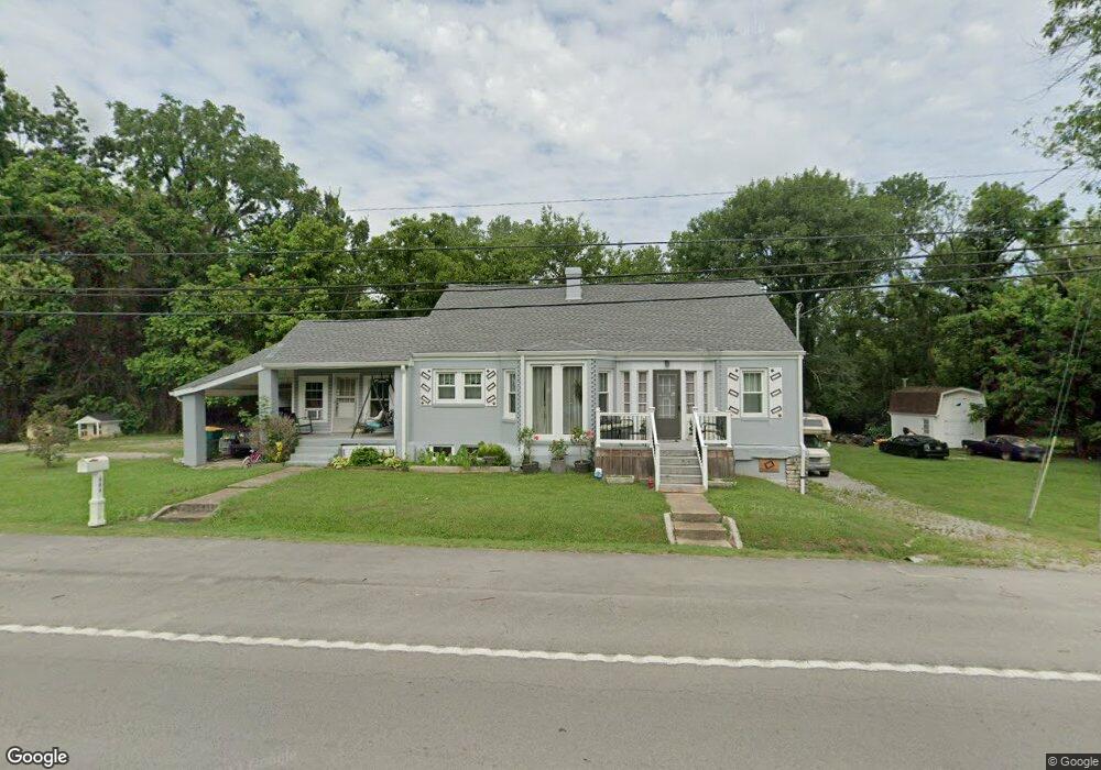
605 Cornersville Rd Lewisburg, TN 37091
Estimated Value: $238,453 - $362,000
--
Bed
2
Baths
1,559
Sq Ft
$188/Sq Ft
Est. Value
About This Home
This home is located at 605 Cornersville Rd, Lewisburg, TN 37091 and is currently estimated at $293,863, approximately $188 per square foot. 605 Cornersville Rd is a home located in Marshall County with nearby schools including Marshall Elementary School, Oak Grove Elementary School, and Westhills Elementary School.
Ownership History
Date
Name
Owned For
Owner Type
Purchase Details
Closed on
Oct 27, 2017
Sold by
Walker Marilyn Marie
Bought by
Scarfone Ricardo Joseph and Scarfone Cheryl Liane
Current Estimated Value
Home Financials for this Owner
Home Financials are based on the most recent Mortgage that was taken out on this home.
Original Mortgage
$94,400
Outstanding Balance
$79,061
Interest Rate
3.83%
Mortgage Type
New Conventional
Estimated Equity
$214,802
Create a Home Valuation Report for This Property
The Home Valuation Report is an in-depth analysis detailing your home's value as well as a comparison with similar homes in the area
Home Values in the Area
Average Home Value in this Area
Purchase History
| Date | Buyer | Sale Price | Title Company |
|---|---|---|---|
| Scarfone Ricardo Joseph | $53,332 | -- |
Source: Public Records
Mortgage History
| Date | Status | Borrower | Loan Amount |
|---|---|---|---|
| Open | Scarfone Ricardo Joseph | $94,400 |
Source: Public Records
Tax History Compared to Growth
Tax History
| Year | Tax Paid | Tax Assessment Tax Assessment Total Assessment is a certain percentage of the fair market value that is determined by local assessors to be the total taxable value of land and additions on the property. | Land | Improvement |
|---|---|---|---|---|
| 2024 | -- | $46,550 | $6,725 | $39,825 |
| 2023 | $1,445 | $46,550 | $6,725 | $39,825 |
| 2022 | $1,445 | $46,550 | $6,725 | $39,825 |
| 2021 | $1,373 | $29,525 | $5,000 | $24,525 |
| 2020 | $1,373 | $29,525 | $5,000 | $24,525 |
| 2019 | $1,329 | $29,525 | $5,000 | $24,525 |
| 2018 | $1,314 | $29,525 | $5,000 | $24,525 |
| 2017 | $1,314 | $29,525 | $5,000 | $24,525 |
| 2016 | $1,391 | $27,175 | $5,000 | $22,175 |
| 2015 | $1,148 | $27,175 | $5,000 | $22,175 |
| 2014 | $1,148 | $24,575 | $5,000 | $19,575 |
Source: Public Records
Map
Nearby Homes
- 640 6th Ave S
- 632 Colburn Dr
- 525 Maple St
- 610 Forrest St
- 518 Maple St
- 535 Clayton Ave
- 966 Berry St
- 215 5th Ave N
- 718 Midway St
- 316 Haynes St
- 726 Thomas Ave
- 0 New Lake Rd Unit RTC3030964
- 319 E Hill Ave
- 416 1st Ave N
- 0 Joyce Ave
- 1159 White Dr
- 1011 Cornersville Rd
- 543 2nd Ave N
- MEDFORD Plan at King's Landing
- 104 Mackenzie Way
- 638 Cornersville Rd
- 655 Cornersville Rd
- 641 Cornersville Rd
- 734 Lynnwood Ave
- 740 Lynnwood Ave
- 728 Lynnwood Ave
- 633 Cornersville Rd
- 545 Montclair St
- 607 Cornersville Rd
- 700 Cornersville Rd
- 731 Lynnwood Ave
- 741 Lynnwood Ave
- 741 Lynnwood Ave
- 721 Lynnwood Ave
- 0 Lynnwood Ave Unit 1777328
- 550 Montclair St
- 539 Montclair St
- 625 6th Ave S
- 631 6th Ave S
- 714 Lynnwood Ave