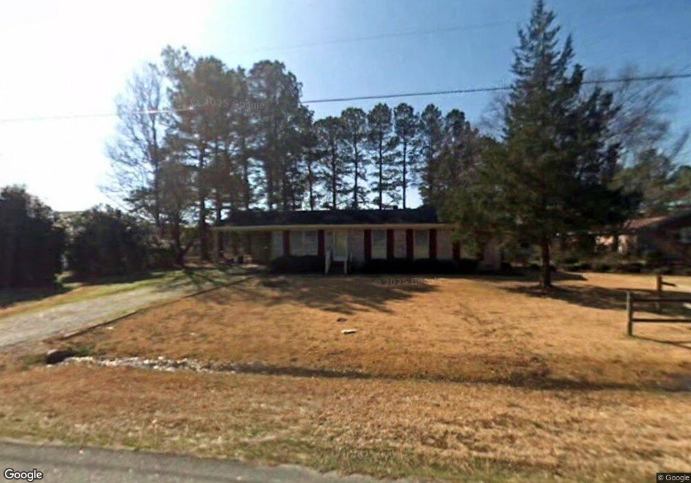
605 W Main St Rocky Mount, NC 27803
Estimated Value: $162,376 - $226,000
3
Beds
2
Baths
1,225
Sq Ft
$152/Sq Ft
Est. Value
About This Home
This home is located at 605 W Main St, Rocky Mount, NC 27803 and is currently estimated at $186,094, approximately $151 per square foot. 605 W Main St is a home located in Nash County with nearby schools including Nash Central High School, Coopers Elementary School, and Nash Central Middle School.
Ownership History
Date
Name
Owned For
Owner Type
Purchase Details
Closed on
Dec 31, 2019
Sold by
Sykes Richard Randall and Sykes Kathy G
Bought by
R & K Rental Investments Ii Llc
Current Estimated Value
Purchase Details
Closed on
Nov 17, 2009
Sold by
Secretary Of Veterans Affairs
Bought by
Sykes Richard
Home Financials for this Owner
Home Financials are based on the most recent Mortgage that was taken out on this home.
Original Mortgage
$30,400
Interest Rate
5.01%
Mortgage Type
New Conventional
Purchase Details
Closed on
Aug 4, 2009
Sold by
Ramsey Denise E
Bought by
Secretary Of Veterans Affairs
Create a Home Valuation Report for This Property
The Home Valuation Report is an in-depth analysis detailing your home's value as well as a comparison with similar homes in the area
Home Values in the Area
Average Home Value in this Area
Purchase History
| Date | Buyer | Sale Price | Title Company |
|---|---|---|---|
| R & K Rental Investments Ii Llc | -- | None Available | |
| Sykes Richard | -- | None Available | |
| Secretary Of Veterans Affairs | $35,252 | None Available |
Source: Public Records
Mortgage History
| Date | Status | Borrower | Loan Amount |
|---|---|---|---|
| Previous Owner | Sykes Richard | $30,400 |
Source: Public Records
Tax History Compared to Growth
Tax History
| Year | Tax Paid | Tax Assessment Tax Assessment Total Assessment is a certain percentage of the fair market value that is determined by local assessors to be the total taxable value of land and additions on the property. | Land | Improvement |
|---|---|---|---|---|
| 2025 | $1,658 | $104,300 | $17,330 | $86,970 |
| 2024 | $1,658 | $78,100 | $17,330 | $60,770 |
| 2023 | $1,328 | $78,100 | $0 | $0 |
| 2022 | $1,132 | $78,100 | $17,330 | $60,770 |
| 2021 | $1,132 | $78,100 | $17,330 | $60,770 |
| 2020 | $1,031 | $78,100 | $17,330 | $60,770 |
| 2019 | $1,031 | $78,100 | $17,330 | $60,770 |
| 2018 | $1,031 | $78,100 | $0 | $0 |
| 2017 | $1,031 | $78,100 | $0 | $0 |
| 2015 | $1,031 | $78,100 | $0 | $0 |
| 2014 | $1,031 | $78,100 | $0 | $0 |
Source: Public Records
Map
Nearby Homes
- 625 Speight Dr
- 117 Holly Dr
- 604 Speight Dr
- 605 Judge St
- 804 Mill Branch Rd
- 4040 S Hathaway Blvd
- 406 Hilltop Dr
- 404 Hilltop Dr
- E Main St
- 709 Queen St
- 216 Katie Dr
- 8804 Mill Branch Rd
- 9007 Brookfield Dr
- 9015 Brookfield Dr
- 5014 Davis Rd
- 2808 S Wesleyan Blvd
- 8833 Town Creek Rd
- 7624 Jordan Rd
- 8498 W Tarboro Rd Unit LotWP001
- 8498 W Tarboro Rd
- 601 W Main St
- 609 W Main St
- 701 W Main St
- 604 W Main St
- 608 W Main St
- 202 Robbins Ave
- 612 W Main St
- 202 N Robbins Dr
- 202 Robbins Dr
- 509 W Main St
- 705 W Main St
- 612 W Main St
- 401-419 Exhange Ln
- 401-419 Exchange Ln
- 100 Kentucky Ave
- 605 Speight Dr
- 105 Kentucky Ave
- 607 Speight Dr
- 603 Speight Dr
- 501 W Main St