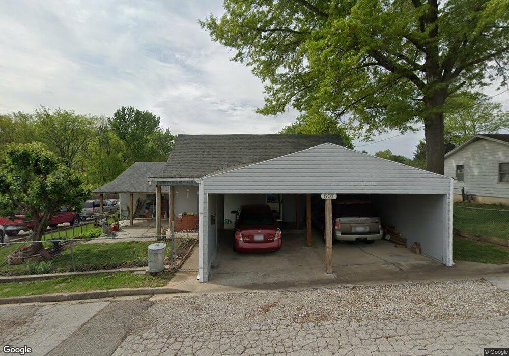
607 E Fair St California, MO 65018
Estimated Value: $122,478 - $195,000
--
Bed
--
Bath
1,351
Sq Ft
$117/Sq Ft
Est. Value
About This Home
This home is located at 607 E Fair St, California, MO 65018 and is currently estimated at $158,370, approximately $117 per square foot. 607 E Fair St is a home located in Moniteau County with nearby schools including California Elementary School, California Middle School, and California High School.
Ownership History
Date
Name
Owned For
Owner Type
Purchase Details
Closed on
Jun 14, 2016
Sold by
Cisneros Vincente and Cisneros Gyadalupe
Bought by
Cisneros Miguel
Current Estimated Value
Home Financials for this Owner
Home Financials are based on the most recent Mortgage that was taken out on this home.
Original Mortgage
$36,550
Outstanding Balance
$29,128
Interest Rate
3.61%
Mortgage Type
Future Advance Clause Open End Mortgage
Estimated Equity
$129,242
Purchase Details
Closed on
Jul 21, 2005
Sold by
Lee David N and Lee David N
Bought by
Cisneros Vincente and Cisneros Guadalupe
Create a Home Valuation Report for This Property
The Home Valuation Report is an in-depth analysis detailing your home's value as well as a comparison with similar homes in the area
Home Values in the Area
Average Home Value in this Area
Purchase History
| Date | Buyer | Sale Price | Title Company |
|---|---|---|---|
| Cisneros Miguel | -- | None Available | |
| Cisneros Vincente | -- | None Available |
Source: Public Records
Mortgage History
| Date | Status | Borrower | Loan Amount |
|---|---|---|---|
| Open | Cisneros Miguel | $36,550 |
Source: Public Records
Tax History Compared to Growth
Tax History
| Year | Tax Paid | Tax Assessment Tax Assessment Total Assessment is a certain percentage of the fair market value that is determined by local assessors to be the total taxable value of land and additions on the property. | Land | Improvement |
|---|---|---|---|---|
| 2024 | $614 | $11,380 | $0 | $0 |
| 2023 | $614 | $11,380 | $0 | $0 |
| 2022 | $615 | $11,380 | $0 | $0 |
| 2021 | $615 | $11,380 | $0 | $0 |
| 2020 | $617 | $11,320 | $0 | $0 |
| 2019 | $616 | $11,320 | $0 | $0 |
| 2018 | $609 | $11,320 | $0 | $0 |
| 2017 | $595 | $8,820 | $650 | $8,170 |
| 2016 | $608 | $11,320 | $0 | $0 |
| 2011 | -- | $10,540 | $0 | $0 |
Source: Public Records
Map
Nearby Homes
- 304 S Hodges St
- 203 S High St
- 0 E Buchanan St
- 707 Noas Ave
- 802 S Oak St
- 201 W Kelly St
- 409 W Buchanan St
- 409 Lorene St
- 1008 S Roache St
- 101 Dale Ln
- 706 Pamela Dr
- 0 Russellville Rd
- 511 Morgan St
- 0 Quail Hollow Dr
- 0 Highway 50
- 30059 Dan Rd
- 32260 Theodore Rd
- 60516 Kratzer Rd
- 0 Little Moniteau Rd
- 61214 E F
- 607 E Fair St
- 607 E Fair St
- 606 E Oliver St
- 604 E Oliver St
- 100 Cherry St
- 100 Cherry St
- 100 Cherry St Unit C
- 100 Cherry St
- 100 Cherry St
- 100 Cherry St
- 602 E Oliver St
- 102 N Taylor Ave
- 102 N Taylor Ave
- 600 E Oliver St
- 605 E Oliver St
- 603 E Oliver St
- 601 E Oliver St
- 601 E Oliver St
- 601 E Oliver St
- 104 S Taylor Ave