Estimated Value: $200,000 - $268,000
--
Bed
2
Baths
1,167
Sq Ft
$190/Sq Ft
Est. Value
About This Home
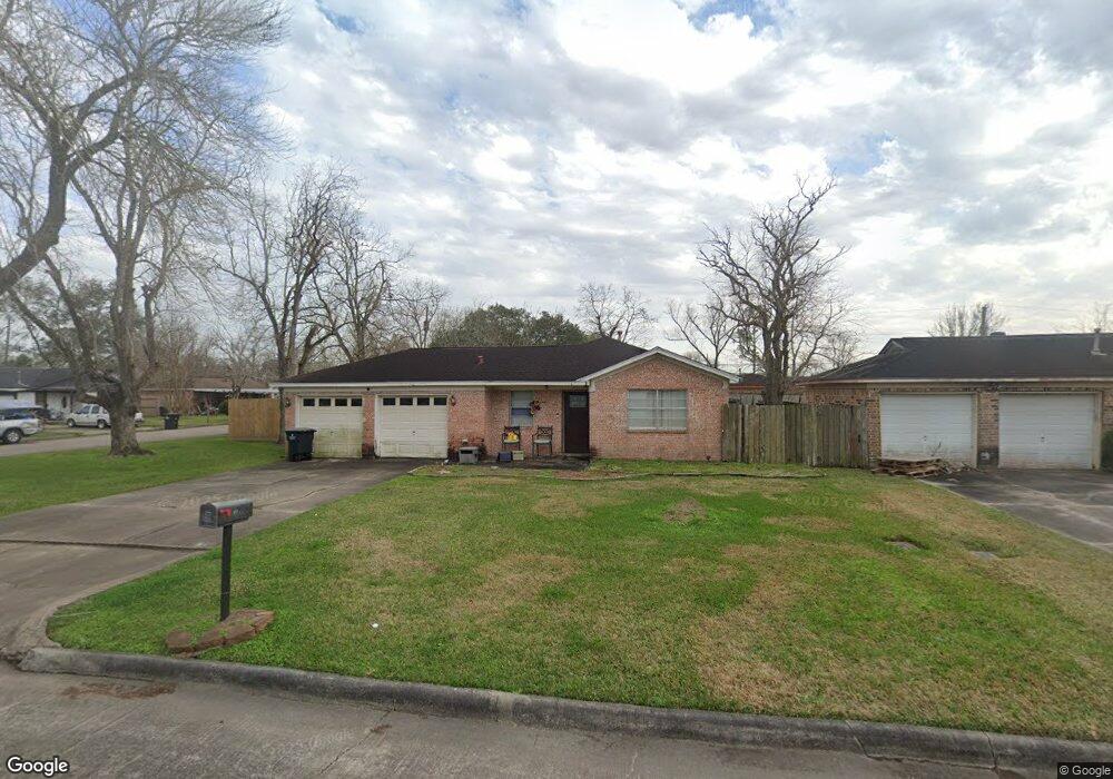
This home is located at 607 Linda Ln, Alvin, TX 77511 and is currently estimated at $222,049, approximately $190 per square foot. 607 Linda Ln is a home located in Brazoria County with nearby schools including R.L. Stevenson Primary School, Alvin Junior High School, and Alvin High School.
Ownership History
Date
Name
Owned For
Owner Type
Purchase Details
Closed on
Jun 1, 2025
Sold by
King Shauna Lynn
Bought by
Ainsworth Brendan Lane
Current Estimated Value
Purchase Details
Closed on
May 10, 2024
Sold by
Day Krista Diane
Bought by
King Shauna Lynn
Purchase Details
Closed on
May 1, 2024
Sold by
Wilson William
Bought by
King Shauna Lynn
Purchase Details
Closed on
Jun 1, 2020
Sold by
Humbird Patricia K
Bought by
Hopkins Shauna
Purchase Details
Closed on
Jun 4, 2003
Sold by
Worsham Tammi
Bought by
Hernandez Mateo
Create a Home Valuation Report for This Property
The Home Valuation Report is an in-depth analysis detailing your home's value as well as a comparison with similar homes in the area
Home Values in the Area
Average Home Value in this Area
Purchase History
| Date | Buyer | Sale Price | Title Company |
|---|---|---|---|
| Ainsworth Brendan Lane | -- | None Listed On Document | |
| King Shauna Lynn | -- | None Listed On Document | |
| King Shauna Lynn | -- | None Listed On Document | |
| Hopkins Shauna Wilson | -- | None Listed On Document | |
| Hopkins Shauna | -- | None Listed On Document | |
| Hernandez Mateo | -- | -- |
Source: Public Records
Tax History Compared to Growth
Tax History
| Year | Tax Paid | Tax Assessment Tax Assessment Total Assessment is a certain percentage of the fair market value that is determined by local assessors to be the total taxable value of land and additions on the property. | Land | Improvement |
|---|---|---|---|---|
| 2025 | $4,941 | $180,000 | $23,650 | $156,350 |
| 2023 | $4,941 | $173,890 | $23,650 | $150,240 |
| 2022 | $4,134 | $150,720 | $22,180 | $128,540 |
| 2021 | $4,046 | $140,130 | $20,400 | $119,730 |
| 2020 | $4,101 | $140,130 | $20,400 | $119,730 |
| 2019 | $3,606 | $120,050 | $14,780 | $105,270 |
| 2018 | $2,974 | $98,850 | $17,740 | $81,110 |
| 2017 | $2,905 | $95,340 | $17,740 | $77,600 |
| 2016 | $2,739 | $89,900 | $17,740 | $72,160 |
| 2015 | $2,451 | $81,030 | $14,780 | $66,250 |
| 2014 | $2,451 | $78,870 | $14,780 | $64,090 |
Source: Public Records
Map
Nearby Homes
- 610 Linda Ln
- 607 Debbie Ln
- 3925 Larkspur St
- 394 Sherandoe Ln
- 3810 Westglen Dr
- 1145 Westglen Dr
- 300 Mustang Rd
- 4800 Heathrow Ln
- 00 Highway 6
- 1751 Rosharon Rd
- 0 W Highway 6 Unit 68293296
- 4850 Heathrow Ln
- 369 Windsor Square
- 201 W Timberlane Dr
- 111 Fairway Dr
- 3221 County Road 890
- 00 County Road 424
- 3200 Fairway Dr
- 4003 Country Trails St
- 204 Hillcrest Dr