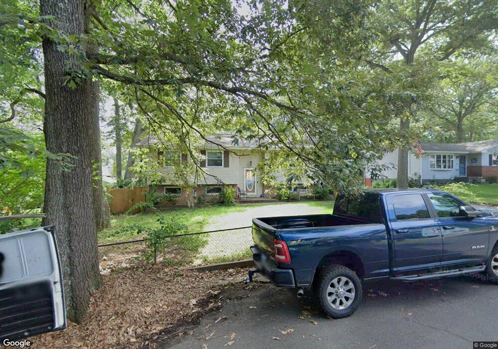
607 Topland Dr Crownsville, MD 21032
Arden on the Severn NeighborhoodEstimated Value: $408,000 - $494,000
--
Bed
2
Baths
1,244
Sq Ft
$358/Sq Ft
Est. Value
About This Home
This home is located at 607 Topland Dr, Crownsville, MD 21032 and is currently estimated at $445,490, approximately $358 per square foot. 607 Topland Dr is a home located in Anne Arundel County with nearby schools including Millersville Elementary School, Old Mill High School, and Rockbridge Academy.
Ownership History
Date
Name
Owned For
Owner Type
Purchase Details
Closed on
Oct 2, 2020
Sold by
Couch Cheryl Lynn and White Wilma G
Bought by
Couch Daniel
Current Estimated Value
Home Financials for this Owner
Home Financials are based on the most recent Mortgage that was taken out on this home.
Original Mortgage
$250,000
Outstanding Balance
$221,956
Interest Rate
2.8%
Mortgage Type
New Conventional
Estimated Equity
$223,534
Purchase Details
Closed on
Nov 19, 2014
Sold by
White Wilma G
Bought by
White Wilma G and Couch Cheryl Lynn
Purchase Details
Closed on
Sep 29, 1998
Sold by
Westfall Wilma E
Bought by
White Edward H and White Wilma G
Create a Home Valuation Report for This Property
The Home Valuation Report is an in-depth analysis detailing your home's value as well as a comparison with similar homes in the area
Home Values in the Area
Average Home Value in this Area
Purchase History
| Date | Buyer | Sale Price | Title Company |
|---|---|---|---|
| Couch Daniel | $300,000 | Maryland Trust T&E Llc | |
| White Wilma G | -- | None Available | |
| White Edward H | $95,000 | -- |
Source: Public Records
Mortgage History
| Date | Status | Borrower | Loan Amount |
|---|---|---|---|
| Open | Couch Daniel | $250,000 | |
| Closed | White Edward H | -- |
Source: Public Records
Tax History Compared to Growth
Tax History
| Year | Tax Paid | Tax Assessment Tax Assessment Total Assessment is a certain percentage of the fair market value that is determined by local assessors to be the total taxable value of land and additions on the property. | Land | Improvement |
|---|---|---|---|---|
| 2025 | $4,442 | $374,300 | $213,000 | $161,300 |
| 2024 | $4,442 | $363,033 | $0 | $0 |
| 2023 | $4,323 | $351,767 | $0 | $0 |
| 2022 | $4,040 | $340,500 | $213,000 | $127,500 |
| 2021 | $7,940 | $332,967 | $0 | $0 |
| 2020 | $2,883 | $325,433 | $0 | $0 |
| 2019 | $2,836 | $317,900 | $183,000 | $134,900 |
| 2018 | $3,094 | $305,167 | $0 | $0 |
| 2017 | $2,631 | $292,433 | $0 | $0 |
| 2016 | -- | $279,700 | $0 | $0 |
| 2015 | -- | $277,000 | $0 | $0 |
| 2014 | -- | $274,300 | $0 | $0 |
Source: Public Records
Map
Nearby Homes
- 1158 Blue Bird Ln
- 610 Echo Cove Dr
- 626 Evergreen Rd
- 518 Lakeland Rd S
- 717 Whitneys Landing Dr
- 596 West Dr
- 405 Ben Oaks Dr W
- 1304 North Rd
- 439A Lakeland Rd N
- 513 Old Pasture Ln
- 1037 Dockser Dr
- 983 Wayside Dr
- 1220 Indian Landing Rd
- 1003 Omar Dr
- 600 Hidden Pond Ln
- 1013 Waterbury Heights Dr
- 8201 Longford Rd
- 771 Generals Hwy
- 762 Cougar Dr
- 621 Kensington Ave
- 609 Topland Dr
- 1153 Blue Bird Ln
- 1151 Blue Bird Ln
- 611 Topland Dr
- 1149 Blue Bird Ln
- 613 Topland Dr
- 608 Topland Dr
- 606 Topland Dr
- 612 Cedarwood Ln
- 616 Cedarwood Ln
- 604 Topland Dr
- 612 Topland Dr
- 615 Topland Dr
- 1155 Blue Bird Ln
- 602 Topland Dr
- 610 Cedarwood Ln
- 1152 Blue Bird Ln
- 618 Cedarwood Ln
- 614 Topland Dr
- 617 Topland Dr