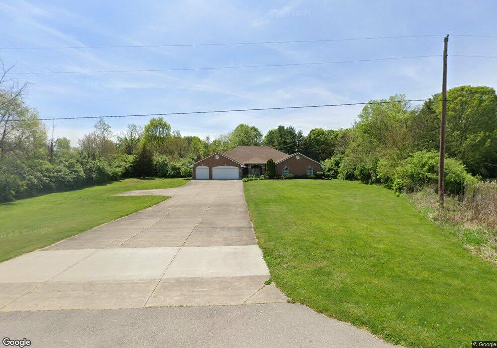
6090 E State Route 571 Tipp City, OH 45371
Estimated Value: $383,000 - $490,000
3
Beds
3
Baths
2,980
Sq Ft
$146/Sq Ft
Est. Value
About This Home
This home is located at 6090 E State Route 571, Tipp City, OH 45371 and is currently estimated at $435,747, approximately $146 per square foot. 6090 E State Route 571 is a home located in Miami County with nearby schools including Bethel Elementary School, Bethel Middle School, and Bethel High School.
Ownership History
Date
Name
Owned For
Owner Type
Purchase Details
Closed on
Aug 6, 2018
Sold by
Benham James E and Benham Beverly J
Bought by
Harbison Kimberly S
Current Estimated Value
Purchase Details
Closed on
Oct 2, 2001
Sold by
Bowling Scott E
Bought by
Harbison Brian L and Harbison Kimberly Sue
Home Financials for this Owner
Home Financials are based on the most recent Mortgage that was taken out on this home.
Original Mortgage
$194,300
Interest Rate
6.97%
Mortgage Type
New Conventional
Create a Home Valuation Report for This Property
The Home Valuation Report is an in-depth analysis detailing your home's value as well as a comparison with similar homes in the area
Home Values in the Area
Average Home Value in this Area
Purchase History
| Date | Buyer | Sale Price | Title Company |
|---|---|---|---|
| Harbison Kimberly S | -- | None Available | |
| Harbison Brian L | $215,900 | -- |
Source: Public Records
Mortgage History
| Date | Status | Borrower | Loan Amount |
|---|---|---|---|
| Previous Owner | Harbison Brian L | $194,300 |
Source: Public Records
Tax History Compared to Growth
Tax History
| Year | Tax Paid | Tax Assessment Tax Assessment Total Assessment is a certain percentage of the fair market value that is determined by local assessors to be the total taxable value of land and additions on the property. | Land | Improvement |
|---|---|---|---|---|
| 2024 | $5,009 | $104,930 | $17,640 | $87,290 |
| 2023 | $5,009 | $104,930 | $17,640 | $87,290 |
| 2022 | $4,952 | $104,930 | $17,640 | $87,290 |
| 2021 | $4,434 | $87,430 | $14,700 | $72,730 |
| 2020 | $4,407 | $87,430 | $14,700 | $72,730 |
| 2019 | $4,458 | $87,430 | $14,700 | $72,730 |
| 2018 | $4,306 | $79,040 | $11,800 | $67,240 |
| 2017 | $4,312 | $79,040 | $11,800 | $67,240 |
| 2016 | $3,882 | $79,040 | $11,800 | $67,240 |
| 2015 | $3,864 | $75,990 | $11,340 | $64,650 |
| 2014 | $3,864 | $75,990 | $11,340 | $64,650 |
| 2013 | $3,277 | $75,990 | $11,340 | $64,650 |
Source: Public Records
Map
Nearby Homes
- 5315 E State Route 571
- 0 Ohio 201
- 7817 Ohio 201
- 6345 Ohio 202
- 7715 E New Carlisle Rd
- 0 Ohio 202 Unit 23014095
- 0 Ohio 202 Unit 23014098
- 7032 Honeylocust St
- 7540 Agenbroad Rd
- 6570 S Tipp Cowl Rd
- 7337 Ross Rd
- 4320 Ginghamsburg West Charleston Rd
- 1037 Arbor Dr
- 4019 Lupine Way
- 605 Fenview Dr
- 4207 Forestedge St
- 930 Firwood Dr
- 907 White Pine St
- 129 Solar Dr
- 8540 Mann Rd
- 6030 E State Route 571
- 6116 E State Route 571
- 5505 Pisgah Rd
- 5455 Pisgah Rd
- 5533 Pisgah Rd
- 6031 E State Route 571
- 6010 E State Route 571
- 5555 Pisgah Rd
- 5585 Pisgah Rd
- 6007 E State Route 571
- 5444 Pisgah Rd
- 5400 Pisgah Rd
- 5605 Pisgah Rd
- 5999 E State Route 571
- 6194 E State Route 571
- 5633 Pisgah Rd
- 6200 E State Route 571
- 5655 Pisgah Rd
- 6336 E State Route 571
- 5707 Pisgah Rd