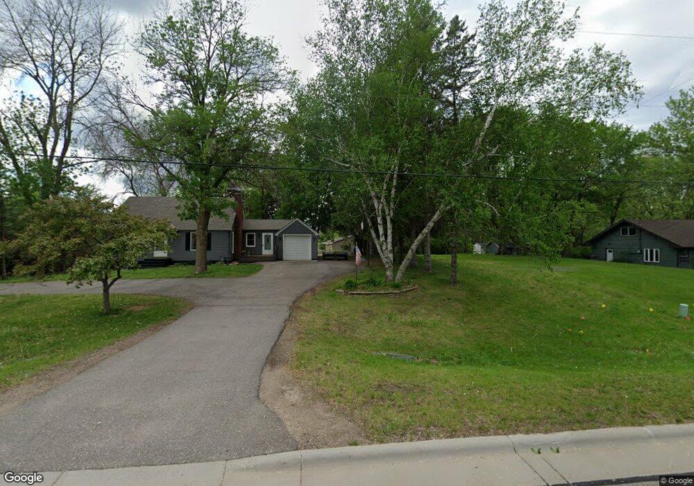
610 County Road 10 NW Watertown, MN 55388
Estimated Value: $444,000 - $568,302
3
Beds
3
Baths
1,516
Sq Ft
$351/Sq Ft
Est. Value
About This Home
This home is located at 610 County Road 10 NW, Watertown, MN 55388 and is currently estimated at $531,576, approximately $350 per square foot. 610 County Road 10 NW is a home located in Carver County with nearby schools including Watertown-Mayer Elementary School, Watertown-Mayer Middle School, and Watertown Mayer High School.
Ownership History
Date
Name
Owned For
Owner Type
Purchase Details
Closed on
Nov 1, 2016
Sold by
Mckusick Richard A and Mckusick Lori J
Bought by
Sing Lucas I and Paine Rebecca R
Current Estimated Value
Home Financials for this Owner
Home Financials are based on the most recent Mortgage that was taken out on this home.
Original Mortgage
$247,200
Outstanding Balance
$198,771
Interest Rate
3.47%
Mortgage Type
New Conventional
Estimated Equity
$332,805
Purchase Details
Closed on
Sep 29, 2010
Sold by
Dailey Nancie J and Dailey Daniel D
Bought by
Mckusick Lori J and Mckusick Richard A
Home Financials for this Owner
Home Financials are based on the most recent Mortgage that was taken out on this home.
Original Mortgage
$207,200
Interest Rate
4.26%
Mortgage Type
New Conventional
Create a Home Valuation Report for This Property
The Home Valuation Report is an in-depth analysis detailing your home's value as well as a comparison with similar homes in the area
Home Values in the Area
Average Home Value in this Area
Purchase History
| Date | Buyer | Sale Price | Title Company |
|---|---|---|---|
| Sing Lucas I | $309,000 | Burnet Title | |
| Mckusick Lori J | $259,000 | -- |
Source: Public Records
Mortgage History
| Date | Status | Borrower | Loan Amount |
|---|---|---|---|
| Open | Sing Lucas I | $247,200 | |
| Previous Owner | Mckusick Lori J | $207,200 |
Source: Public Records
Tax History Compared to Growth
Tax History
| Year | Tax Paid | Tax Assessment Tax Assessment Total Assessment is a certain percentage of the fair market value that is determined by local assessors to be the total taxable value of land and additions on the property. | Land | Improvement |
|---|---|---|---|---|
| 2025 | $5,796 | $537,300 | $220,500 | $316,800 |
| 2024 | $5,624 | $465,100 | $147,000 | $318,100 |
| 2023 | $5,518 | $463,800 | $147,000 | $316,800 |
| 2022 | $5,206 | $463,600 | $146,900 | $316,700 |
| 2021 | $5,184 | $353,100 | $122,400 | $230,700 |
| 2020 | $5,232 | $353,300 | $122,400 | $230,900 |
| 2019 | $4,668 | $319,400 | $116,600 | $202,800 |
| 2018 | $4,588 | $319,400 | $116,600 | $202,800 |
| 2017 | $5,166 | $296,600 | $116,600 | $180,000 |
| 2016 | $5,014 | $308,900 | $0 | $0 |
| 2015 | $4,116 | $275,400 | $0 | $0 |
| 2014 | $4,116 | $227,500 | $0 | $0 |
Source: Public Records
Map
Nearby Homes
- 417 Lewis Ave N
- 604 White St SW Unit 35
- 604 White St SW
- 13265 Highway 25 SW
- 605 Stevens St SW Unit 43
- 29 Riverside Terrace Dr Unit 29
- xxx Stevens St SW
- 115 Riverside Terrace Dr Unit 115
- 408 Franklin Ave SW
- 313 Angel Ave SW
- 120 Riverside Terrace Dr Unit 102
- 85 Riverside Terrace Dr Unit 85
- 412 Angel Ave SW
- 160 Wildwood Cir Unit 160
- 600 Jefferson Ave SW
- The Calhoun Plan at Forest Hills
- The Rockwell Plan at Forest Hills
- The Stratford Plan at Forest Hills
- The Springfield Plan at Forest Hills
- The Wentworth Plan at Forest Hills
- 621 County Road 10 NW
- 629 County Road 10 NW
- 637 County Road 10 NW
- xxxx County Road 10
- 613 County Road 10 NW
- 420 Ortloff Trail NW
- 624 Hillside Dr NW
- 413 Ortloff Trail NW
- 416 Ortloff Trail NW
- 620 Hillside Dr NW
- 600 Hillside Dr NW
- 409 Ortloff Trail NW
- 604 Hillside Dr NW
- 412 Ortloff Trail NW
- 500 County Road 10 NW
- 616 Hillside Dr NW
- 612 Hillside Dr NW
- 608 Hillside Dr NW
- 408 Ortloff Trail NW
- 407 Ortloff Trail NW