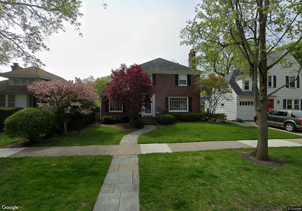
610 Wayland Ave Kenilworth, IL 60043
Estimated Value: $1,348,967 - $1,840,000
5
Beds
3
Baths
2,636
Sq Ft
$578/Sq Ft
Est. Value
About This Home
This home is located at 610 Wayland Ave, Kenilworth, IL 60043 and is currently estimated at $1,522,492, approximately $577 per square foot. 610 Wayland Ave is a home located in Cook County with nearby schools including The Joseph Sears School, New Trier Township High School, and New Trier Township High School - Northfield.
Ownership History
Date
Name
Owned For
Owner Type
Purchase Details
Closed on
Dec 2, 1993
Sold by
Maloney James J and Maloney Bridie E
Bought by
Maloney James J and Maloney Bridie E
Current Estimated Value
Home Financials for this Owner
Home Financials are based on the most recent Mortgage that was taken out on this home.
Original Mortgage
$170,000
Interest Rate
7.25%
Create a Home Valuation Report for This Property
The Home Valuation Report is an in-depth analysis detailing your home's value as well as a comparison with similar homes in the area
Home Values in the Area
Average Home Value in this Area
Purchase History
| Date | Buyer | Sale Price | Title Company |
|---|---|---|---|
| Maloney James J | -- | -- |
Source: Public Records
Mortgage History
| Date | Status | Borrower | Loan Amount |
|---|---|---|---|
| Closed | Maloney James J | $170,000 |
Source: Public Records
Tax History Compared to Growth
Tax History
| Year | Tax Paid | Tax Assessment Tax Assessment Total Assessment is a certain percentage of the fair market value that is determined by local assessors to be the total taxable value of land and additions on the property. | Land | Improvement |
|---|---|---|---|---|
| 2024 | $20,859 | $86,253 | $20,000 | $66,253 |
| 2023 | $21,022 | $86,253 | $20,000 | $66,253 |
| 2022 | $21,022 | $92,386 | $20,000 | $72,386 |
| 2021 | $19,329 | $68,794 | $13,125 | $55,669 |
| 2020 | $18,814 | $68,794 | $13,125 | $55,669 |
| 2019 | $18,229 | $75,598 | $13,125 | $62,473 |
| 2018 | $20,719 | $83,845 | $11,250 | $72,595 |
| 2017 | $20,122 | $83,845 | $11,250 | $72,595 |
| 2016 | $19,171 | $83,845 | $11,250 | $72,595 |
| 2015 | $20,694 | $79,973 | $9,218 | $70,755 |
| 2014 | $20,167 | $79,973 | $9,218 | $70,755 |
| 2013 | $18,996 | $79,973 | $9,218 | $70,755 |
Source: Public Records
Map
Nearby Homes
- 517 Cumnor Rd
- 507 Kenilworth Ave
- 1947 Kenilworth Ave
- 615 Ridge Rd
- 643 Abbotsford Rd
- 711 Brier St
- 530 Essex Rd
- 330 Abbotsford Rd
- 527 Warwick Rd
- 528 Roslyn Rd
- 1416 Elmwood Ave
- 141 Kenilworth Ave
- 321 Leicester Rd
- 923 Harvard Ln
- 900 Cambridge Ln
- 640 Hill Rd
- 1925 Lake Ave Unit 318
- 518 Elder Ln
- 228 Poplar St
- 800 Ridge Rd Unit 114
- 614 Wayland Ave
- 606 Wayland Ave
- 618 Wayland Ave
- 514 Sterling Rd
- 611 Melrose Ave
- 620 Wayland Ave
- 615 Melrose Ave
- 607 Melrose Ave
- 605 Wayland Ave
- 619 Melrose Ave
- 601 Melrose Ave
- 626 Wayland Ave
- 623 Melrose Ave
- 530 Sterling Rd
- 515 Sterling Rd
- 533 Exmoor Rd
- 627 Melrose Ave
- 630 Wayland Ave
- 557 Melrose Ave
- 532 Sterling Rd