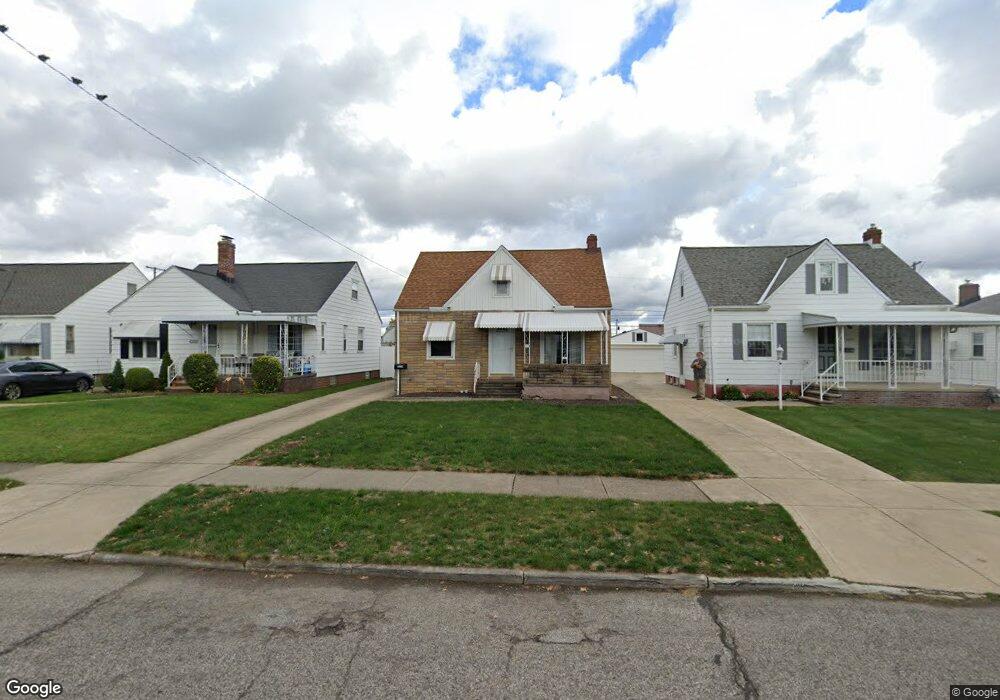
6114 Morningside Dr Cleveland, OH 44129
Estimated Value: $179,422 - $212,000
3
Beds
1
Bath
1,092
Sq Ft
$175/Sq Ft
Est. Value
About This Home
This home is located at 6114 Morningside Dr, Cleveland, OH 44129 and is currently estimated at $190,856, approximately $174 per square foot. 6114 Morningside Dr is a home located in Cuyahoga County with nearby schools including Renwood Elementary School, Thoreau Park Elementary School, and Shiloh Middle School.
Ownership History
Date
Name
Owned For
Owner Type
Purchase Details
Closed on
Jul 7, 1993
Sold by
Ligus James P
Bought by
Ligus Donna M
Current Estimated Value
Purchase Details
Closed on
Apr 22, 1991
Sold by
Ligus Judith A
Bought by
Ligus James P
Purchase Details
Closed on
Jul 1, 1987
Sold by
Michael J Sima
Bought by
Sima Michael J
Purchase Details
Closed on
Nov 30, 1979
Sold by
Sima Michael J and Sima Margaret F
Bought by
Michael J Sima
Purchase Details
Closed on
Jan 1, 1975
Bought by
Sima Michael J and Sima Margaret F
Create a Home Valuation Report for This Property
The Home Valuation Report is an in-depth analysis detailing your home's value as well as a comparison with similar homes in the area
Home Values in the Area
Average Home Value in this Area
Purchase History
| Date | Buyer | Sale Price | Title Company |
|---|---|---|---|
| Ligus Donna M | $68,000 | -- | |
| Ligus James P | $34,000 | -- | |
| Ligus Judith A | -- | -- | |
| Sima Michael J | -- | -- | |
| Michael J Sima | -- | -- | |
| Sima Michael J | -- | -- |
Source: Public Records
Tax History Compared to Growth
Tax History
| Year | Tax Paid | Tax Assessment Tax Assessment Total Assessment is a certain percentage of the fair market value that is determined by local assessors to be the total taxable value of land and additions on the property. | Land | Improvement |
|---|---|---|---|---|
| 2024 | $3,038 | $49,105 | $10,920 | $38,185 |
| 2023 | $2,873 | $40,150 | $9,660 | $30,490 |
| 2022 | $2,845 | $40,150 | $9,660 | $30,490 |
| 2021 | $2,926 | $40,150 | $9,660 | $30,490 |
| 2020 | $2,563 | $30,870 | $7,420 | $23,450 |
| 2019 | $2,451 | $88,200 | $21,200 | $67,000 |
| 2018 | $2,337 | $30,870 | $7,420 | $23,450 |
| 2017 | $2,370 | $27,660 | $5,780 | $21,880 |
| 2016 | $2,356 | $27,660 | $5,780 | $21,880 |
| 2015 | $2,243 | $27,660 | $5,780 | $21,880 |
| 2014 | $2,243 | $28,210 | $5,880 | $22,330 |
Source: Public Records
Map
Nearby Homes
- 5815 Wilber Ave
- 6708 Thornton Dr
- 6704 Charles Ave
- 5603 Allanwood Dr
- 6818 Hampstead Ave
- 6021 Snow Rd
- 6610 Renwood Dr
- 6706 Alber Ave
- 7014 Thornton Dr
- 6903 Alber Ave
- 7115 Hampstead Ave
- 6506 Snow Rd
- 6096 Wareham Dr
- 6111 Manchester Rd
- 6403 Kenneth Ave
- 6406 Sunderland Dr
- 5415 Pelham Dr
- 7514 Spring Garden Rd
- 6306 Gilbert Ave
- 6189 W 54th St
- 6202 Morningside Dr
- 6110 Morningside Dr
- 6206 Morningside Dr
- 6106 Morningside Dr
- 6210 Morningside Dr
- 6102 Morningside Dr
- 6115 Hampstead Ave
- 6203 Hampstead Ave
- 6111 Hampstead Ave
- 6207 Hampstead Ave
- 6107 Hampstead Ave
- 6214 Morningside Dr
- 6211 Hampstead Ave
- 6014 Morningside Dr
- 6103 Hampstead Ave
- 6215 Hampstead Ave
- 6115 Morningside Dr
- 6111 Morningside Dr
- 6107 Morningside Dr
- 6203 Morningside Dr