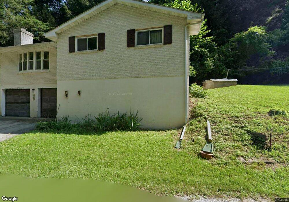
612 Norris Rd Airville, PA 17302
Estimated Value: $305,709 - $321,000
3
Beds
2
Baths
1,463
Sq Ft
$213/Sq Ft
Est. Value
About This Home
This home is located at 612 Norris Rd, Airville, PA 17302 and is currently estimated at $311,927, approximately $213 per square foot. 612 Norris Rd is a home located in York County with nearby schools including Clearview Elementary School, Red Lion Area Junior High School, and Red Lion Area Senior High School.
Ownership History
Date
Name
Owned For
Owner Type
Purchase Details
Closed on
Jan 3, 2013
Sold by
Auble Doris M and Fauth Doris M
Bought by
Fauth Doris M
Current Estimated Value
Home Financials for this Owner
Home Financials are based on the most recent Mortgage that was taken out on this home.
Original Mortgage
$217,500
Outstanding Balance
$148,298
Interest Rate
2.96%
Mortgage Type
Reverse Mortgage Home Equity Conversion Mortgage
Estimated Equity
$163,629
Purchase Details
Closed on
Nov 9, 1967
Bought by
Aubel Doris M
Create a Home Valuation Report for This Property
The Home Valuation Report is an in-depth analysis detailing your home's value as well as a comparison with similar homes in the area
Home Values in the Area
Average Home Value in this Area
Purchase History
| Date | Buyer | Sale Price | Title Company |
|---|---|---|---|
| Fauth Doris M | -- | None Available | |
| Aubel Doris M | -- | -- |
Source: Public Records
Mortgage History
| Date | Status | Borrower | Loan Amount |
|---|---|---|---|
| Open | Fauth Doris M | $217,500 |
Source: Public Records
Tax History Compared to Growth
Tax History
| Year | Tax Paid | Tax Assessment Tax Assessment Total Assessment is a certain percentage of the fair market value that is determined by local assessors to be the total taxable value of land and additions on the property. | Land | Improvement |
|---|---|---|---|---|
| 2025 | $4,844 | $154,460 | $41,760 | $112,700 |
| 2024 | $4,692 | $154,460 | $41,760 | $112,700 |
| 2023 | $4,677 | $154,460 | $41,760 | $112,700 |
| 2022 | $4,677 | $154,460 | $41,760 | $112,700 |
| 2021 | $4,522 | $154,460 | $41,760 | $112,700 |
| 2020 | $4,522 | $154,460 | $41,760 | $112,700 |
| 2019 | $4,492 | $154,460 | $41,760 | $112,700 |
| 2018 | $4,492 | $154,460 | $41,760 | $112,700 |
| 2017 | $4,487 | $154,460 | $41,760 | $112,700 |
| 2016 | $0 | $154,460 | $41,760 | $112,700 |
| 2015 | -- | $154,460 | $41,760 | $112,700 |
| 2014 | -- | $154,460 | $41,760 | $112,700 |
Source: Public Records
Map
Nearby Homes
- Lot 4 Ridge Rd
- 8290 Woodbine Rd
- 53 Dogwood Rd
- 0 Dogwood Rd
- 1081 Bridgeton Rd
- 63 Cherry Rd
- 0 Highview Dr
- 76 Laurel Dr
- 45 Wenzel Rd
- Parcel 859 Neill Run Rd
- 46 Corn Tassel Rd
- 216 Meadow Trail
- 55 Highfield Rd
- 219 Center Rd
- 115 Highfield Rd
- 556 Bair Rd
- 0 Valley Ln
- 387 Garvine Mill Rd
- 65 W Mckinley Rd
- Lot C Bryansville Rd
- 3 Orson Hollow Rd Unit 3
- 628 Norris Rd
- 640 Norris Rd
- 631 Norris Rd
- 540 Norris Rd
- 675 Norris Rd
- 652 Norris Rd
- 689 Norris Rd
- 711 Norris Rd
- 321 Orson Hollow Rd
- 541 Norris Rd
- 709 Norris Rd
- 703 Norris Rd Unit 49
- 703 Norris Rd
- 708 Norris Rd
- 522 Norris Rd
- 319 Orson Hollow Rd
- 1390 Woodbine Rd
- 317 Orson Hollow Rd Unit 3
- 317 Orson Hollow Rd