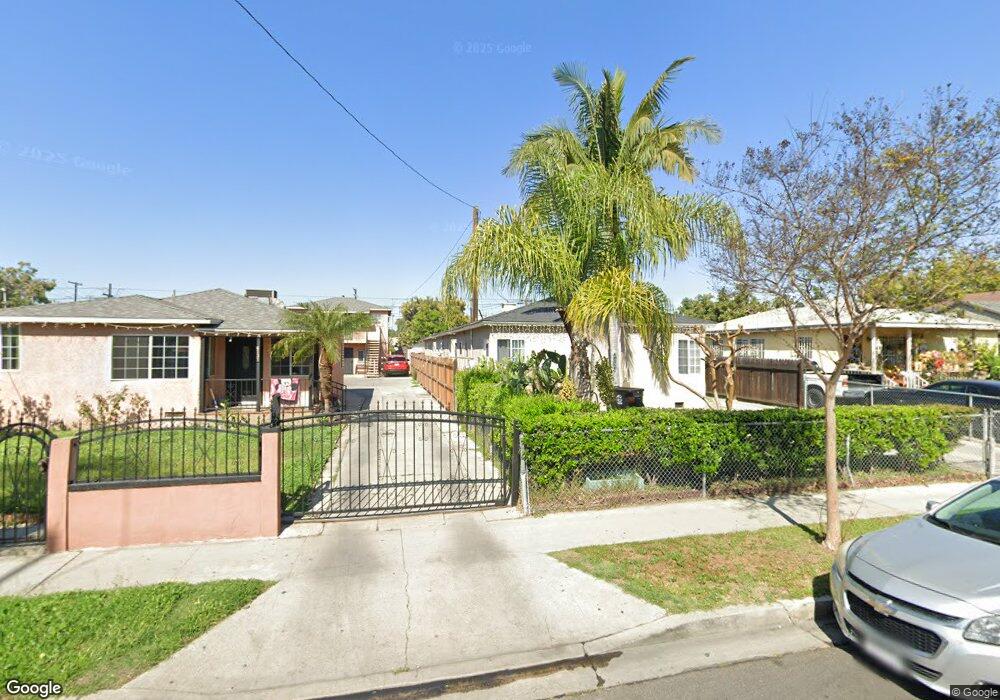
6127 King Ave Maywood, CA 90270
Estimated Value: $770,156 - $924,000
3
Beds
3
Baths
1,728
Sq Ft
$493/Sq Ft
Est. Value
About This Home
This home is located at 6127 King Ave, Maywood, CA 90270 and is currently estimated at $852,539, approximately $493 per square foot. 6127 King Ave is a home located in Los Angeles County with nearby schools including Nueva Vista Elementary School, Chester W. Nimitz Middle School, and Maywood Academy High School.
Ownership History
Date
Name
Owned For
Owner Type
Purchase Details
Closed on
Sep 13, 2000
Sold by
Fierro Joseph
Bought by
Barragan Jose Luis and Barragan Sandra
Current Estimated Value
Home Financials for this Owner
Home Financials are based on the most recent Mortgage that was taken out on this home.
Original Mortgage
$183,487
Outstanding Balance
$66,732
Interest Rate
8.07%
Estimated Equity
$785,807
Purchase Details
Closed on
Jul 26, 2000
Sold by
Barragan Imelda
Bought by
Barragan Jose Luis
Home Financials for this Owner
Home Financials are based on the most recent Mortgage that was taken out on this home.
Original Mortgage
$183,487
Outstanding Balance
$66,732
Interest Rate
8.07%
Estimated Equity
$785,807
Purchase Details
Closed on
Jul 12, 2000
Sold by
Fierro Joseph
Bought by
Basulto Sofia
Purchase Details
Closed on
Dec 18, 1997
Sold by
Fierro Joseph and Fierro Joseph
Bought by
Fierro Joseph
Home Financials for this Owner
Home Financials are based on the most recent Mortgage that was taken out on this home.
Original Mortgage
$134,000
Interest Rate
4.25%
Purchase Details
Closed on
Oct 22, 1997
Sold by
Padilla Steven and Ramirez Arturo
Bought by
Fierro Joseph
Home Financials for this Owner
Home Financials are based on the most recent Mortgage that was taken out on this home.
Original Mortgage
$134,000
Interest Rate
4.25%
Purchase Details
Closed on
Sep 4, 1997
Sold by
Federal National Mortgage Association
Bought by
Padilla Steven and Ramirez Arturo
Home Financials for this Owner
Home Financials are based on the most recent Mortgage that was taken out on this home.
Original Mortgage
$129,000
Interest Rate
7.54%
Purchase Details
Closed on
Aug 25, 1997
Sold by
Jacobs Donna
Bought by
Padilla Steven
Home Financials for this Owner
Home Financials are based on the most recent Mortgage that was taken out on this home.
Original Mortgage
$129,000
Interest Rate
7.54%
Purchase Details
Closed on
May 8, 1997
Sold by
Renteria Jesus and Federal National Mortgage Asso
Bought by
Federal National Mortgage Association
Create a Home Valuation Report for This Property
The Home Valuation Report is an in-depth analysis detailing your home's value as well as a comparison with similar homes in the area
Home Values in the Area
Average Home Value in this Area
Purchase History
| Date | Buyer | Sale Price | Title Company |
|---|---|---|---|
| Barragan Jose Luis | $185,000 | Gateway Title Company | |
| Fierro Joseph | -- | Gateway Title Company | |
| Barragan Jose Luis | -- | Gateway Title Company | |
| Basulto Sofia | -- | -- | |
| Basulto Sofia | -- | -- | |
| Fierro Joseph | -- | Landsafe Title Co | |
| Fierro Joseph | -- | -- | |
| Padilla Steven | $134,000 | South Coast Title | |
| Padilla Steven | -- | South Coast Title | |
| Federal National Mortgage Association | $167,200 | -- |
Source: Public Records
Mortgage History
| Date | Status | Borrower | Loan Amount |
|---|---|---|---|
| Open | Barragan Jose Luis | $183,487 | |
| Previous Owner | Fierro Joseph | $134,000 | |
| Previous Owner | Padilla Steven | $129,000 |
Source: Public Records
Tax History Compared to Growth
Tax History
| Year | Tax Paid | Tax Assessment Tax Assessment Total Assessment is a certain percentage of the fair market value that is determined by local assessors to be the total taxable value of land and additions on the property. | Land | Improvement |
|---|---|---|---|---|
| 2025 | $4,518 | $278,739 | $141,026 | $137,713 |
| 2024 | $4,518 | $273,274 | $138,261 | $135,013 |
| 2023 | $4,445 | $267,916 | $135,550 | $132,366 |
| 2022 | $4,215 | $262,664 | $132,893 | $129,771 |
| 2021 | $4,158 | $257,515 | $130,288 | $127,227 |
| 2020 | $4,178 | $254,876 | $128,953 | $125,923 |
| 2019 | $4,035 | $249,879 | $126,425 | $123,454 |
| 2018 | $3,887 | $244,981 | $123,947 | $121,034 |
| 2017 | $3,703 | $240,178 | $121,517 | $118,661 |
| 2016 | $3,602 | $235,470 | $119,135 | $116,335 |
| 2015 | $3,405 | $231,934 | $117,346 | $114,588 |
| 2014 | $3,412 | $227,392 | $115,048 | $112,344 |
Source: Public Records
Map
Nearby Homes
- 6000 Vinevale Ave
- 4301 E 60th St
- 4339 E 58th St
- 4425 E 57th St
- 5712 Fishburn Ave
- 4212 E 58th St
- 6117 Alamo Ave
- 6059 Riverside Ave
- 6212 Alamo Ave
- 5958 Alamo Ave
- 4539 E 53rd St
- 6704 Vinevale Ave
- 4026 Gage Ave
- 4860 Bell Ave
- 6133 Orchard Ave
- 3800 E 57th St
- 4610 Weik Ave
- 4114 Beck Ave
- 4305 Florence Ave
- 3633 Gage Ave
- 6121 King Ave
- 6117 King Ave
- 6135 King Ave
- 6113 King Ave
- 6139 King Ave
- 6124 Woodward Ave
- 6128 Woodward Ave
- 6136 Woodward Ave
- 6143 King Ave
- 6109 King Ave
- 6122 Woodward Ave Unit A
- 6122 Woodward Ave
- 6112 Woodward Ave
- 6126 King Ave
- 6138 Woodward Ave
- 6147 King Ave
- 6132 King Ave
- 6110 Woodward Ave
- 6144 Woodward Ave
- 4556 E 61st St