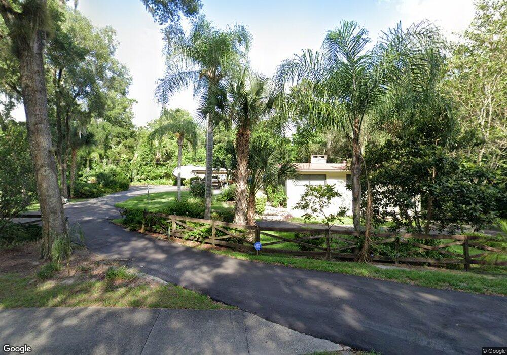
613 N Boston Ave Deland, FL 32724
Estimated Value: $370,000 - $410,000
3
Beds
3
Baths
2,217
Sq Ft
$177/Sq Ft
Est. Value
About This Home
This home is located at 613 N Boston Ave, Deland, FL 32724 and is currently estimated at $391,706, approximately $176 per square foot. 613 N Boston Ave is a home located in Volusia County with nearby schools including Deland High School, Blue Lake Elementary School, and Deland Middle School.
Ownership History
Date
Name
Owned For
Owner Type
Purchase Details
Closed on
Nov 28, 2023
Sold by
Jackson Thomas Dean and Jackson Karen Faye
Bought by
Jackson Thomas Dean
Current Estimated Value
Purchase Details
Closed on
Sep 6, 2017
Sold by
Jackson Thomas Dean
Bought by
Jackson Thomas Dean
Purchase Details
Closed on
Jun 25, 2004
Sold by
Jackson Kenneth L and Jackson Marie W
Bought by
Jackson Kenneth Lee and Jackson Marie Woodhouse
Purchase Details
Closed on
May 15, 1970
Bought by
Jackson Marie Woodhouse Tr
Create a Home Valuation Report for This Property
The Home Valuation Report is an in-depth analysis detailing your home's value as well as a comparison with similar homes in the area
Home Values in the Area
Average Home Value in this Area
Purchase History
| Date | Buyer | Sale Price | Title Company |
|---|---|---|---|
| Jackson Thomas Dean | $100 | None Listed On Document | |
| Jackson Thomas Dean | -- | Attorney | |
| Jackson Kenneth Lee | -- | -- | |
| Jackson Marie Woodhouse Tr | $38,000 | -- |
Source: Public Records
Tax History Compared to Growth
Tax History
| Year | Tax Paid | Tax Assessment Tax Assessment Total Assessment is a certain percentage of the fair market value that is determined by local assessors to be the total taxable value of land and additions on the property. | Land | Improvement |
|---|---|---|---|---|
| 2025 | -- | $255,719 | -- | -- |
| 2024 | -- | $248,513 | -- | -- |
| 2023 | -- | $241,275 | $0 | $0 |
| 2022 | $0 | $234,248 | $0 | $0 |
| 2021 | $0 | $227,425 | $0 | $0 |
| 2020 | $0 | $224,285 | $0 | $0 |
| 2019 | $0 | $219,242 | $0 | $0 |
| 2018 | $0 | $215,154 | $38,896 | $176,258 |
| 2017 | $2,172 | $136,657 | $0 | $0 |
| 2016 | $2,086 | $133,846 | $0 | $0 |
| 2015 | $2,135 | $132,916 | $0 | $0 |
| 2014 | $2,159 | $131,861 | $0 | $0 |
Source: Public Records
Map
Nearby Homes
- 45 S University Cir
- 851 E Pennsylvania Ave
- 437 N Boston Ave Unit 437
- 3 S University Cir
- 706 E Minnesota Ave Unit C
- 612 E Plymouth Ave
- 419 N Frankfort Ave
- 503 E Minnesota Ave
- 708 Montreville Ave
- 406 N Kentucky Ave
- 818 Eastover Cir
- 405 N McDonald Ave
- 927 Azalea Walk Cir
- 931 Azalea Walk Cir
- 701 N Tuxedo Ave
- 505 E Plymouth Ave
- 1005 Crescent Pkwy
- 401 N McDonald Ave
- 1007 Crescent Pkwy
- 322 N Frankfort Ave
- 616 E Pennsylvania Ave
- 708 E Pennsylvania Ave
- 610 N Boston Ave
- 608 N Boston Ave
- 606 N Boston Ave
- 614 E Pennsylvania Ave
- 604 N Boston Ave
- 711 E Pennsylvania Ave
- 700 N Boston Ave
- 601 N Boston Ave
- 602 N Boston Ave
- 641 E Pennsylvania Ave
- 37 N University Cir
- 39 N University Cir
- 600 N Boston Ave
- 720 E Pennsylvania Ave
- 639 E Pennsylvania Ave
- 610 E Pennsylvania Ave
- 41 N University Cir
- 35 N University Cir