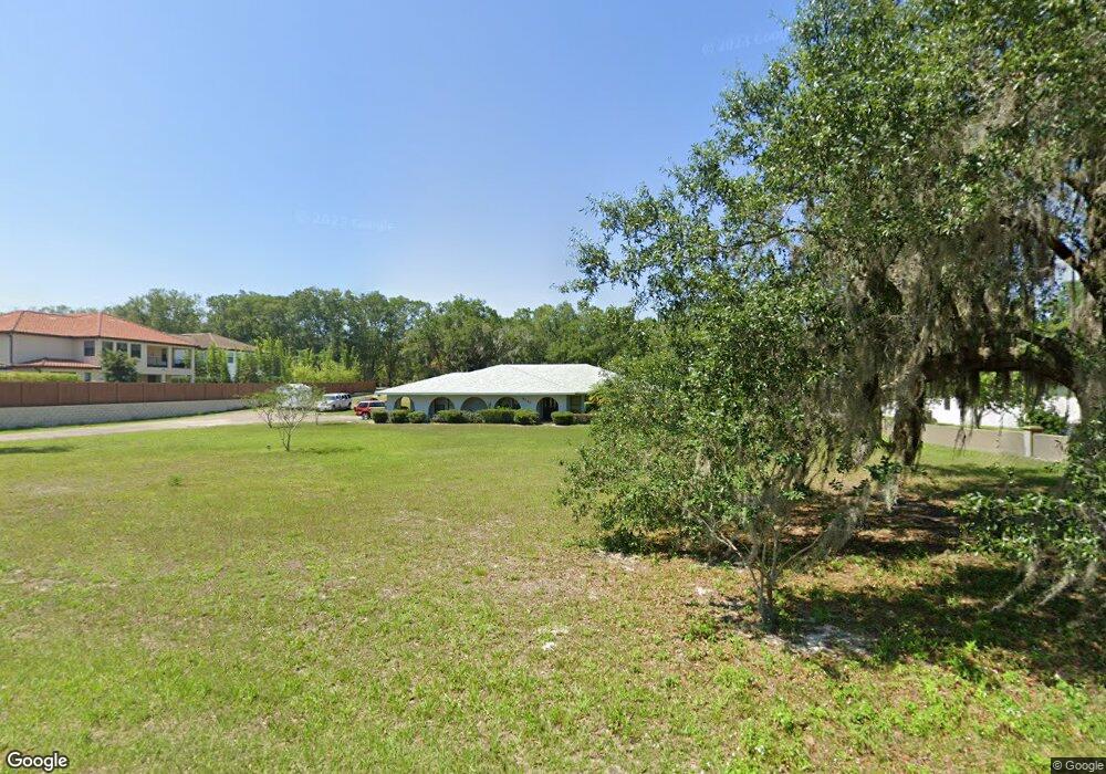
6130 Markham Rd Sanford, FL 32771
Estimated Value: $609,000 - $724,000
4
Beds
3
Baths
3,041
Sq Ft
$222/Sq Ft
Est. Value
About This Home
This home is located at 6130 Markham Rd, Sanford, FL 32771 and is currently estimated at $676,333, approximately $222 per square foot. 6130 Markham Rd is a home located in Seminole County with nearby schools including Wilson Elementary School, Bentley Elementary School, and Idyllwilde Elementary School.
Ownership History
Date
Name
Owned For
Owner Type
Purchase Details
Closed on
Dec 21, 2021
Sold by
Hawthorne Living Trust
Bought by
Hawthorne Mae Alice
Current Estimated Value
Purchase Details
Closed on
Dec 2, 2004
Sold by
Hawthorne George O and Hawthorne Mae Alice
Bought by
Hawthorne George O and Hawthorne Mae A
Purchase Details
Closed on
Jul 17, 1998
Sold by
Hawthorne George O and Hawthorne Mar
Bought by
Cfg At Chapman Inc
Create a Home Valuation Report for This Property
The Home Valuation Report is an in-depth analysis detailing your home's value as well as a comparison with similar homes in the area
Home Values in the Area
Average Home Value in this Area
Purchase History
| Date | Buyer | Sale Price | Title Company |
|---|---|---|---|
| Hawthorne Mae Alice | -- | Stacy A Eckert Pa | |
| Hawthorne George O | -- | -- | |
| Cfg At Chapman Inc | $70,000 | -- |
Source: Public Records
Mortgage History
| Date | Status | Borrower | Loan Amount |
|---|---|---|---|
| Previous Owner | Cfg At Chapman Inc | $238,400 | |
| Previous Owner | Cfg At Chapman Inc | $83,400 |
Source: Public Records
Tax History Compared to Growth
Tax History
| Year | Tax Paid | Tax Assessment Tax Assessment Total Assessment is a certain percentage of the fair market value that is determined by local assessors to be the total taxable value of land and additions on the property. | Land | Improvement |
|---|---|---|---|---|
| 2024 | $1,848 | $161,814 | -- | -- |
| 2023 | $1,798 | $157,101 | $0 | $0 |
| 2021 | $1,732 | $148,083 | $0 | $0 |
| 2020 | $1,713 | $146,038 | $0 | $0 |
| 2019 | $1,691 | $142,755 | $0 | $0 |
| 2018 | $1,666 | $140,093 | $0 | $0 |
| 2017 | $1,650 | $137,212 | $0 | $0 |
| 2016 | $1,681 | $135,331 | $0 | $0 |
| 2015 | $1,469 | $133,456 | $0 | $0 |
| 2014 | $1,469 | $132,397 | $0 | $0 |
Source: Public Records
Map
Nearby Homes
- 1869 Merlot Dr
- 1560 Katie Cove
- 1555 Katie Cove
- 1070 Henley Downs Place
- 1245 Pallister Ln
- 1569 Katie Cove
- 1177 Chantry Place
- 1086 Henley Downs Place
- 1387 Stanfield Cove
- 6125 Village Edge Place
- 6503 Everingham Ln
- 1283 Chessington Cir
- 1116 Saint Albans Loop
- 6689 Bell Glade Place
- 1895 Piedmont Place
- 1656 Utica Trail
- 1178 Kersfield Cir
- 1795 Piedmont Place
- 1677 Utica Trail
- 5769 Saybrook Cir
- 5722 Fulham Place
- 5718 Fulham Place
- 6124 Markham Rd
- 5726 Fulham Place
- 5730 Fulham Place
- 1068 Bloomsbury Run
- 1072 Bloomsbury Run
- 1064 Bloomsbury Run
- 1076 Bloomsbury Run
- 5734 Fulham Place
- 1060 Bloomsbury Run
- 1080 Bloomsbury Run
- 6118 Markham Rd
- 6583 Kyrkham Ct
- 1056 Bloomsbury Run
- 1084 Bloomsbury Run
- 5738 Fulham Place
- 6577 Kyrkham Ct
- 1052 Bloomsbury Run
- 1056 Surreywood Ln