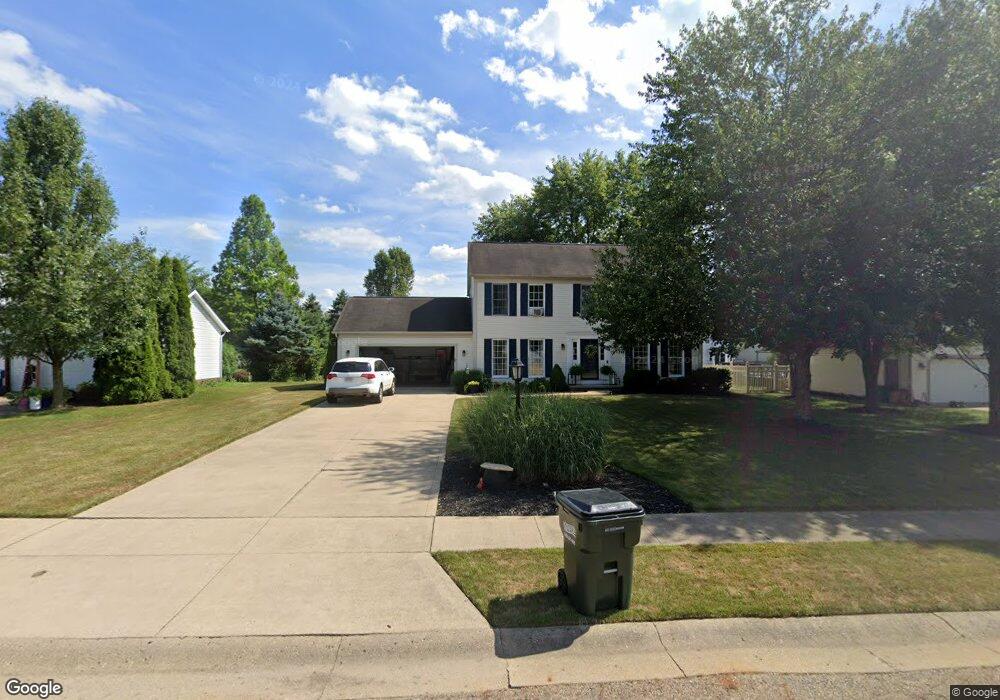
614 Shawnee St Louisville, OH 44641
Estimated Value: $275,000 - $362,000
3
Beds
3
Baths
1,880
Sq Ft
$163/Sq Ft
Est. Value
About This Home
This home is located at 614 Shawnee St, Louisville, OH 44641 and is currently estimated at $307,198, approximately $163 per square foot. 614 Shawnee St is a home located in Stark County with nearby schools including Louisville High School and St. Thomas Aquinas High School & Middle School.
Ownership History
Date
Name
Owned For
Owner Type
Purchase Details
Closed on
Apr 25, 1996
Sold by
Elson J Hershberger Cons
Bought by
Hollifield David G and Hollifield Keri
Current Estimated Value
Home Financials for this Owner
Home Financials are based on the most recent Mortgage that was taken out on this home.
Original Mortgage
$123,400
Outstanding Balance
$6,973
Interest Rate
7.91%
Mortgage Type
New Conventional
Estimated Equity
$300,225
Purchase Details
Closed on
Dec 5, 1995
Sold by
Buffalo Ridge Allotment
Bought by
Elson J Hershberger Const
Create a Home Valuation Report for This Property
The Home Valuation Report is an in-depth analysis detailing your home's value as well as a comparison with similar homes in the area
Home Values in the Area
Average Home Value in this Area
Purchase History
| Date | Buyer | Sale Price | Title Company |
|---|---|---|---|
| Hollifield David G | $129,900 | -- | |
| Elson J Hershberger Const | $42,000 | -- |
Source: Public Records
Mortgage History
| Date | Status | Borrower | Loan Amount |
|---|---|---|---|
| Open | Hollifield David G | $123,400 |
Source: Public Records
Tax History Compared to Growth
Tax History
| Year | Tax Paid | Tax Assessment Tax Assessment Total Assessment is a certain percentage of the fair market value that is determined by local assessors to be the total taxable value of land and additions on the property. | Land | Improvement |
|---|---|---|---|---|
| 2025 | -- | $85,830 | $17,750 | $68,080 |
| 2024 | -- | $85,830 | $17,750 | $68,080 |
| 2023 | $2,808 | $65,350 | $17,610 | $47,740 |
| 2022 | $2,814 | $65,350 | $17,610 | $47,740 |
| 2021 | $2,822 | $65,350 | $17,610 | $47,740 |
| 2020 | $2,338 | $58,800 | $15,890 | $42,910 |
| 2019 | $2,348 | $56,490 | $15,890 | $40,600 |
| 2018 | $2,247 | $56,490 | $15,890 | $40,600 |
| 2017 | $2,089 | $50,680 | $12,950 | $37,730 |
| 2016 | $2,132 | $50,680 | $12,950 | $37,730 |
| 2015 | $2,035 | $50,680 | $12,950 | $37,730 |
| 2014 | $1,986 | $43,750 | $11,200 | $32,550 |
| 2013 | $997 | $43,750 | $11,200 | $32,550 |
Source: Public Records
Map
Nearby Homes
- 908 Sand Lot Cir
- 1702 View Pointe Ave
- 1639 Horizon Dr
- 8225 Georgetown St
- 641 S Nickelplate St
- 520 S Silver St
- 728 E Broad St
- 510 S Bauman Ct
- 204 E Broad St
- 107 E Broad St
- 308 Superior St
- 2425 Miday Ave NE
- 6969 Georgetown St NE
- 1715 High St
- 2110 Edmar St
- 3390 Meese Rd NE
- 1812 E Broad St
- 325 Lincoln Ave
- 0 Michigan Blvd
- 201 Indiana Ave
- 624 Shawnee St
- 604 Shawnee St
- 615 Buffalo Ridge St
- 625 Buffalo Ridge St
- 605 Buffalo Ridge St
- 524 Shawnee St
- 615 Shawnee St
- 625 Shawnee St
- 605 Shawnee St
- 525 Buffalo Ridge St
- 525 Shawnee St
- 514 Shawnee St
- 515 Buffalo Ridge St
- 515 Shawnee St
- 618 Cheyenne Cir
- 614 Buffalo Ridge St
- 504 Shawnee St
- 604 Buffalo Ridge St
- 608 Cheyenne Cir
- 624 Cheyenne Cir