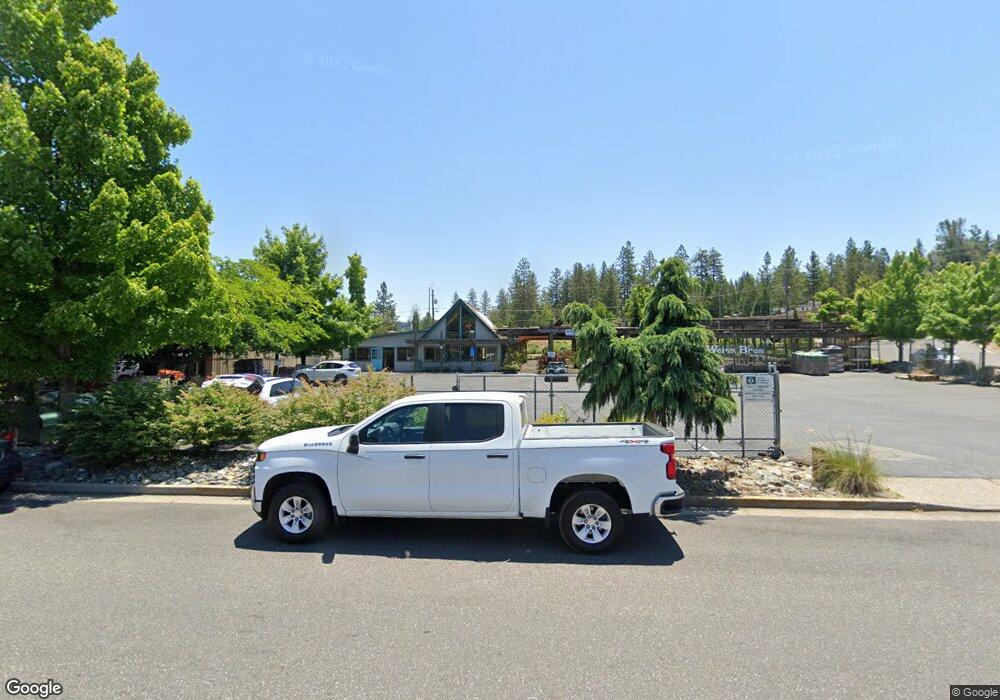
615 Maltman Dr Grass Valley, CA 95945
Estimated Value: $594,000 - $740,136
--
Bed
--
Bath
3,185
Sq Ft
$209/Sq Ft
Est. Value
About This Home
This home is located at 615 Maltman Dr, Grass Valley, CA 95945 and is currently estimated at $664,784, approximately $208 per square foot. 615 Maltman Dr is a home located in Nevada County with nearby schools including Bell Hill Academy, Margaret G. Scotten Elementary School, and Lyman Gilmore Middle School.
Ownership History
Date
Name
Owned For
Owner Type
Purchase Details
Closed on
Feb 21, 2020
Sold by
Weiss Dwight J and Weiss Debra S
Bought by
Sierra Mountain Tree Farm And Nursery
Current Estimated Value
Purchase Details
Closed on
Jan 14, 2020
Sold by
Baldoni Emil T and Baldoni Rebecca E
Bought by
Sierra Mountain Tree Farm And Nursery
Purchase Details
Closed on
Dec 18, 2019
Sold by
Weiss Dwight and Weiss Debra
Bought by
Weiss Dwight J and Weiss Debra S
Create a Home Valuation Report for This Property
The Home Valuation Report is an in-depth analysis detailing your home's value as well as a comparison with similar homes in the area
Home Values in the Area
Average Home Value in this Area
Purchase History
| Date | Buyer | Sale Price | Title Company |
|---|---|---|---|
| Sierra Mountain Tree Farm And Nursery | -- | None Available | |
| Sierra Mountain Tree Farm And Nursery | -- | None Available | |
| Weiss Dwight J | -- | None Available |
Source: Public Records
Tax History Compared to Growth
Tax History
| Year | Tax Paid | Tax Assessment Tax Assessment Total Assessment is a certain percentage of the fair market value that is determined by local assessors to be the total taxable value of land and additions on the property. | Land | Improvement |
|---|---|---|---|---|
| 2025 | $5,837 | $551,297 | $142,092 | $409,205 |
| 2024 | $5,665 | $540,488 | $139,306 | $401,182 |
| 2023 | $5,665 | $529,891 | $136,575 | $393,316 |
| 2022 | $5,602 | $519,502 | $133,898 | $385,604 |
| 2021 | $5,445 | $509,317 | $131,273 | $378,044 |
| 2020 | $5,442 | $504,095 | $129,927 | $374,168 |
| 2019 | $5,214 | $494,212 | $127,380 | $366,832 |
| 2018 | $0 | $484,523 | $124,883 | $359,640 |
| 2017 | $4,987 | $475,025 | $122,435 | $352,590 |
| 2016 | $4,949 | $465,712 | $120,035 | $345,677 |
| 2015 | $4,735 | $458,717 | $118,232 | $340,485 |
| 2014 | -- | $449,733 | $115,916 | $333,817 |
Source: Public Records
Map
Nearby Homes
- 970 Laurel Ln
- 1025 Amber Loop
- 975 Amber Loop
- 133 Brunswick Rd
- 987 Pampas Dr
- 1517 Mulberry Dr
- 262 W Olympia Dr
- 136 Jackrabbit Rd
- 114 Jackrabbit Rd
- 118 Jackrabbit Rd
- 106 Jackrabbit Rd
- 110 Jackrabbit Rd
- 122 Jackrabbit Rd
- 126 Jackrabbit Rd
- 1576 Mulberry Dr
- 614 Cold Spring Ct
- 606 Cold Spring Ct
- 611 Cold Spring Ct
- 605 Cold Spring Ct
- 607 Cold Spring Ct
- 0 Joerschke Dr Unit 80600956
- 633 Maltman Dr
- 653 Maltman Dr
- 153 Joerschke Dr
- 151 Joershke Dr
- 671 Maltman Dr
- 147 Joerschke Dr
- 960 Laurel Ln
- 980 Laurel Ln
- 139 Joerschke Dr
- 131 Joerschke Dr
- 137 Joerschke Dr
- 135 Joerschke Dr
- 133 Joerschke Dr
- 131 Joerschke Dr
- 999 Laurel Ln
- 971 Laurel Ln
- 715 Maltman Dr
- 1020 Laurel Ln
- 10031 Joerschke Dr
