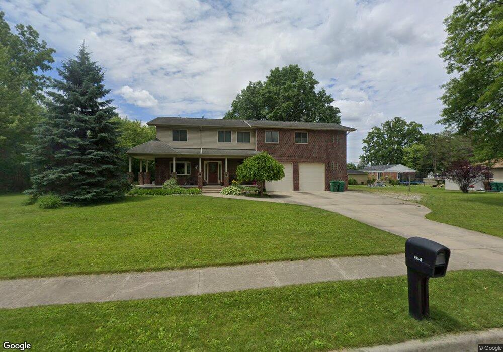
6155 Brandt St Garden City, MI 48135
Estimated Value: $285,000 - $495,000
--
Bed
1
Bath
2,768
Sq Ft
$141/Sq Ft
Est. Value
About This Home
This home is located at 6155 Brandt St, Garden City, MI 48135 and is currently estimated at $389,531, approximately $140 per square foot. 6155 Brandt St is a home located in Wayne County with nearby schools including Memorial Elementary 1-2 Campus, Douglas Elementary 3-4 Campus, and Garden City Middle School.
Ownership History
Date
Name
Owned For
Owner Type
Purchase Details
Closed on
Dec 30, 2003
Sold by
Wiseman Ronald Allan
Bought by
Wiseman Ronald Allan
Current Estimated Value
Home Financials for this Owner
Home Financials are based on the most recent Mortgage that was taken out on this home.
Original Mortgage
$223,000
Interest Rate
5.91%
Mortgage Type
Stand Alone Refi Refinance Of Original Loan
Create a Home Valuation Report for This Property
The Home Valuation Report is an in-depth analysis detailing your home's value as well as a comparison with similar homes in the area
Home Values in the Area
Average Home Value in this Area
Purchase History
| Date | Buyer | Sale Price | Title Company |
|---|---|---|---|
| Wiseman Ronald Allan | -- | Multiple |
Source: Public Records
Mortgage History
| Date | Status | Borrower | Loan Amount |
|---|---|---|---|
| Closed | Wiseman Ronald Allan | $223,000 |
Source: Public Records
Tax History Compared to Growth
Tax History
| Year | Tax Paid | Tax Assessment Tax Assessment Total Assessment is a certain percentage of the fair market value that is determined by local assessors to be the total taxable value of land and additions on the property. | Land | Improvement |
|---|---|---|---|---|
| 2025 | $3,951 | $186,200 | $0 | $0 |
| 2024 | $3,951 | $182,300 | $0 | $0 |
| 2023 | $3,789 | $159,500 | $0 | $0 |
| 2022 | $4,234 | $151,600 | $0 | $0 |
| 2021 | $4,140 | $148,100 | $0 | $0 |
| 2020 | $4,144 | $133,000 | $0 | $0 |
| 2019 | $3,408 | $121,500 | $0 | $0 |
| 2018 | $3,023 | $100,100 | $0 | $0 |
| 2017 | $964 | $97,100 | $0 | $0 |
| 2016 | $3,426 | $95,400 | $0 | $0 |
| 2015 | $6,255 | $85,000 | $0 | $0 |
| 2013 | $6,060 | $63,500 | $0 | $0 |
| 2012 | $3,729 | $64,900 | $10,200 | $54,700 |
Source: Public Records
Map
Nearby Homes
- 29825 Dawson Ave
- 5689 Brandt St
- 30436 Beechwood St
- 6649 Burnly St
- 6705 Whitby St
- 6747 Burnly St
- 157 Middlebelt Rd
- 29801 Bridge St
- 6550 Golfview St
- 28832 Block St
- 29498 Bridge St
- 6727 Hawthorne St
- 28843 Balmoral St
- 29404 Meadow Ln Unit 1
- 30759 Ford Rd
- 0000 Brandt St
- 6439 Huntleigh St
- 31022 Birchlawn St Unit 20
- 28614 Block St
- 28538 Block St
- 29921 Elmwood St
- 5663 Burnly St
- 29941 Elmwood St
- 30008 Dawson St
- 29957 Elmwood St
- 29899 Elmwood St
- 29969 Elmwood St
- 29883 Elmwood St
- 30014 Dawson St
- 30018 Dawson St
- 29918 Elmwood St
- 29934 Elmwood St
- 29910 Elmwood St
- 29985 Elmwood St
- 29942 Elmwood St
- 29856 Dawson St
- 29958 Elmwood St
- 29896 Elmwood St
- 30026 Dawson St
- 29855 Elmwood St