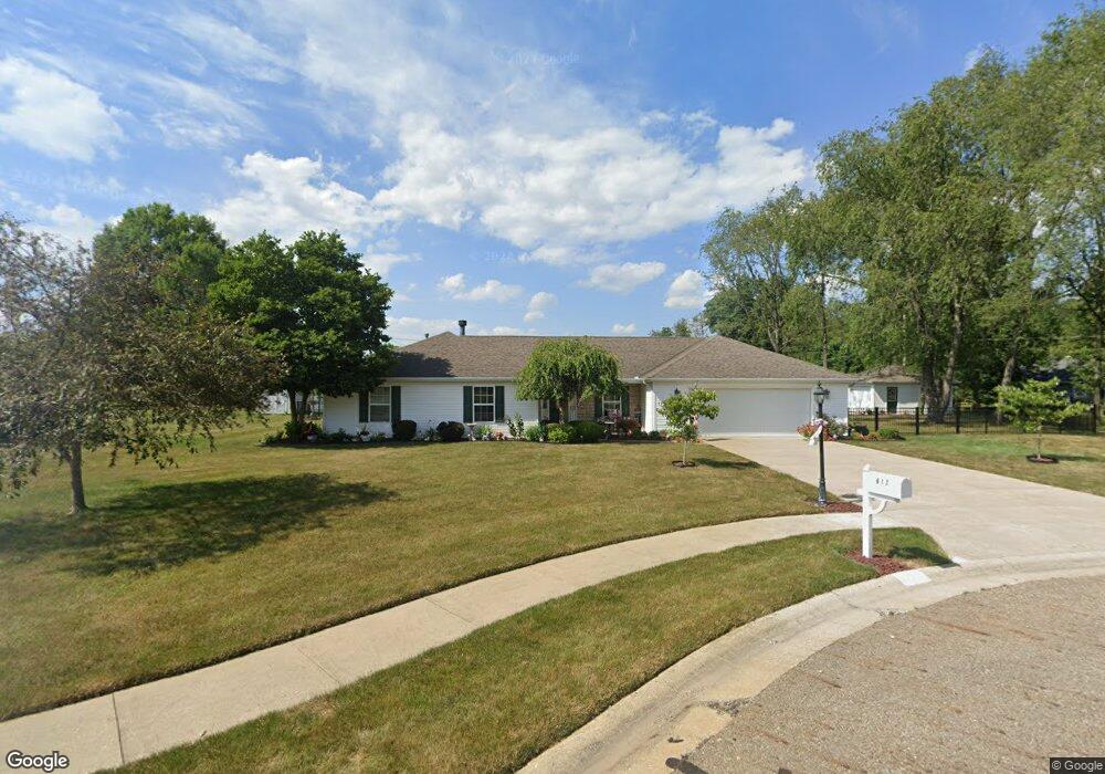
617 Cheyenne Cir Louisville, OH 44641
Estimated Value: $265,000 - $315,000
2
Beds
3
Baths
1,677
Sq Ft
$174/Sq Ft
Est. Value
About This Home
This home is located at 617 Cheyenne Cir, Louisville, OH 44641 and is currently estimated at $292,060, approximately $174 per square foot. 617 Cheyenne Cir is a home located in Stark County with nearby schools including Louisville High School and St. Thomas Aquinas High School & Middle School.
Ownership History
Date
Name
Owned For
Owner Type
Purchase Details
Closed on
May 11, 2000
Sold by
Holbrook Kedrick E and Holbrook Pearl
Bought by
Kent George R and Kent Sherri A
Current Estimated Value
Purchase Details
Closed on
Mar 20, 1998
Sold by
Davis Sarah F
Bought by
Holbrook Kedrick E and Holbrook Pearl
Create a Home Valuation Report for This Property
The Home Valuation Report is an in-depth analysis detailing your home's value as well as a comparison with similar homes in the area
Home Values in the Area
Average Home Value in this Area
Purchase History
| Date | Buyer | Sale Price | Title Company |
|---|---|---|---|
| Kent George R | $30,000 | Mk Title Agency Of Stark Cou | |
| Holbrook Kedrick E | $24,000 | -- |
Source: Public Records
Tax History Compared to Growth
Tax History
| Year | Tax Paid | Tax Assessment Tax Assessment Total Assessment is a certain percentage of the fair market value that is determined by local assessors to be the total taxable value of land and additions on the property. | Land | Improvement |
|---|---|---|---|---|
| 2025 | -- | $105,780 | $21,460 | $84,320 |
| 2024 | -- | $105,780 | $21,460 | $84,320 |
| 2023 | $3,387 | $78,790 | $21,280 | $57,510 |
| 2022 | $3,332 | $77,350 | $21,280 | $56,070 |
| 2021 | $3,341 | $77,350 | $21,280 | $56,070 |
| 2020 | $2,766 | $69,550 | $19,180 | $50,370 |
| 2019 | $2,778 | $72,280 | $21,910 | $50,370 |
| 2018 | $2,875 | $72,280 | $21,910 | $50,370 |
| 2017 | $2,758 | $66,890 | $17,890 | $49,000 |
| 2016 | $2,814 | $66,890 | $17,890 | $49,000 |
| 2015 | $2,822 | $66,890 | $17,890 | $49,000 |
| 2014 | $566 | $56,570 | $15,440 | $41,130 |
| 2013 | $1,287 | $56,570 | $15,440 | $41,130 |
Source: Public Records
Map
Nearby Homes
- 908 Sand Lot Cir
- 1702 View Pointe Ave
- 1639 Horizon Dr
- 641 S Nickelplate St
- 520 S Silver St
- 728 E Broad St
- 510 S Bauman Ct
- 204 E Broad St
- 107 E Broad St
- 8225 Georgetown St
- 308 Superior St
- 1715 High St
- 2110 Edmar St
- 1812 E Broad St
- 3390 Meese Rd NE
- 325 Lincoln Ave
- 6969 Georgetown St NE
- 2425 Miday Ave NE
- 0 Michigan Blvd
- 201 Indiana Ave