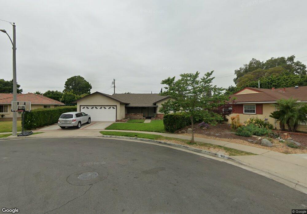
617 S Newcastle Dr Anaheim, CA 92804
West Anaheim NeighborhoodEstimated Value: $955,000 - $998,000
3
Beds
3
Baths
1,586
Sq Ft
$616/Sq Ft
Est. Value
About This Home
This home is located at 617 S Newcastle Dr, Anaheim, CA 92804 and is currently estimated at $976,730, approximately $615 per square foot. 617 S Newcastle Dr is a home located in Orange County with nearby schools including Baden-Powell Elementary School, Dale Jr High School, and Magnolia High.
Ownership History
Date
Name
Owned For
Owner Type
Purchase Details
Closed on
Jun 17, 2021
Sold by
Martinez John M and Martinez Gloria J
Bought by
Martinez John M and Martinez Gloria J
Current Estimated Value
Purchase Details
Closed on
Jun 14, 2001
Sold by
Martinez John M and Martinez Gloria J
Bought by
Martinez John M and Martinez Gloria J
Home Financials for this Owner
Home Financials are based on the most recent Mortgage that was taken out on this home.
Original Mortgage
$158,600
Interest Rate
7.1%
Create a Home Valuation Report for This Property
The Home Valuation Report is an in-depth analysis detailing your home's value as well as a comparison with similar homes in the area
Home Values in the Area
Average Home Value in this Area
Purchase History
| Date | Buyer | Sale Price | Title Company |
|---|---|---|---|
| Martinez John M | -- | None Available | |
| Martinez John M | -- | Lawyers Title Company |
Source: Public Records
Mortgage History
| Date | Status | Borrower | Loan Amount |
|---|---|---|---|
| Closed | Martinez John M | $158,600 |
Source: Public Records
Tax History Compared to Growth
Tax History
| Year | Tax Paid | Tax Assessment Tax Assessment Total Assessment is a certain percentage of the fair market value that is determined by local assessors to be the total taxable value of land and additions on the property. | Land | Improvement |
|---|---|---|---|---|
| 2025 | $1,494 | $111,253 | $29,079 | $82,174 |
| 2024 | $1,494 | $109,072 | $28,509 | $80,563 |
| 2023 | $1,451 | $106,934 | $27,950 | $78,984 |
| 2022 | $1,430 | $104,838 | $27,402 | $77,436 |
| 2021 | $1,411 | $102,783 | $26,865 | $75,918 |
| 2020 | $1,401 | $101,730 | $26,590 | $75,140 |
| 2019 | $1,372 | $99,736 | $26,069 | $73,667 |
| 2018 | $1,354 | $97,781 | $25,558 | $72,223 |
| 2017 | $1,311 | $95,864 | $25,057 | $70,807 |
| 2016 | $1,301 | $93,985 | $24,566 | $69,419 |
| 2015 | $1,287 | $92,574 | $24,197 | $68,377 |
| 2014 | $1,229 | $90,761 | $23,723 | $67,038 |
Source: Public Records
Map
Nearby Homes
- 507 S Shields Dr
- 619 S Shields Dr
- 2945 W Bridgeport Ave
- 2942 W Floyd Ave
- 231 S Laxore St
- 716 S Hayward St Unit 2
- 1223 S Dale Ave
- 2770 W Lincoln Ave Unit 40
- 2770 W Lincoln Ave Unit 58
- 1234 S Macduff St
- 103 S Laxore St
- 106 S Laxore St Unit 407
- 107 S Laxore St
- 900 S Hayward St
- 211 S Beach Blvd Unit 92
- 235 S Beach Blvd Unit 132
- Plan Two at Mason
- Plan Four at Mason
- Plan Three at Mason
- Plan Seven at Mason
- 621 S Newcastle Dr
- 612 S Newcastle Dr
- 616 S Birchleaf Dr
- 620 S Birchleaf Dr
- 2830 W Orange Ave
- 2820 W Orange Ave
- 625 S Newcastle Dr
- 616 S Newcastle Dr
- 624 S Birchleaf Dr
- 612 S Birchleaf Dr
- 2836 W Orange Ave
- 629 S Newcastle Dr
- 624 S Newcastle Dr
- 628 S Birchleaf Dr
- 2840 W Orange Ave
- 628 S Newcastle Dr
- 621 S Birchleaf Dr
- 611 S Dale Ave
- 615 S Dale Ave
- 607 S Dale Ave