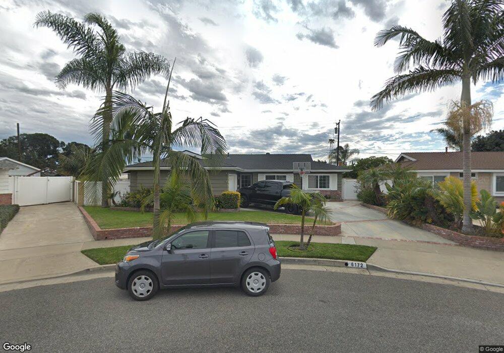
6172 Dundee Dr Huntington Beach, CA 92647
Estimated Value: $1,217,000 - $1,268,000
3
Beds
3
Baths
1,756
Sq Ft
$708/Sq Ft
Est. Value
About This Home
This home is located at 6172 Dundee Dr, Huntington Beach, CA 92647 and is currently estimated at $1,242,703, approximately $707 per square foot. 6172 Dundee Dr is a home located in Orange County with nearby schools including Schroeder Elementary School, Helen Stacey Intermediate School, and Marina High School.
Ownership History
Date
Name
Owned For
Owner Type
Purchase Details
Closed on
Jun 7, 2000
Sold by
Sutton Kenneth H
Bought by
Vanwaardenburg Matthew J and Vanwaardenburg Ginette L
Current Estimated Value
Home Financials for this Owner
Home Financials are based on the most recent Mortgage that was taken out on this home.
Original Mortgage
$270,375
Interest Rate
8.2%
Mortgage Type
Stand Alone First
Create a Home Valuation Report for This Property
The Home Valuation Report is an in-depth analysis detailing your home's value as well as a comparison with similar homes in the area
Home Values in the Area
Average Home Value in this Area
Purchase History
| Date | Buyer | Sale Price | Title Company |
|---|---|---|---|
| Vanwaardenburg Matthew J | $309,000 | First Southwestern Title Co | |
| Sutton Kenneth | -- | First Southwestern Title Co |
Source: Public Records
Mortgage History
| Date | Status | Borrower | Loan Amount |
|---|---|---|---|
| Previous Owner | Vanwaardenburg Matthew J | $270,375 | |
| Closed | Vanwaardenburg Matthew J | $61,800 |
Source: Public Records
Tax History Compared to Growth
Tax History
| Year | Tax Paid | Tax Assessment Tax Assessment Total Assessment is a certain percentage of the fair market value that is determined by local assessors to be the total taxable value of land and additions on the property. | Land | Improvement |
|---|---|---|---|---|
| 2025 | $6,253 | $530,690 | $375,589 | $155,101 |
| 2024 | $6,253 | $520,285 | $368,225 | $152,060 |
| 2023 | $6,041 | $510,084 | $361,005 | $149,079 |
| 2022 | $5,952 | $500,083 | $353,927 | $146,156 |
| 2021 | $5,824 | $490,278 | $346,987 | $143,291 |
| 2020 | $5,753 | $485,251 | $343,429 | $141,822 |
| 2019 | $5,687 | $475,737 | $336,695 | $139,042 |
| 2018 | $5,686 | $466,409 | $330,093 | $136,316 |
| 2017 | $5,466 | $457,264 | $323,620 | $133,644 |
| 2016 | $5,289 | $448,299 | $317,275 | $131,024 |
| 2015 | $5,197 | $441,566 | $312,510 | $129,056 |
| 2014 | $5,077 | $432,917 | $306,389 | $126,528 |
Source: Public Records
Map
Nearby Homes
- 6091 Dundee Dr
- 14862 Sabre Ln
- 6022 Larchwood Dr
- 15012 Hanover Ln
- 6101 Jade Cir
- 15801 Carrie Ln
- 6401 Royal Oak Dr
- 15072 Sussex Cir
- 6522 Limerick Dr
- 15722 Dawson Ln
- 6311 Wisteria Dr
- 6631 Walton Dr
- 5932 Chinook Dr
- 5751 Mangrum Dr
- 16081 Windemeir Ln
- 14281 Edwards St
- 16261 Angler Ln
- 7221 Siena Ave
- 5872 Camphor Ave
- 5521 Dollar Dr
- 6182 Dundee Dr
- 6152 Dundee Dr
- 6171 Cornell Dr
- 6181 Cornell Dr
- 6151 Cornell Dr
- 6191 Cornell Dr
- 6142 Dundee Dr
- 6181 Dundee Dr
- 6141 Cornell Dr
- 6171 Dundee Dr
- 6151 Dundee Dr
- 6132 Dundee Dr
- 6131 Cornell Dr
- 6141 Dundee Dr
- 6172 Cornell Dr
- 6182 Cornell Dr
- 6122 Dundee Dr
- 6152 Cornell Dr
- 6131 Dundee Dr
- 6192 Cornell Dr