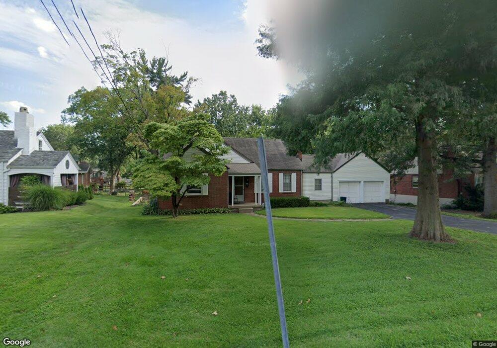
618 Darst Rd Saint Louis, MO 63135
Estimated Value: $156,000 - $178,102
4
Beds
2
Baths
1,683
Sq Ft
$101/Sq Ft
Est. Value
About This Home
This home is located at 618 Darst Rd, Saint Louis, MO 63135 and is currently estimated at $169,526, approximately $100 per square foot. 618 Darst Rd is a home located in St. Louis County with nearby schools including Vogt Elementary School, Ferguson Middle School, and McCluer High School.
Ownership History
Date
Name
Owned For
Owner Type
Purchase Details
Closed on
Aug 7, 1998
Sold by
Hammond Kenneth M and Hammond Peggy A
Bought by
Romeo Michael D and Romeo Patricia Kay
Current Estimated Value
Home Financials for this Owner
Home Financials are based on the most recent Mortgage that was taken out on this home.
Original Mortgage
$60,000
Outstanding Balance
$12,550
Interest Rate
6.95%
Estimated Equity
$156,976
Create a Home Valuation Report for This Property
The Home Valuation Report is an in-depth analysis detailing your home's value as well as a comparison with similar homes in the area
Home Values in the Area
Average Home Value in this Area
Purchase History
| Date | Buyer | Sale Price | Title Company |
|---|---|---|---|
| Romeo Michael D | -- | -- |
Source: Public Records
Mortgage History
| Date | Status | Borrower | Loan Amount |
|---|---|---|---|
| Open | Romeo Michael D | $60,000 |
Source: Public Records
Tax History Compared to Growth
Tax History
| Year | Tax Paid | Tax Assessment Tax Assessment Total Assessment is a certain percentage of the fair market value that is determined by local assessors to be the total taxable value of land and additions on the property. | Land | Improvement |
|---|---|---|---|---|
| 2025 | $2,256 | $33,100 | $4,520 | $28,580 |
| 2024 | $2,256 | $31,260 | $3,140 | $28,120 |
| 2023 | $2,256 | $31,260 | $3,140 | $28,120 |
| 2022 | $2,068 | $25,100 | $3,930 | $21,170 |
| 2021 | $2,002 | $25,100 | $3,930 | $21,170 |
| 2020 | $2,015 | $22,720 | $3,150 | $19,570 |
| 2019 | $1,977 | $22,720 | $3,150 | $19,570 |
| 2018 | $2,021 | $20,730 | $2,850 | $17,880 |
| 2017 | $1,981 | $20,730 | $2,850 | $17,880 |
| 2016 | $1,580 | $16,210 | $2,470 | $13,740 |
| 2015 | $1,591 | $16,210 | $2,470 | $13,740 |
| 2014 | $1,599 | $16,110 | $2,980 | $13,130 |
Source: Public Records
Map
Nearby Homes
- 208 Coppinger Dr
- 310 Ames Place
- 315 Coppinger Dr
- 135 S Barat Ave
- 141 S Barat Ave
- 320 Church St
- 324 Ames Place
- 406 Teston Dr
- 26 N Maple Ave
- 418 Millman Dr
- 408 Coppinger Dr
- 12 N Maple Ave
- 405 Teston Dr
- 215 Bruce Ave
- 610 Superior Dr
- 514 La Motte Ln
- 1006 Highmont Dr
- 539 Coppinger Dr
- 506 Averill Ave
- 29 Godfrey Ln