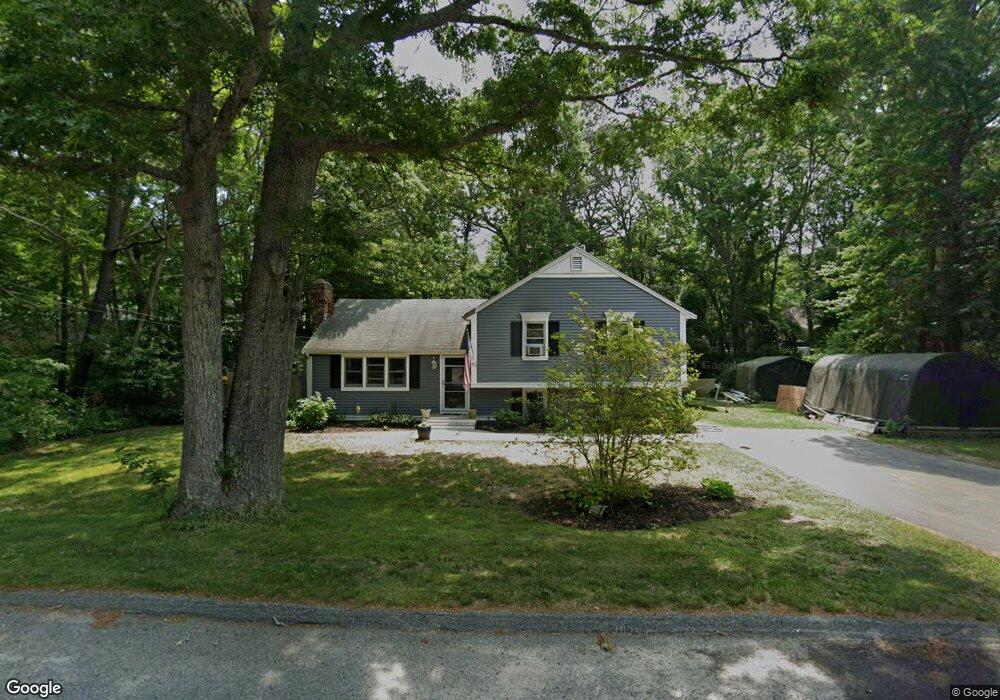
62 Janebar Cir Plymouth, MA 02360
Estimated Value: $479,000 - $560,000
3
Beds
1
Bath
1,100
Sq Ft
$470/Sq Ft
Est. Value
About This Home
This home is located at 62 Janebar Cir, Plymouth, MA 02360 and is currently estimated at $517,061, approximately $470 per square foot. 62 Janebar Cir is a home located in Plymouth County with nearby schools including Indian Brook, Plymouth South Middle School, and Plymouth South High School.
Ownership History
Date
Name
Owned For
Owner Type
Purchase Details
Closed on
Mar 18, 1996
Sold by
Packard Keith S and Packard Denise L
Bought by
Washburn Glenn E and Washburn Kris E
Current Estimated Value
Purchase Details
Closed on
Jul 3, 1992
Sold by
Fed Natl Mtg Assn
Bought by
Packard Keith S and Packard Denise L
Purchase Details
Closed on
Mar 19, 1992
Sold by
Russell Lawrence R
Bought by
Natl City Mtg Corp
Create a Home Valuation Report for This Property
The Home Valuation Report is an in-depth analysis detailing your home's value as well as a comparison with similar homes in the area
Home Values in the Area
Average Home Value in this Area
Purchase History
| Date | Buyer | Sale Price | Title Company |
|---|---|---|---|
| Washburn Glenn E | $107,000 | -- | |
| Packard Keith S | $101,000 | -- | |
| Packard Keith S | $101,000 | -- | |
| Natl City Mtg Corp | $126,000 | -- | |
| Natl City Mtg Corp | $126,000 | -- |
Source: Public Records
Mortgage History
| Date | Status | Borrower | Loan Amount |
|---|---|---|---|
| Open | Natl City Mtg Corp | $277,000 | |
| Closed | Natl City Mtg Corp | $240,000 |
Source: Public Records
Tax History Compared to Growth
Tax History
| Year | Tax Paid | Tax Assessment Tax Assessment Total Assessment is a certain percentage of the fair market value that is determined by local assessors to be the total taxable value of land and additions on the property. | Land | Improvement |
|---|---|---|---|---|
| 2025 | $5,372 | $423,300 | $224,900 | $198,400 |
| 2024 | $5,317 | $413,100 | $220,200 | $192,900 |
| 2023 | $5,132 | $374,300 | $192,200 | $182,100 |
| 2022 | $4,735 | $306,900 | $174,800 | $132,100 |
| 2021 | $4,652 | $287,900 | $174,800 | $113,100 |
| 2020 | $4,712 | $288,200 | $177,200 | $111,000 |
| 2019 | $4,446 | $268,800 | $157,800 | $111,000 |
| 2018 | $4,187 | $254,400 | $145,600 | $108,800 |
| 2017 | $3,987 | $240,500 | $139,800 | $100,700 |
| 2016 | $3,724 | $228,900 | $128,200 | $100,700 |
| 2015 | $3,557 | $228,900 | $128,200 | $100,700 |
| 2014 | $3,351 | $221,500 | $128,200 | $93,300 |
Source: Public Records
Map
Nearby Homes
- 12 Kara's Way
- 5 Laurie Ann's Ln
- 1 Kara's Way
- 11 Village Green Dr Unit B
- 26 Spencer Dr
- 1150 Long Pond Rd
- 37 Spencer Dr
- 65 Lakewood Dr
- 29 Sheppard Rd
- 368 Old Plymouth Rd
- 4 Clapp Ln
- 0 State Rd
- 53 White Cliff Dr
- 110 Valley Rd
- 48 Menotomy Rd
- 15 Nonantum Rd
- 92 Cliffside Dr
- 92 Cliffside Dr Unit White Cliff
- 18 Westcliff Dr
- 20 Westcliff Dr Unit 20