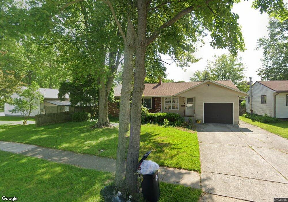
62 Parsons St Norwalk, OH 44857
Estimated Value: $161,000 - $181,000
3
Beds
2
Baths
1,204
Sq Ft
$142/Sq Ft
Est. Value
About This Home
This home is located at 62 Parsons St, Norwalk, OH 44857 and is currently estimated at $171,464, approximately $142 per square foot. 62 Parsons St is a home located in Huron County with nearby schools including Maplehurst Elementary School, League Elementary School, and Pleasant Elementary School.
Ownership History
Date
Name
Owned For
Owner Type
Purchase Details
Closed on
Jun 13, 2024
Sold by
Krupp Brian T and Krupp Steven P
Bought by
Wayne And Mary Jane Uther Living Trust and Uther
Current Estimated Value
Home Financials for this Owner
Home Financials are based on the most recent Mortgage that was taken out on this home.
Original Mortgage
$131,250
Outstanding Balance
$127,411
Interest Rate
7.22%
Mortgage Type
Credit Line Revolving
Estimated Equity
$44,053
Purchase Details
Closed on
Jul 6, 1987
Bought by
Krupp Leona E
Create a Home Valuation Report for This Property
The Home Valuation Report is an in-depth analysis detailing your home's value as well as a comparison with similar homes in the area
Home Values in the Area
Average Home Value in this Area
Purchase History
| Date | Buyer | Sale Price | Title Company |
|---|---|---|---|
| Wayne And Mary Jane Uther Living Trust | -- | None Listed On Document | |
| Krupp Leona E | $10,000 | -- |
Source: Public Records
Mortgage History
| Date | Status | Borrower | Loan Amount |
|---|---|---|---|
| Open | Wayne And Mary Jane Uther Living Trust | $131,250 |
Source: Public Records
Tax History Compared to Growth
Tax History
| Year | Tax Paid | Tax Assessment Tax Assessment Total Assessment is a certain percentage of the fair market value that is determined by local assessors to be the total taxable value of land and additions on the property. | Land | Improvement |
|---|---|---|---|---|
| 2024 | $1,700 | $51,460 | $7,810 | $43,650 |
| 2023 | $1,700 | $38,670 | $6,230 | $32,440 |
| 2022 | $1,206 | $38,670 | $6,230 | $32,440 |
| 2021 | $1,207 | $38,670 | $6,230 | $32,440 |
| 2020 | $1,018 | $32,760 | $6,230 | $26,530 |
| 2019 | $995 | $32,760 | $6,230 | $26,530 |
| 2018 | $978 | $32,760 | $6,230 | $26,530 |
| 2017 | $916 | $31,160 | $6,230 | $24,930 |
| 2016 | $899 | $31,160 | $6,230 | $24,930 |
| 2015 | $898 | $31,170 | $6,240 | $24,930 |
| 2014 | $896 | $30,910 | $6,230 | $24,680 |
| 2013 | $778 | $30,910 | $6,230 | $24,680 |
Source: Public Records
Map
Nearby Homes
- 203 Spino St
- 14 Republic St
- 45 Grove Ave
- 6 Blossom Dr Unit B
- 173 Saint Marys St
- 154 Gallup Ave
- 0 Milan Ave
- 34 Old State Rd N
- 123 E Main St
- 112 State Route 61 Unit 25
- 57 Milan Ave
- 121 Leisure Ln
- 6 White Tail Way Unit A
- 17 Sara Dr
- 29 Corwin St
- 14 Corwin St
- 33 Falcon Crest Dr Unit C
- 0 Cleveland Rd
- 13 Spring St
- 15 E Washington St