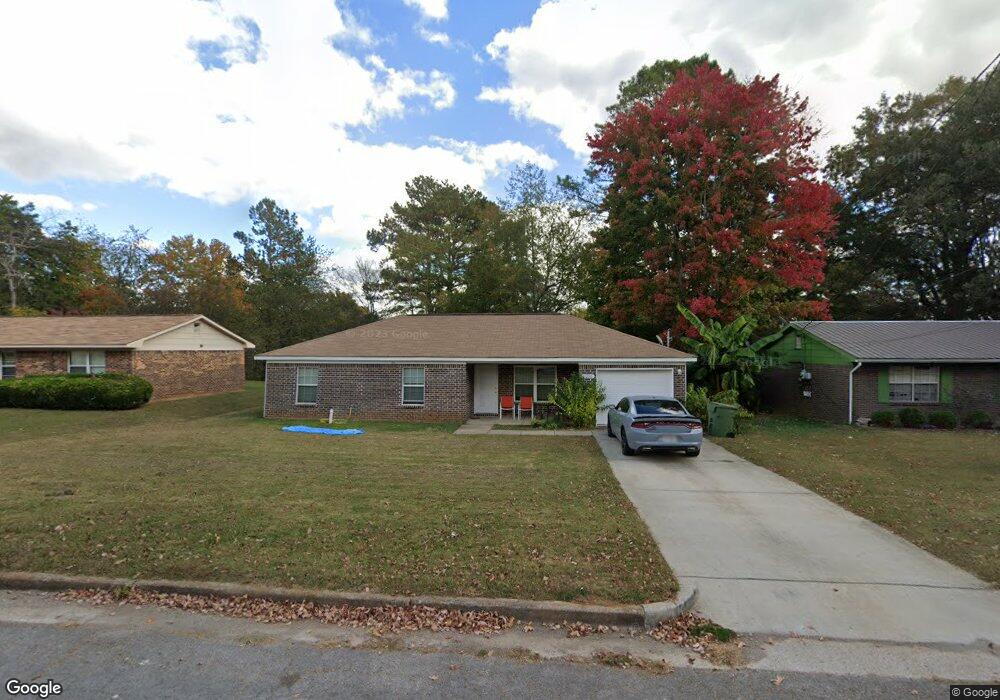
6220 Maywick Dr NW Huntsville, AL 35810
Meadow Hills NeighborhoodEstimated Value: $158,855 - $248,000
--
Bed
--
Bath
1,064
Sq Ft
$172/Sq Ft
Est. Value
About This Home
This home is located at 6220 Maywick Dr NW, Huntsville, AL 35810 and is currently estimated at $183,464, approximately $172 per square foot. 6220 Maywick Dr NW is a home with nearby schools including Rolling Hills Elementary School, Ronald E. McNair Junior High School, and Jemison High School.
Ownership History
Date
Name
Owned For
Owner Type
Purchase Details
Closed on
Sep 9, 2021
Sold by
Habitat For Humanity Inc
Bought by
Sheppard Lashondra Tarshae
Current Estimated Value
Home Financials for this Owner
Home Financials are based on the most recent Mortgage that was taken out on this home.
Original Mortgage
$76,104
Interest Rate
2.7%
Mortgage Type
Purchase Money Mortgage
Create a Home Valuation Report for This Property
The Home Valuation Report is an in-depth analysis detailing your home's value as well as a comparison with similar homes in the area
Home Values in the Area
Average Home Value in this Area
Purchase History
| Date | Buyer | Sale Price | Title Company |
|---|---|---|---|
| Sheppard Lashondra Tarshae | $132,000 | Adm Title Services Llc |
Source: Public Records
Mortgage History
| Date | Status | Borrower | Loan Amount |
|---|---|---|---|
| Previous Owner | Sheppard Lashondra Tarshae | $76,104 |
Source: Public Records
Tax History Compared to Growth
Tax History
| Year | Tax Paid | Tax Assessment Tax Assessment Total Assessment is a certain percentage of the fair market value that is determined by local assessors to be the total taxable value of land and additions on the property. | Land | Improvement |
|---|---|---|---|---|
| 2024 | $1,762 | $28,660 | $5,000 | $23,660 |
| 2023 | $1,662 | $28,020 | $5,000 | $23,020 |
| 2022 | $1,361 | $23,460 | $1,520 | $21,940 |
| 2021 | $0 | $19,980 | $820 | $19,160 |
| 2020 | $0 | $17,580 | $680 | $16,900 |
| 2019 | $0 | $680 | $680 | $0 |
| 2018 | $0 | $680 | $0 | $0 |
| 2017 | $0 | $680 | $0 | $0 |
| 2016 | -- | $680 | $0 | $0 |
| 2015 | $39 | $680 | $0 | $0 |
| 2014 | $39 | $680 | $0 | $0 |
Source: Public Records
Map
Nearby Homes
- .29 Menifee Dr NW
- 6313 Sandia Blvd NW
- 6223 Pisgah Dr NW
- 6220 Pisgah Dr NW
- 6222 Pisgah Dr NW
- 6224 Pisgah Dr NW
- 6235 Pisgah Dr NW
- 6106 Tuscaloosa Dr NW
- 6116 Pisgah Dr NW
- 6236 Pisgah Dr NW
- 6027 Trent Dr NW
- 2131 Pisgah Cir NW
- 2819 Coosa Cir NW
- 85 Acres Spragins Hollow Rd NW
- The Chelsea A Plan at Spragins Cove
- The Butler Plan at Spragins Cove
- The Franklin Plan at Spragins Cove
- The Daphne Plan at Spragins Cove
- The Everett Plan at Spragins Cove
- The Shelby A Plan at Spragins Cove
- 6222 Maywick Dr NW
- 6218 Maywick Dr NW
- 6224 Maywick Dr NW
- 6223 Maywick Dr NW
- 6216 Maywick Dr NW
- 6221 Maywick Dr NW
- 6219 Maywick Dr NW
- 6207 Sandia Blvd NW
- 6209 Sandia Blvd NW
- 6225 Maywick Dr NW
- 6211 Sandia Blvd NW
- 6226 Maywick Dr NW
- 6205 Sandia Blvd NW
- 6217 Maywick Dr NW
- 6214 Maywick Dr NW
- 6203 Sandia Blvd NW
- 6227 Maywick Dr NW
- 6213 Sandia Blvd NW
- 6215 Maywick Dr NW
- 6228 Maywick Dr NW