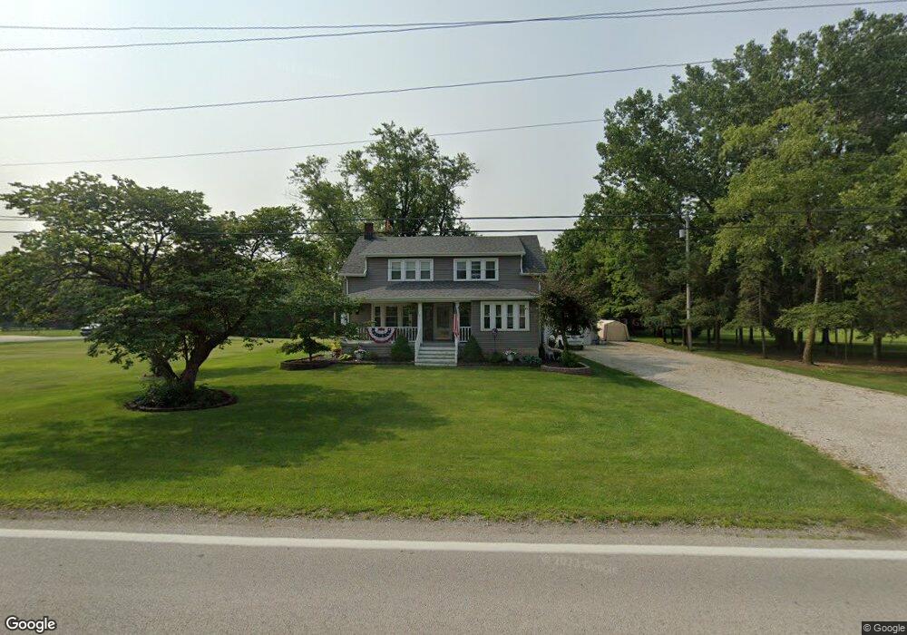
625 Pemberville Rd Woodville, OH 43469
Estimated Value: $236,756 - $281,000
4
Beds
2
Baths
1,806
Sq Ft
$139/Sq Ft
Est. Value
About This Home
This home is located at 625 Pemberville Rd, Woodville, OH 43469 and is currently estimated at $251,689, approximately $139 per square foot. 625 Pemberville Rd is a home located in Sandusky County with nearby schools including Woodmore Elementary School and Woodmore Middle School.
Ownership History
Date
Name
Owned For
Owner Type
Purchase Details
Closed on
Mar 25, 1999
Sold by
Beam Sherry K
Bought by
Lambert Michael and Lambert Karyn S
Current Estimated Value
Home Financials for this Owner
Home Financials are based on the most recent Mortgage that was taken out on this home.
Original Mortgage
$41,000
Outstanding Balance
$10,008
Interest Rate
6.85%
Mortgage Type
New Conventional
Estimated Equity
$241,681
Purchase Details
Closed on
May 1, 1989
Bought by
Lambert Michael L and Lambert Karyn S
Create a Home Valuation Report for This Property
The Home Valuation Report is an in-depth analysis detailing your home's value as well as a comparison with similar homes in the area
Home Values in the Area
Average Home Value in this Area
Purchase History
| Date | Buyer | Sale Price | Title Company |
|---|---|---|---|
| Lambert Michael | $117,500 | -- | |
| Lambert Michael L | $69,000 | -- |
Source: Public Records
Mortgage History
| Date | Status | Borrower | Loan Amount |
|---|---|---|---|
| Open | Lambert Michael | $41,000 |
Source: Public Records
Tax History Compared to Growth
Tax History
| Year | Tax Paid | Tax Assessment Tax Assessment Total Assessment is a certain percentage of the fair market value that is determined by local assessors to be the total taxable value of land and additions on the property. | Land | Improvement |
|---|---|---|---|---|
| 2024 | $2,709 | $61,180 | $9,100 | $52,080 |
| 2023 | $2,709 | $44,660 | $6,650 | $38,010 |
| 2022 | $2,263 | $44,660 | $6,650 | $38,010 |
| 2021 | $2,276 | $44,660 | $6,650 | $38,010 |
| 2020 | $2,077 | $39,480 | $6,650 | $32,830 |
| 2019 | $2,078 | $39,480 | $6,650 | $32,830 |
| 2018 | $2,203 | $39,480 | $6,650 | $32,830 |
| 2017 | $1,895 | $35,210 | $6,650 | $28,560 |
| 2016 | $1,828 | $35,210 | $6,650 | $28,560 |
| 2015 | $1,930 | $35,210 | $6,650 | $28,560 |
| 2014 | $2,009 | $34,760 | $6,650 | $28,110 |
| 2013 | $1,986 | $34,760 | $6,650 | $28,110 |
Source: Public Records
Map
Nearby Homes
- 571 Parklane Dr
- 421 Parklane Dr
- 739 Riverside Dr
- 612 W Main St
- 219 Lime St
- 415 Fort Findlay Rd
- 712 Lueke Ave Unit 572 p
- 212 S Perry St
- 110 E 1st St
- 20180 Us Highway 23
- 20240 W Portage River South Rd
- 2067 Devils Hole Rd
- 0 Recker Rd
- 1936 County Road 32
- 0 Pemberville Rd
- 3291 Middleton Pike
- 510 Wilson St
- 416 Castle Cove
- 514 West St
- 151 Marshall Ave
- 203 Forest Court Dr
- 203 Forest Court Dr
- 602 Pemberville Rd
- 604 Pemberville Rd
- 600 Pemberville Rd
- 606 Pemberville Rd
- 603 Parklane Dr
- 651 Pemberville Rd
- 102 Aspen Cir
- 100 Aspen Cir
- 601 Parklane Dr
- 104 Aspen Cir
- 575 Pemberville Rd
- 582 Parklane Dr
- 300 Woodpointe Dr
- 669 Pemberville Rd
- 0 Aspen Cir
- 302 Woodpointe Dr
- 565 Pemberville Rd
- 581 Parklane Dr