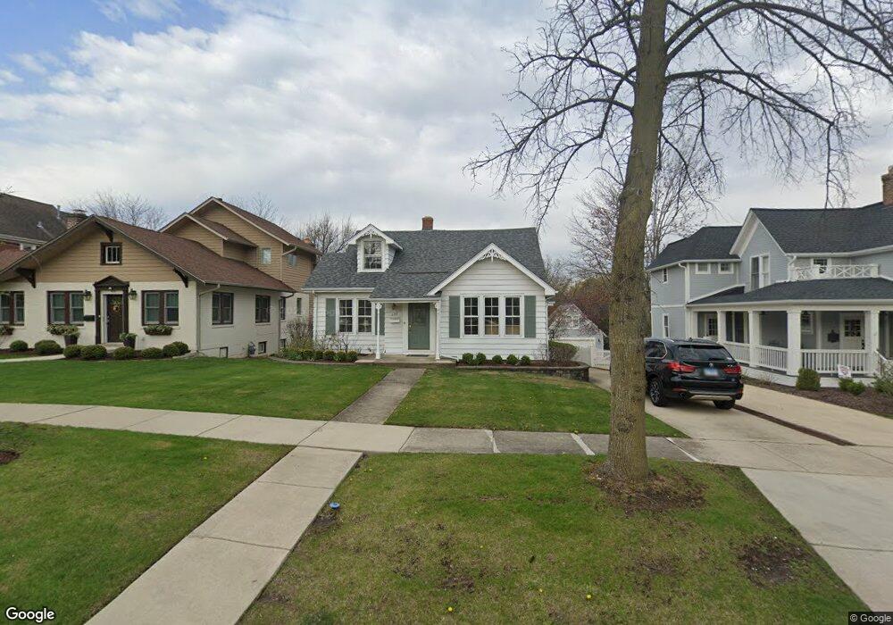
626 N Lincoln St Hinsdale, IL 60521
North Hinsdale NeighborhoodEstimated Value: $687,926 - $974,000
--
Bed
--
Bath
1,620
Sq Ft
$473/Sq Ft
Est. Value
About This Home
This home is located at 626 N Lincoln St, Hinsdale, IL 60521 and is currently estimated at $765,982, approximately $472 per square foot. 626 N Lincoln St is a home located in DuPage County with nearby schools including The Lane Elementary School, Hinsdale Middle School, and Hinsdale Central High School.
Ownership History
Date
Name
Owned For
Owner Type
Purchase Details
Closed on
Feb 21, 2002
Sold by
Knight Sean and Knight Kimberly
Bought by
Knight Kimberly J
Current Estimated Value
Home Financials for this Owner
Home Financials are based on the most recent Mortgage that was taken out on this home.
Original Mortgage
$239,000
Outstanding Balance
$94,903
Interest Rate
6.5%
Estimated Equity
$671,079
Purchase Details
Closed on
Aug 21, 1997
Sold by
Drinnon Robert K
Bought by
Knight Sean and Knight Kimberly
Home Financials for this Owner
Home Financials are based on the most recent Mortgage that was taken out on this home.
Original Mortgage
$185,000
Interest Rate
7.54%
Mortgage Type
Balloon
Create a Home Valuation Report for This Property
The Home Valuation Report is an in-depth analysis detailing your home's value as well as a comparison with similar homes in the area
Home Values in the Area
Average Home Value in this Area
Purchase History
| Date | Buyer | Sale Price | Title Company |
|---|---|---|---|
| Knight Kimberly J | -- | First American Title | |
| Knight Sean | $285,000 | -- |
Source: Public Records
Mortgage History
| Date | Status | Borrower | Loan Amount |
|---|---|---|---|
| Open | Knight Kimberly J | $239,000 | |
| Closed | Knight Sean | $185,000 | |
| Closed | Knight Sean | $10,000 |
Source: Public Records
Tax History Compared to Growth
Tax History
| Year | Tax Paid | Tax Assessment Tax Assessment Total Assessment is a certain percentage of the fair market value that is determined by local assessors to be the total taxable value of land and additions on the property. | Land | Improvement |
|---|---|---|---|---|
| 2024 | $9,584 | $192,878 | $86,404 | $106,474 |
| 2023 | $9,093 | $177,310 | $79,430 | $97,880 |
| 2022 | $9,116 | $179,870 | $80,570 | $99,300 |
| 2021 | $8,782 | $177,820 | $79,650 | $98,170 |
| 2020 | $8,579 | $174,300 | $78,070 | $96,230 |
| 2019 | $8,578 | $167,240 | $74,910 | $92,330 |
| 2018 | $7,682 | $155,680 | $74,510 | $81,170 |
| 2017 | $7,397 | $149,810 | $71,700 | $78,110 |
| 2016 | $7,247 | $142,980 | $68,430 | $74,550 |
| 2015 | $7,204 | $134,520 | $64,380 | $70,140 |
| 2014 | $6,890 | $124,600 | $62,600 | $62,000 |
| 2013 | $7,546 | $137,840 | $69,230 | $68,610 |
Source: Public Records
Map
Nearby Homes
- 401 Birchwood Rd
- 401 Glendale Ave
- 531 N York Rd
- 539 Kensington Ct
- 527 Kensington Ct
- 3801 Madison St
- 719 N Elm St
- 210 W Hickory St
- 736 N Oak St
- 415 N Adams St
- 123 N Vine St
- 118 N Grant St
- 117 N Monroe St
- 15 Templeton Dr
- 317 E Walnut St
- 437 N County Line Rd
- 3504 York Rd
- 735 Phillippa St
- 3420 York Rd
- 28 S Clay St
- 622 N Lincoln St
- 632 N Lincoln St
- 618 N Lincoln St
- 636 N Lincoln St
- 616 N Lincoln St
- 631 N Lincoln St
- 627 N Lincoln St
- 619 N Lincoln St
- 629 N Grant St
- 610 N Lincoln St
- 635 N Lincoln St
- 617 N Grant St
- 606 N Lincoln St
- 615 N Grant St
- 32 W Ogden Ave
- 12 Bonnie Brae Rd
- 16 Bonnie Brae Rd
- 609 N Grant St
- 35 Center St
- 31 Center St