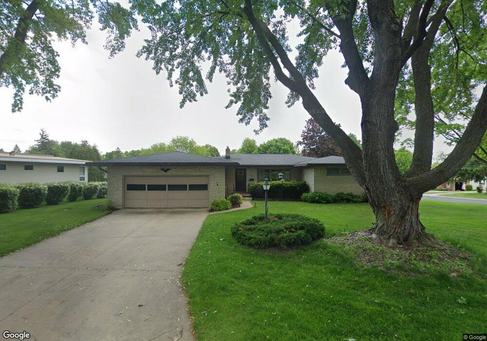
629 Paul St Sun Prairie, WI 53590
Estimated Value: $412,733 - $438,000
3
Beds
2
Baths
1,620
Sq Ft
$261/Sq Ft
Est. Value
About This Home
This home is located at 629 Paul St, Sun Prairie, WI 53590 and is currently estimated at $422,933, approximately $261 per square foot. 629 Paul St is a home located in Dane County with nearby schools including Northside Elementary School, Patrick Marsh Middle School, and Sun Prairie East High School.
Ownership History
Date
Name
Owned For
Owner Type
Purchase Details
Closed on
Jul 31, 2013
Sold by
Mcgovern Gerald A and Mcgovern Jean B
Bought by
Quinn Joshua C and Mcgovern Mariah J
Current Estimated Value
Home Financials for this Owner
Home Financials are based on the most recent Mortgage that was taken out on this home.
Original Mortgage
$164,825
Outstanding Balance
$120,289
Interest Rate
3.93%
Mortgage Type
New Conventional
Estimated Equity
$302,644
Purchase Details
Closed on
Jan 27, 2009
Sold by
Mcgovern Gerald A
Bought by
Mcgovern Gerald A and Mcgovern Jean Betty Jeanette
Create a Home Valuation Report for This Property
The Home Valuation Report is an in-depth analysis detailing your home's value as well as a comparison with similar homes in the area
Home Values in the Area
Average Home Value in this Area
Purchase History
| Date | Buyer | Sale Price | Title Company |
|---|---|---|---|
| Quinn Joshua C | $173,500 | None Available | |
| Mcgovern Gerald A | -- | None Available |
Source: Public Records
Mortgage History
| Date | Status | Borrower | Loan Amount |
|---|---|---|---|
| Open | Quinn Joshua C | $164,825 |
Source: Public Records
Tax History Compared to Growth
Tax History
| Year | Tax Paid | Tax Assessment Tax Assessment Total Assessment is a certain percentage of the fair market value that is determined by local assessors to be the total taxable value of land and additions on the property. | Land | Improvement |
|---|---|---|---|---|
| 2024 | $7,394 | $391,900 | $73,000 | $318,900 |
| 2023 | $6,710 | $391,900 | $73,000 | $318,900 |
| 2021 | $6,011 | $288,600 | $64,600 | $224,000 |
| 2020 | $6,162 | $288,600 | $64,600 | $224,000 |
| 2019 | $5,932 | $247,100 | $56,000 | $191,100 |
| 2018 | $5,495 | $247,100 | $56,000 | $191,100 |
| 2017 | $5,280 | $247,100 | $56,000 | $191,100 |
| 2016 | $4,863 | $206,600 | $47,400 | $159,200 |
| 2015 | $4,726 | $206,600 | $47,400 | $159,200 |
| 2014 | $4,422 | $192,300 | $47,400 | $144,900 |
| 2013 | $4,835 | $192,800 | $47,400 | $145,400 |
Source: Public Records
Map
Nearby Homes
- 706 Woodland Dr
- 921 Pine St
- 147 Flint St
- 1013 Vandenburg St
- 530 W Main St
- 1010 Andrews Dr
- 227 Windsor St
- 1048 Stonewood Crossing
- 918 N Pine St
- 856 Saint Albert the Great Dr Unit 856
- 2560 Water Lily Cir
- 2543 Water Lily Cir
- 2535 Water Lily Cir
- 2522 Water Lily Cir
- 1171 School St Unit 1171
- 972 Chandler Ln Unit 972
- 994 Chandler Ln
- 952 Chandler Ln Unit 952
- 1033 Lothe St
- 916 Ring St