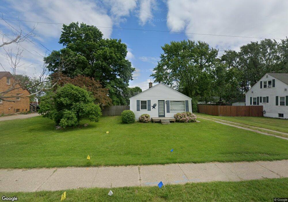
6296 Balsam Dr Hudsonville, MI 49426
Estimated Value: $212,834 - $328,000
2
Beds
1
Bath
1
Sq Ft
$271,959/Sq Ft
Est. Value
About This Home
This home is located at 6296 Balsam Dr, Hudsonville, MI 49426 and is currently estimated at $271,959, approximately $271,959 per square foot. 6296 Balsam Dr is a home located in Ottawa County with nearby schools including Hudsonville Freshman Campus, Baldwin Street Middle School, and Riley Street Middle School.
Ownership History
Date
Name
Owned For
Owner Type
Purchase Details
Closed on
Nov 6, 2024
Sold by
Zuyddyk Daniel L and Zuyddyk Patricia V
Bought by
Zuyddyk Patricia V and Zuyddyk Living Trust
Current Estimated Value
Purchase Details
Closed on
May 8, 2009
Sold by
Vansprange James A
Bought by
Vansprange Jeremy A and Zuyddyk Daniel L
Home Financials for this Owner
Home Financials are based on the most recent Mortgage that was taken out on this home.
Original Mortgage
$80,891
Interest Rate
4.83%
Mortgage Type
FHA
Purchase Details
Closed on
Sep 29, 2004
Sold by
Baker Stephen H and Baker Tricia M
Bought by
Vansprange Jeremy A and Vansprange James A
Home Financials for this Owner
Home Financials are based on the most recent Mortgage that was taken out on this home.
Original Mortgage
$82,000
Interest Rate
5.93%
Mortgage Type
Purchase Money Mortgage
Purchase Details
Closed on
Mar 24, 2003
Sold by
Baker Stephen H
Bought by
Baker Stephen H and Baker Tricia M
Create a Home Valuation Report for This Property
The Home Valuation Report is an in-depth analysis detailing your home's value as well as a comparison with similar homes in the area
Home Values in the Area
Average Home Value in this Area
Purchase History
| Date | Buyer | Sale Price | Title Company |
|---|---|---|---|
| Zuyddyk Patricia V | -- | None Listed On Document | |
| Vansprange Jeremy A | -- | Stewart Title Guaranty Co | |
| Vansprange Jeremy A | $102,500 | -- | |
| Baker Stephen H | -- | -- |
Source: Public Records
Mortgage History
| Date | Status | Borrower | Loan Amount |
|---|---|---|---|
| Previous Owner | Vansprange Jeremy A | $80,891 | |
| Previous Owner | Vansprange Jeremy A | $82,000 |
Source: Public Records
Tax History Compared to Growth
Tax History
| Year | Tax Paid | Tax Assessment Tax Assessment Total Assessment is a certain percentage of the fair market value that is determined by local assessors to be the total taxable value of land and additions on the property. | Land | Improvement |
|---|---|---|---|---|
| 2025 | $2,217 | $72,100 | $0 | $0 |
| 2024 | $2,217 | $64,300 | $0 | $0 |
| 2023 | $2,115 | $66,900 | $0 | $0 |
| 2022 | $2,013 | $55,800 | $0 | $0 |
| 2021 | $1,311 | $54,900 | $0 | $0 |
| 2020 | $1,296 | $42,800 | $0 | $0 |
| 2019 | $1,275 | $37,400 | $0 | $0 |
| 2018 | $1,169 | $39,400 | $0 | $0 |
| 2017 | $1,169 | $37,800 | $0 | $0 |
| 2016 | -- | $35,200 | $0 | $0 |
| 2015 | -- | $34,400 | $0 | $0 |
| 2014 | -- | $34,200 | $0 | $0 |
Source: Public Records
Map
Nearby Homes
- 6340 Summer Dr
- 6724 28th Ave
- 6714 Cedar Grove W
- 3204 Port Sheldon St
- 6760 N Wentward Ct
- V/L Port Sheldon St
- 2921 N Wentward Ct
- 0 V/L Edson (Parcel B) Dr
- 3126 Van Buren St
- 3544 Nobb Hill Dr
- 5557 Pleasant Ave
- 2323 Rosewood St
- 2339 Van Buren St
- 6129 W Bay Ct
- 5744 36th Ave
- 3808 Port Sheldon St
- 5833 Nelson Dr
- 2101 Rosewood St
- 6293 Eastridge Dr
- 6363 Eastridge Ct