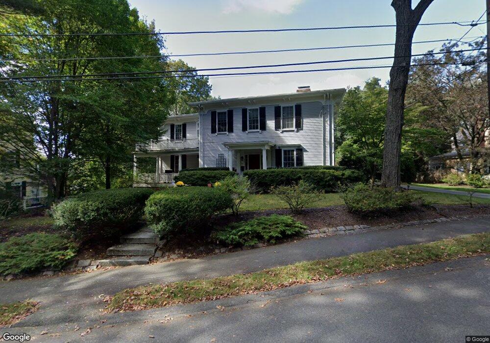
63 Hawthorne Ave Auburndale, MA 02466
Auburndale NeighborhoodEstimated Value: $1,966,000 - $2,990,000
4
Beds
3
Baths
3,182
Sq Ft
$789/Sq Ft
Est. Value
About This Home
This home is located at 63 Hawthorne Ave, Auburndale, MA 02466 and is currently estimated at $2,511,752, approximately $789 per square foot. 63 Hawthorne Ave is a home located in Middlesex County with nearby schools including Williams Elementary School, Charles E Brown Middle School, and Newton South High School.
Ownership History
Date
Name
Owned For
Owner Type
Purchase Details
Closed on
Aug 18, 2011
Sold by
Rolle F R and Rolle L
Bought by
Kelly Robert M and Kelley Kirsten D
Current Estimated Value
Home Financials for this Owner
Home Financials are based on the most recent Mortgage that was taken out on this home.
Original Mortgage
$108,000
Outstanding Balance
$74,952
Interest Rate
4.62%
Mortgage Type
Purchase Money Mortgage
Estimated Equity
$2,436,800
Purchase Details
Closed on
Mar 31, 1995
Sold by
Benway Joseph J and Costa Sarah
Bought by
Rolle L Norene and Robert Rolle F
Purchase Details
Closed on
Jan 4, 1993
Sold by
Lasell College
Bought by
Benway Joseph J and Costa Sarah
Create a Home Valuation Report for This Property
The Home Valuation Report is an in-depth analysis detailing your home's value as well as a comparison with similar homes in the area
Home Values in the Area
Average Home Value in this Area
Purchase History
| Date | Buyer | Sale Price | Title Company |
|---|---|---|---|
| Kelly Robert M | $1,082,000 | -- | |
| Rolle L Norene | $600,000 | -- | |
| Benway Joseph J | $297,000 | -- |
Source: Public Records
Mortgage History
| Date | Status | Borrower | Loan Amount |
|---|---|---|---|
| Open | Kelly Robert M | $108,000 | |
| Open | Benway Joseph J | $865,600 | |
| Previous Owner | Benway Joseph J | $227,150 | |
| Previous Owner | Benway Joseph J | $240,000 |
Source: Public Records
Tax History Compared to Growth
Tax History
| Year | Tax Paid | Tax Assessment Tax Assessment Total Assessment is a certain percentage of the fair market value that is determined by local assessors to be the total taxable value of land and additions on the property. | Land | Improvement |
|---|---|---|---|---|
| 2025 | $20,351 | $2,076,600 | $1,253,900 | $822,700 |
| 2024 | $19,677 | $2,016,100 | $1,217,400 | $798,700 |
| 2023 | $18,911 | $1,857,700 | $966,100 | $891,600 |
| 2022 | $18,095 | $1,720,100 | $894,500 | $825,600 |
| 2021 | $17,460 | $1,622,700 | $843,900 | $778,800 |
| 2020 | $16,941 | $1,622,700 | $843,900 | $778,800 |
| 2019 | $15,791 | $1,511,100 | $819,300 | $691,800 |
| 2018 | $15,327 | $1,416,500 | $727,800 | $688,700 |
| 2017 | $14,860 | $1,336,300 | $686,600 | $649,700 |
| 2016 | $13,984 | $1,228,800 | $641,700 | $587,100 |
| 2015 | $13,333 | $1,148,400 | $599,700 | $548,700 |
Source: Public Records
Map
Nearby Homes
- 17 Lasell St
- 283 Woodland Rd
- 27 Oakwood Rd
- 1754 Washington St
- 224 Auburn St Unit 224
- 224 Auburn St Unit A
- 226 Auburn St Unit 226
- 283 Melrose St
- 1639 Washington St
- 2202 Commonwealth Ave Unit 2
- 2202 Commonwealth Ave Unit 1
- 13 Weir St
- 17 Gilbert St
- 51 Bourne St
- 62-64 Rowe St Unit B
- 1640 Commonwealth Ave
- 17 Deforest Rd
- 0 Duncan Rd Unit 72925240
- 2084 Washington St
- 17 Crescent St
- 73 Hawthorne Ave
- 0 Hawthorne Ave
- 57 Hawthorne Ave
- 79 Hawthorne Ave
- 85 Hawthorne Ave
- 51 Hawthorne Ave
- 14 Aspen Ave
- 6 Aspen Ave
- 96 Lake Ave
- 78 Hawthorne Ave
- 78 Hawthorn St
- 33 Aspen Ave
- 27 Aspen Ave
- 53 Vista Ave Unit E
- 53 Vista Ave Unit C
- 53 Vista Ave Unit B
- 53 Vista Ave Unit A
- 53 Vista Ave
- 53 Vista Ave Unit B,1
- 53 Vista Ave Unit A & B