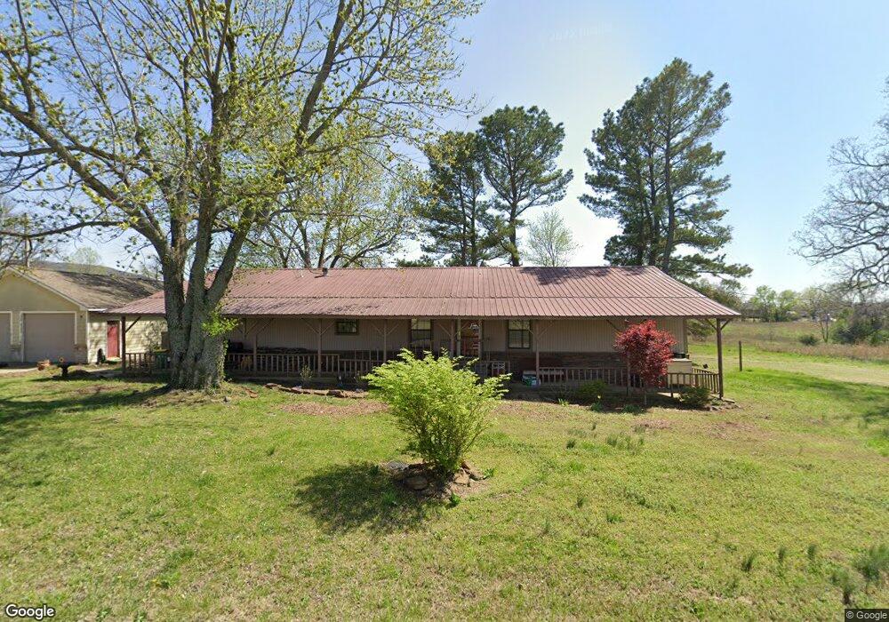
63 Wolfdale Rd Farmington, AR 72730
Estimated Value: $267,218 - $333,000
4
Beds
2
Baths
1,960
Sq Ft
$148/Sq Ft
Est. Value
About This Home
This home is located at 63 Wolfdale Rd, Farmington, AR 72730 and is currently estimated at $290,305, approximately $148 per square foot. 63 Wolfdale Rd is a home located in Washington County with nearby schools including Randall G. Lynch Middle School, Bob Folsom Elementary School, and Farmington Jr. High.
Ownership History
Date
Name
Owned For
Owner Type
Purchase Details
Closed on
May 12, 2005
Sold by
The Garner Family Trust
Bought by
Hassell John Stanley and Hassell Randan Lee
Current Estimated Value
Home Financials for this Owner
Home Financials are based on the most recent Mortgage that was taken out on this home.
Original Mortgage
$45,000
Interest Rate
5.64%
Mortgage Type
Purchase Money Mortgage
Create a Home Valuation Report for This Property
The Home Valuation Report is an in-depth analysis detailing your home's value as well as a comparison with similar homes in the area
Home Values in the Area
Average Home Value in this Area
Purchase History
| Date | Buyer | Sale Price | Title Company |
|---|---|---|---|
| Hassell John Stanley | $60,000 | Lenders |
Source: Public Records
Mortgage History
| Date | Status | Borrower | Loan Amount |
|---|---|---|---|
| Previous Owner | Hassell John Stanley | $45,000 | |
| Closed | Hassell John Stanley | $60,000 |
Source: Public Records
Tax History Compared to Growth
Tax History
| Year | Tax Paid | Tax Assessment Tax Assessment Total Assessment is a certain percentage of the fair market value that is determined by local assessors to be the total taxable value of land and additions on the property. | Land | Improvement |
|---|---|---|---|---|
| 2025 | $847 | $36,210 | $14,000 | $22,210 |
| 2024 | $253 | $36,210 | $14,000 | $22,210 |
| 2023 | $324 | $36,210 | $14,000 | $22,210 |
| 2022 | $338 | $13,310 | $10,000 | $3,310 |
| 2021 | $320 | $13,310 | $10,000 | $3,310 |
| 2020 | $288 | $13,310 | $10,000 | $3,310 |
| 2019 | $259 | $11,720 | $5,000 | $6,720 |
| 2018 | $284 | $11,720 | $5,000 | $6,720 |
| 2017 | $278 | $11,720 | $5,000 | $6,720 |
| 2016 | $278 | $11,720 | $5,000 | $6,720 |
| 2015 | $278 | $11,720 | $5,000 | $6,720 |
| 2014 | $296 | $12,050 | $5,000 | $7,050 |
Source: Public Records
Map
Nearby Homes
- 216 Idaho Ave
- 142 N Sheep Dog Ave
- 485 W Branta St
- 48 Cedar St
- 93 Old Depot Rd
- 271 Greenfield Ave
- 10800 Blue Sky Rd
- TBD White St
- 10948 Blue Sky Rd
- 311 S Sundown Dr
- 237 Briarhill Dr
- 201 Countryside Dr
- 285 Briarhill Dr
- 9 Bois d Arc St
- 87 James St
- 215 N Broyles St
- 179 Birchfield Ln
- 275 S Nightfall Ave
- 114 W Main St
- Rye 1903 Plan at The Grove at Engles Mill
- 60 Wolfdale Rd
- 52 Wolfdale Rd
- 68 Wolfdale Rd
- 40 Wolfdale Rd
- 24 Wolfdale Rd
- 12710 N Highway 170
- 419 S Hunter St Unit 3
- 419 S Hunter St
- 2.2 Acres W Rainsong St
- 2 W Rainsong St
- 2 W Rainsong St
- 2 W Rainsong St
- 100 Wolfdale Rd
- 96 Wolfdale Rd
- Lot 4 W Rainsong St
- Lot 4 Rainsong
- 403 S Hunter St
- 2 & 4 Rainsong St
- 421 S Hunter St
- 324 S Hunter St