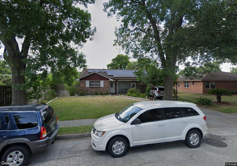
630 Nest Ln Houston, TX 77022
Independence Heights NeighborhoodEstimated Value: $220,000 - $287,929
3
Beds
3
Baths
1,984
Sq Ft
$130/Sq Ft
Est. Value
About This Home
This home is located at 630 Nest Ln, Houston, TX 77022 and is currently estimated at $257,732, approximately $129 per square foot. 630 Nest Ln is a home located in Harris County with nearby schools including Kennedy Elementary School, Williams Middle, and Booker T Washington Sr High.
Ownership History
Date
Name
Owned For
Owner Type
Purchase Details
Closed on
Oct 31, 2013
Sold by
Salmeron Ofelia
Bought by
Pineda Luis and Martinez Benita A
Current Estimated Value
Purchase Details
Closed on
Feb 27, 2012
Sold by
Salmeron George and Salmeron Ofelia
Bought by
Salmeron Flora
Purchase Details
Closed on
Apr 29, 1997
Sold by
Trautwein Michelle R
Bought by
Salmeron Flora M
Create a Home Valuation Report for This Property
The Home Valuation Report is an in-depth analysis detailing your home's value as well as a comparison with similar homes in the area
Home Values in the Area
Average Home Value in this Area
Purchase History
| Date | Buyer | Sale Price | Title Company |
|---|---|---|---|
| Pineda Luis | -- | Capital Title | |
| Salmeron Flora | -- | None Available | |
| Salmeron Flora M | -- | -- |
Source: Public Records
Tax History Compared to Growth
Tax History
| Year | Tax Paid | Tax Assessment Tax Assessment Total Assessment is a certain percentage of the fair market value that is determined by local assessors to be the total taxable value of land and additions on the property. | Land | Improvement |
|---|---|---|---|---|
| 2025 | $3,940 | $246,056 | $122,108 | $123,948 |
| 2024 | $3,940 | $263,747 | $122,108 | $141,639 |
| 2023 | $3,325 | $238,668 | $97,686 | $140,982 |
| 2022 | $4,916 | $223,250 | $97,686 | $125,564 |
| 2021 | $4,874 | $209,144 | $97,686 | $111,458 |
| 2020 | $4,468 | $184,512 | $48,843 | $135,669 |
| 2019 | $3,879 | $153,277 | $48,843 | $104,434 |
| 2018 | $3,194 | $126,217 | $28,492 | $97,725 |
| 2017 | $3,191 | $126,217 | $28,492 | $97,725 |
| 2016 | $3,140 | $124,165 | $20,351 | $103,814 |
| 2015 | $2,193 | $101,977 | $20,351 | $81,626 |
| 2014 | $2,193 | $85,326 | $20,351 | $64,975 |
Source: Public Records
Map
Nearby Homes
- 510 Victoria Dr
- 4440 Castor St
- 600 E Whitney St
- 627 Glenburnie Dr
- 5035 North Fwy
- 312 Walthall Dr
- 0 Victoria Unit 54691087
- 310 Walthall Dr
- 315 E Whitney St
- 330 Spell St
- 4311 Busiek St
- 4309 Delhi St
- 4305 Castor St
- 423 Gammon Dr
- 4303 Castor Na St
- 4303 Cadmus St
- 502 W Crosstimbers St
- 4311 Europa St
- 4303 Castor St
- 4402 Airline Dr