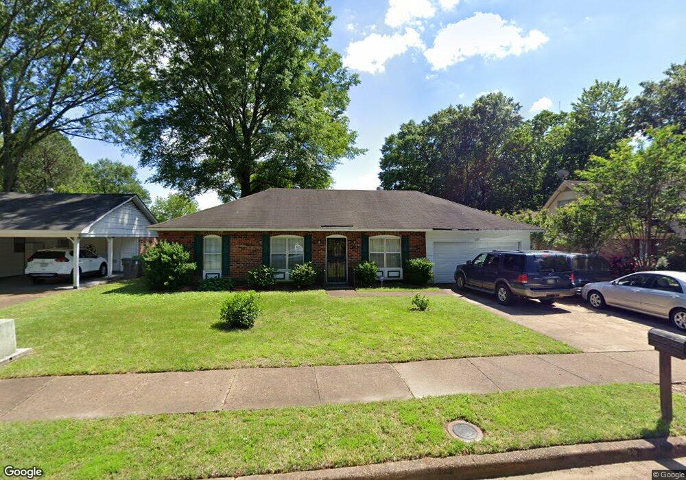
6309 Thornfield Dr Memphis, TN 38134
Cordova NeighborhoodEstimated Value: $165,000 - $203,000
3
Beds
2
Baths
1,310
Sq Ft
$142/Sq Ft
Est. Value
About This Home
This home is located at 6309 Thornfield Dr, Memphis, TN 38134 and is currently estimated at $185,515, approximately $141 per square foot. 6309 Thornfield Dr is a home located in Shelby County with nearby schools including White Station Elementary School, White Station Middle, and White Station High.
Ownership History
Date
Name
Owned For
Owner Type
Purchase Details
Closed on
Jul 25, 2002
Sold by
Andersen William F and Andersen Heidi J
Bought by
Bronson Kimberly
Current Estimated Value
Home Financials for this Owner
Home Financials are based on the most recent Mortgage that was taken out on this home.
Original Mortgage
$89,900
Outstanding Balance
$37,867
Interest Rate
6.62%
Estimated Equity
$147,648
Purchase Details
Closed on
Apr 28, 1998
Sold by
Carter William A
Bought by
Andersen William F and Andersen Heidi J
Home Financials for this Owner
Home Financials are based on the most recent Mortgage that was taken out on this home.
Original Mortgage
$75,102
Interest Rate
7.03%
Mortgage Type
FHA
Purchase Details
Closed on
Mar 19, 1997
Sold by
Carter Tina Louise
Bought by
Carter William A
Create a Home Valuation Report for This Property
The Home Valuation Report is an in-depth analysis detailing your home's value as well as a comparison with similar homes in the area
Home Values in the Area
Average Home Value in this Area
Purchase History
| Date | Buyer | Sale Price | Title Company |
|---|---|---|---|
| Bronson Kimberly | $89,900 | Lenders Title & Escrow Llc | |
| Andersen William F | $74,500 | -- | |
| Carter William A | -- | -- |
Source: Public Records
Mortgage History
| Date | Status | Borrower | Loan Amount |
|---|---|---|---|
| Open | Bronson Kimberly | $89,900 | |
| Previous Owner | Andersen William F | $75,102 |
Source: Public Records
Tax History Compared to Growth
Tax History
| Year | Tax Paid | Tax Assessment Tax Assessment Total Assessment is a certain percentage of the fair market value that is determined by local assessors to be the total taxable value of land and additions on the property. | Land | Improvement |
|---|---|---|---|---|
| 2025 | $965 | $38,900 | $5,750 | $33,150 |
| 2024 | $965 | $28,475 | $4,250 | $24,225 |
| 2023 | $1,735 | $28,475 | $4,250 | $24,225 |
| 2022 | $1,735 | $28,475 | $4,250 | $24,225 |
| 2021 | $1,755 | $28,475 | $4,250 | $24,225 |
| 2020 | $1,391 | $19,200 | $4,250 | $14,950 |
| 2019 | $1,391 | $19,200 | $4,250 | $14,950 |
| 2018 | $1,391 | $19,200 | $4,250 | $14,950 |
| 2017 | $789 | $19,200 | $4,250 | $14,950 |
| 2016 | $796 | $18,225 | $0 | $0 |
| 2014 | $796 | $18,225 | $0 | $0 |
Source: Public Records
Map
Nearby Homes
- 1289 Heathcliff Dr
- 1339 Mullins Station Rd
- 0 Mullins Station Rd
- 1472 Kinilwood St
- 6690 Whitten Pine Dr
- 6774 Whitten Pine Dr
- 1461 Phillips Rd
- 6830 Garmin Ln
- 6838 Lagrange Cir N
- 6880 Wrigley Dr
- 6840 Lagrange Pines Rd
- 6916 Lagrange Pines Rd
- 6925 Raleigh Lagrange Rd
- 7004 Presmond Rd
- 6990 Parkbrook Ln
- 7020 Wynne Ridge Rd N
- 7115 Lindsey Leaf Cove
- 0 Summer Ave Unit 10195870
- 0 Summer Ave Unit 10200827
- 0 Summer Ave Unit 10195869
- 6315 Thornfield Dr
- 6301 Thornfield Dr
- 6308 Heathcliff Cove
- 6323 Thornfield Dr
- 6300 Heathcliff Cove
- 6314 Heathcliff Cove
- 6289 Thornfield Dr
- 1252 Heathcliff Dr
- 6312 Thornfield Dr
- 6320 Thornfield Dr
- 6298 Thornfield Dr
- 6329 Thornfield Dr
- 6318 Heathcliff Cove
- 6326 Thornfield Dr
- 1278 Heathcliff Dr
- 6337 Thornfield Dr
- 6334 Thornfield Dr
- 6313 Merimac Dr
- 6338 Mullins Station Cove
- 6299 Heathcliff Cove