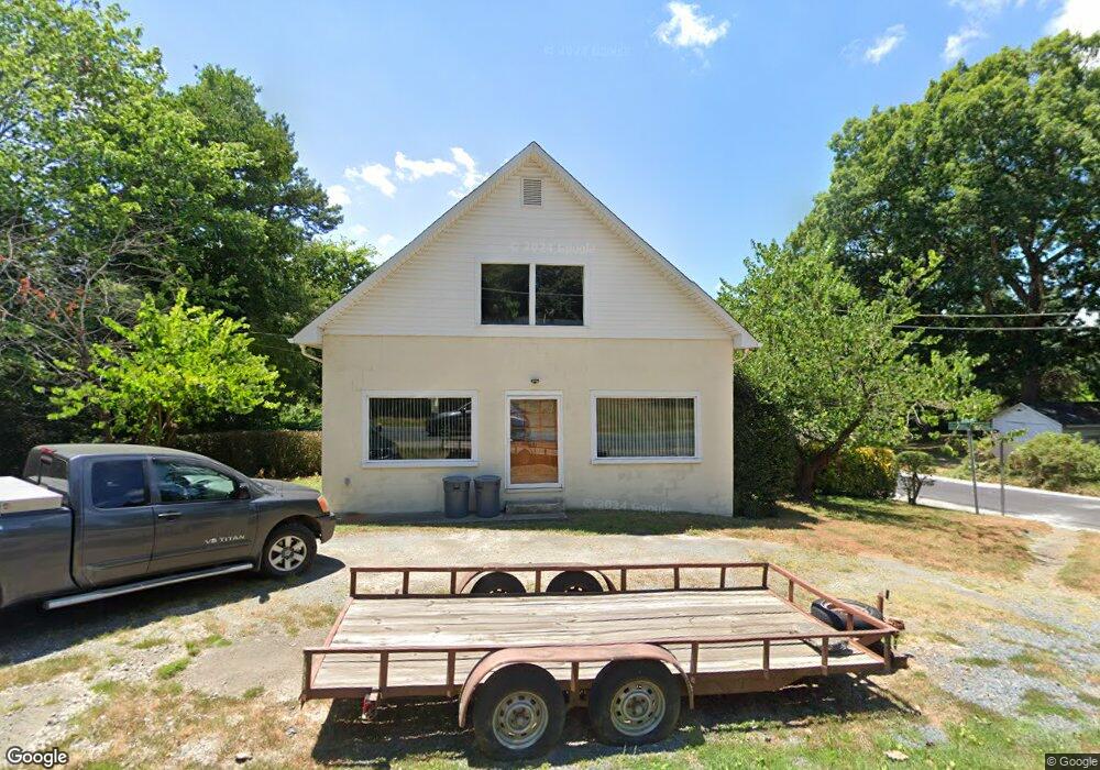
631 N Mccrary St Asheboro, NC 27205
Estimated Value: $128,317 - $187,000
--
Bed
1
Bath
1,200
Sq Ft
$135/Sq Ft
Est. Value
About This Home
This home is located at 631 N Mccrary St, Asheboro, NC 27205 and is currently estimated at $162,329, approximately $135 per square foot. 631 N Mccrary St is a home located in Randolph County with nearby schools including Charles W. McCrary Elementary School, North Asheboro Middle School, and Asheboro High School.
Ownership History
Date
Name
Owned For
Owner Type
Purchase Details
Closed on
Jun 7, 1996
Bought by
Bradley Ludwig
Current Estimated Value
Home Financials for this Owner
Home Financials are based on the most recent Mortgage that was taken out on this home.
Original Mortgage
$33,000
Outstanding Balance
$1,916
Interest Rate
8.21%
Mortgage Type
Unknown
Estimated Equity
$160,413
Purchase Details
Closed on
Dec 19, 1995
Bought by
Bradley Ludwig
Create a Home Valuation Report for This Property
The Home Valuation Report is an in-depth analysis detailing your home's value as well as a comparison with similar homes in the area
Home Values in the Area
Average Home Value in this Area
Purchase History
| Date | Buyer | Sale Price | Title Company |
|---|---|---|---|
| Bradley Ludwig | $36,000 | -- | |
| Bradley Ludwig | $31,500 | -- |
Source: Public Records
Mortgage History
| Date | Status | Borrower | Loan Amount |
|---|---|---|---|
| Open | Bradley Ludwig | $33,000 |
Source: Public Records
Tax History Compared to Growth
Tax History
| Year | Tax Paid | Tax Assessment Tax Assessment Total Assessment is a certain percentage of the fair market value that is determined by local assessors to be the total taxable value of land and additions on the property. | Land | Improvement |
|---|---|---|---|---|
| 2025 | $720 | $92,280 | $22,120 | $70,160 |
| 2024 | $711 | $92,280 | $22,120 | $70,160 |
| 2023 | $711 | $92,280 | $22,120 | $70,160 |
| 2022 | $607 | $65,510 | $17,400 | $48,110 |
| 2021 | $607 | $65,510 | $17,400 | $48,110 |
| 2020 | $605 | $66,760 | $17,400 | $49,360 |
| 2019 | $605 | $66,760 | $17,400 | $49,360 |
| 2018 | $559 | $59,980 | $20,260 | $39,720 |
| 2016 | $553 | $59,980 | $20,260 | $39,720 |
| 2015 | $552 | $59,980 | $20,260 | $39,720 |
| 2014 | -- | $59,980 | $20,260 | $39,720 |
Source: Public Records
Map
Nearby Homes
- 1110 Park Dr
- 866 Mountain Rd
- 0 Highwood Dr
- 627 Oakmont Dr
- 0000 Little Gate Dr
- 1011 Westmont Dr
- TBD Oakland Ave
- 435 Peachtree St
- 1025 Neely Dr
- 516 and 518 Peachtree St
- 1407 Oakland Ave
- 1582 Westmont Dr
- 923 Arnold St
- 1142 Westover Terrace
- 0 Amity Rd
- 330 W Presnell St Unit 37
- 330 13 W Presnell St
- 914 Tamworth Rd
- 1263 Winslow Ave Unit A, B & C
- 255 Liberty St
- 621 N Mccrary St
- 709 N Mccrary St
- 615 N Mccrary St
- 0 Wilson St
- 656 Lincoln Ave
- 636 N Mccrary St
- 712 N Mccrary St
- 664 Lincoln Ave
- 618 N Mccrary St
- 648 Lincoln Ave
- 719 N Mccrary St
- 716 Lincoln Ave
- 607 N Mccrary St
- 610 N Mccrary St
- 636 Lincoln Ave
- 724 Lincoln Ave
- 707 Wilson St
- 587 N Mccrary St
- 728 N Mccrary St
- 657 Lincoln Ave