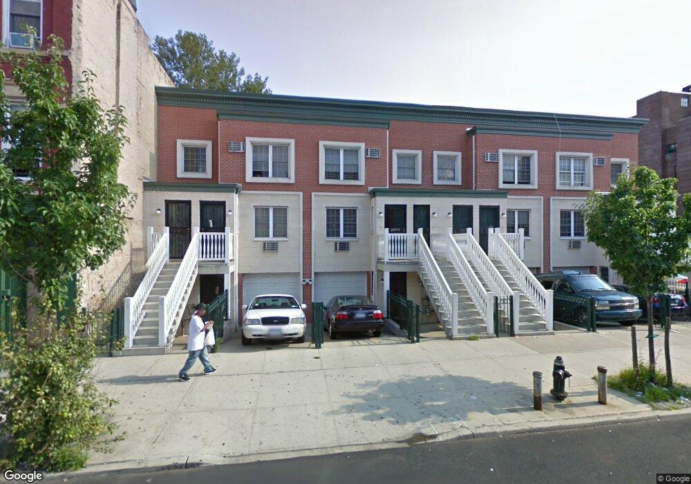
632 Blake Ave Brooklyn, NY 11207
Brownsville NeighborhoodEstimated Value: $895,680 - $1,116,000
--
Bed
--
Bath
2,964
Sq Ft
$333/Sq Ft
Est. Value
About This Home
This home is located at 632 Blake Ave, Brooklyn, NY 11207 and is currently estimated at $988,170, approximately $333 per square foot. 632 Blake Ave is a home located in Kings County with nearby schools including P.S. 13 Roberto Clemente, J.H.S 292 Margaret S. Douglas, and Hyde Leadership Charter School-Brooklyn.
Ownership History
Date
Name
Owned For
Owner Type
Purchase Details
Closed on
Sep 28, 2020
Sold by
Richards Albertine
Bought by
Richards Albertine and Richards Franklin A
Current Estimated Value
Purchase Details
Closed on
May 24, 2007
Sold by
Drummond Alman H and Richards Albertine
Bought by
Richards Albertine
Create a Home Valuation Report for This Property
The Home Valuation Report is an in-depth analysis detailing your home's value as well as a comparison with similar homes in the area
Home Values in the Area
Average Home Value in this Area
Purchase History
| Date | Buyer | Sale Price | Title Company |
|---|---|---|---|
| Richards Albertine | -- | -- | |
| Richards Albertine | -- | -- | |
| Richards Albertine | -- | -- |
Source: Public Records
Mortgage History
| Date | Status | Borrower | Loan Amount |
|---|---|---|---|
| Closed | Richards Albertine | $0 |
Source: Public Records
Tax History Compared to Growth
Tax History
| Year | Tax Paid | Tax Assessment Tax Assessment Total Assessment is a certain percentage of the fair market value that is determined by local assessors to be the total taxable value of land and additions on the property. | Land | Improvement |
|---|---|---|---|---|
| 2025 | $6,608 | $59,160 | $15,660 | $43,500 |
| 2024 | $6,608 | $46,740 | $15,660 | $31,080 |
| 2023 | $6,287 | $49,140 | $15,660 | $33,480 |
| 2022 | $5,807 | $49,080 | $15,660 | $33,420 |
| 2021 | $5,716 | $42,300 | $15,660 | $26,640 |
| 2020 | $2,611 | $44,400 | $15,660 | $28,740 |
| 2019 | $4,689 | $35,280 | $15,660 | $19,620 |
| 2018 | $3,925 | $26,966 | $11,333 | $15,633 |
| 2017 | $3,341 | $25,440 | $10,279 | $15,161 |
| 2016 | $3,207 | $28,560 | $10,279 | $18,281 |
| 2015 | $774 | $28,320 | $10,039 | $18,281 |
| 2014 | $774 | $27,093 | $8,812 | $18,281 |
Source: Public Records
Map
Nearby Homes
- 637 Blake Ave
- 444 New Jersey Ave
- 353 Pennsylvania Ave
- 486 Vermont St
- 477 Vermont St
- 317 Pennsylvania Ave
- 663 Sutter Ave
- 439 Vermont St
- 667 Sutter Ave
- 297 Pennsylvania Ave
- 297 Hinsdale St
- 412 Bradford St
- 342 Wyona St
- 34&36 Marginal St
- 406 Hinsdale St
- 440 Miller Ave
- 774 Blake Ave
- 459 Belmont Ave
- 443 Miller Ave
- 402 van Siclen Ave
- 630 Blake Ave
- 634 Blake Ave
- 640 Blake Ave Unit 1
- 642 Blake Ave
- 646 Blake Ave
- 648 Blake Ave
- 633 Blake Ave
- 629 Blake Ave
- 627 Blake Ave
- 398 Sheffield Ave
- 375 Sheffield Ave
- 625 Blake Ave
- 625 Blake Ave Unit Office
- 625 Blake Ave Unit 2R
- 639 Blake Ave
- 643 Blake Ave
- 645 Blake Ave
- 647 Blake Ave
- 369 Sheffield Ave
- 363 Sheffield Ave Unit 367