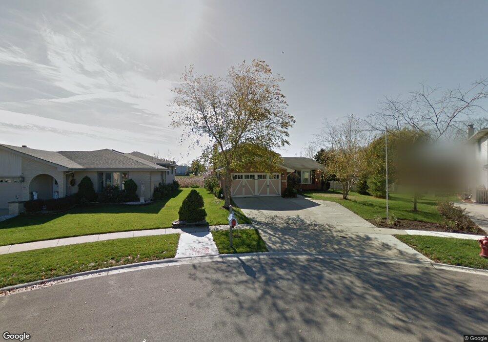
632 Driftwood Ave Romeoville, IL 60446
Estimated Value: $334,792 - $382,000
--
Bed
--
Bath
1,922
Sq Ft
$187/Sq Ft
Est. Value
About This Home
This home is located at 632 Driftwood Ave, Romeoville, IL 60446 and is currently estimated at $359,198, approximately $186 per square foot. 632 Driftwood Ave is a home located in Will County with nearby schools including Robert C. Hill Elementary School, A. Vito Martinez Middle School, and Romeoville High School.
Ownership History
Date
Name
Owned For
Owner Type
Purchase Details
Closed on
Dec 16, 2002
Sold by
Albrecht Luther G and Albrecht Janet G
Bought by
Albrecht Janet G and Albrecht Declaration O Janet G
Current Estimated Value
Purchase Details
Closed on
May 2, 1997
Sold by
Standard Bank & Trust Company
Bought by
Albrecht Luther G and Albrecht Janet G
Home Financials for this Owner
Home Financials are based on the most recent Mortgage that was taken out on this home.
Original Mortgage
$112,720
Outstanding Balance
$15,800
Interest Rate
8.27%
Estimated Equity
$343,398
Create a Home Valuation Report for This Property
The Home Valuation Report is an in-depth analysis detailing your home's value as well as a comparison with similar homes in the area
Home Values in the Area
Average Home Value in this Area
Purchase History
| Date | Buyer | Sale Price | Title Company |
|---|---|---|---|
| Albrecht Janet G | -- | -- | |
| Albrecht Luther G | $141,000 | Chicago Title Insurance Co |
Source: Public Records
Mortgage History
| Date | Status | Borrower | Loan Amount |
|---|---|---|---|
| Open | Albrecht Luther G | $112,720 |
Source: Public Records
Tax History Compared to Growth
Tax History
| Year | Tax Paid | Tax Assessment Tax Assessment Total Assessment is a certain percentage of the fair market value that is determined by local assessors to be the total taxable value of land and additions on the property. | Land | Improvement |
|---|---|---|---|---|
| 2024 | $8,505 | $107,351 | $26,892 | $80,459 |
| 2023 | $8,505 | $96,374 | $24,142 | $72,232 |
| 2022 | $7,695 | $88,156 | $22,520 | $65,636 |
| 2021 | $7,311 | $82,845 | $21,163 | $61,682 |
| 2020 | $7,091 | $80,121 | $20,467 | $59,654 |
| 2019 | $6,758 | $75,944 | $19,400 | $56,544 |
| 2018 | $6,554 | $73,023 | $18,654 | $54,369 |
| 2017 | $6,131 | $68,935 | $17,610 | $51,325 |
| 2016 | $5,754 | $64,606 | $16,504 | $48,102 |
| 2015 | $5,271 | $59,681 | $15,246 | $44,435 |
| 2014 | $5,271 | $57,943 | $14,802 | $43,141 |
| 2013 | $5,271 | $57,943 | $14,802 | $43,141 |
Source: Public Records
Map
Nearby Homes
- 923 E Savannah Dr Unit 2
- 312 Fremont Ave
- 939 E Savannah Dr
- 255 W Romeo Rd
- 346 Wild Rose Ln
- 322 Kent Ave
- Lot 2 Governors Hwy
- 0 N Weber Rd Unit MRD12364369
- 1282 W Normantown Rd
- Lot 5 Weber Rd
- 1033 Key Largo Dr Unit M702
- 1086 Princeton Dr
- 408 Haller Ave
- 343 Hale Ave
- 487 N Anna Ln
- 440 N Kelly Ct
- 497 N Frieh Dr
- 242 Tallman Ave
- 915 Brassfield Ave
- 947 Brassfield Ave
- 630 Driftwood Ave
- 634 Driftwood Ave
- 628 Driftwood Ave
- 636 Driftwood Ave
- 295 Georgetown Ave
- 299 Georgetown Ave Unit 1
- 287 Georgetown Ave
- 626 Driftwood Ave
- 638 Driftwood Ave
- 635 Driftwood Ave
- 303 Georgetown Ave
- 283 Georgetown Ave Unit 1
- 638 Briarwood Ave
- 637 Driftwood Ave
- 624 Driftwood Ave
- 640 Driftwood Ave
- 640 Briarwood Ave
- 279 Georgetown Ave
- 633 Driftwood Ave
- 307 Georgetown Ave