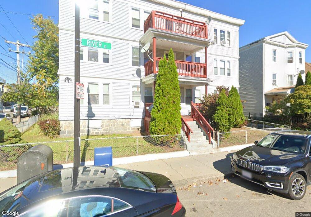
633 River St Unit 1R Mattapan, MA 02126
Southern Mattapan NeighborhoodEstimated Value: $315,000 - $351,576
2
Beds
1
Bath
860
Sq Ft
$390/Sq Ft
Est. Value
About This Home
This home is located at 633 River St Unit 1R, Mattapan, MA 02126 and is currently estimated at $335,144, approximately $389 per square foot. 633 River St Unit 1R is a home located in Suffolk County with nearby schools including KIPP Academy Boston Charter School, Boston Preparatory Charter Public School, and Berea Seventh-day Adventist Academy.
Ownership History
Date
Name
Owned For
Owner Type
Purchase Details
Closed on
Nov 28, 2006
Sold by
633 River St Condo
Bought by
Matthews Monica L
Current Estimated Value
Home Financials for this Owner
Home Financials are based on the most recent Mortgage that was taken out on this home.
Original Mortgage
$142,500
Outstanding Balance
$85,575
Interest Rate
6.39%
Mortgage Type
Purchase Money Mortgage
Estimated Equity
$249,569
Create a Home Valuation Report for This Property
The Home Valuation Report is an in-depth analysis detailing your home's value as well as a comparison with similar homes in the area
Home Values in the Area
Average Home Value in this Area
Purchase History
| Date | Buyer | Sale Price | Title Company |
|---|---|---|---|
| Matthews Monica L | $150,000 | -- |
Source: Public Records
Mortgage History
| Date | Status | Borrower | Loan Amount |
|---|---|---|---|
| Open | Matthews Monica L | $142,500 |
Source: Public Records
Tax History Compared to Growth
Tax History
| Year | Tax Paid | Tax Assessment Tax Assessment Total Assessment is a certain percentage of the fair market value that is determined by local assessors to be the total taxable value of land and additions on the property. | Land | Improvement |
|---|---|---|---|---|
| 2025 | $2,653 | $229,100 | $0 | $229,100 |
| 2024 | $2,630 | $241,300 | $0 | $241,300 |
| 2023 | $2,514 | $234,100 | $0 | $234,100 |
| 2022 | $2,381 | $218,800 | $0 | $218,800 |
| 2021 | $2,202 | $206,400 | $0 | $206,400 |
| 2020 | $1,676 | $158,700 | $0 | $158,700 |
| 2019 | $1,521 | $144,300 | $0 | $144,300 |
| 2018 | $1,512 | $144,300 | $0 | $144,300 |
| 2017 | $1,441 | $136,100 | $0 | $136,100 |
| 2016 | $1,454 | $132,200 | $0 | $132,200 |
| 2015 | $1,493 | $123,300 | $0 | $123,300 |
| 2014 | $1,505 | $119,600 | $0 | $119,600 |
Source: Public Records
Map
Nearby Homes
- 645 River St
- 23 Caton St
- 90 Hollingsworth St
- 25 Alpine St Unit 7
- 48-50 Rockdale St
- 20 Massasoit St
- 16 Blue Hill Ave
- 112 Brush Hill Rd
- 42 Osceola St
- 84 Blue Hills Pkwy
- 96 Brook Rd
- 7 Winborough St
- 128 Blue Hills Pkwy
- 770 Cummins Hwy Unit 1
- 770 Cummins Hwy Unit 22
- 16 Concord Ave Unit 1
- 10 Brockton St
- 839-843 Cummins Hwy
- 27 Hawthorn Rd
- 95 Woodhaven St
- 633 River St Unit 3L
- 633 River St Unit 3R
- 633 River St Unit 2L
- 633 River St Unit 2R
- 633 River St Unit 1L
- 633 River St Unit 6
- 9 Rector Rd Unit 11
- 637 River St
- 629 River St
- 629 River St Unit 2
- 629 River St Unit 1
- 629 River St Unit 3
- 643 River St
- 643 River St
- 625 River St
- 8 Rector Rd
- 108 Rockdale St
- 623 River St
- 12 Rector Rd
- 640 River St Unit 3B