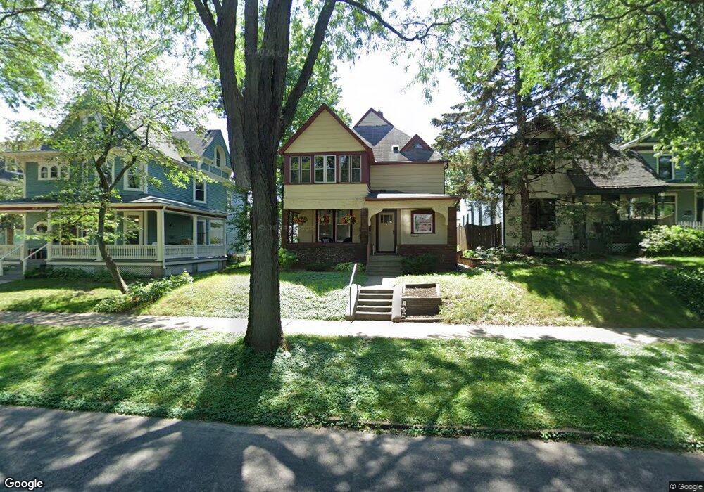
634 Ashland Ave Unit 1 Saint Paul, MN 55104
Summit-University NeighborhoodEstimated Value: $411,000 - $436,127
4
Beds
2
Baths
2,049
Sq Ft
$205/Sq Ft
Est. Value
About This Home
This home is located at 634 Ashland Ave Unit 1, Saint Paul, MN 55104 and is currently estimated at $419,032, approximately $204 per square foot. 634 Ashland Ave Unit 1 is a home located in Ramsey County with nearby schools including Maxfield Magnet Elementary School, Hidden River Middle School, and Central Senior High School.
Ownership History
Date
Name
Owned For
Owner Type
Purchase Details
Closed on
Apr 15, 2016
Sold by
Eldred David M and Elliott Meghan
Bought by
Sieger Kristine M
Current Estimated Value
Home Financials for this Owner
Home Financials are based on the most recent Mortgage that was taken out on this home.
Original Mortgage
$208,800
Outstanding Balance
$165,879
Interest Rate
3.68%
Mortgage Type
New Conventional
Estimated Equity
$253,153
Create a Home Valuation Report for This Property
The Home Valuation Report is an in-depth analysis detailing your home's value as well as a comparison with similar homes in the area
Home Values in the Area
Average Home Value in this Area
Purchase History
| Date | Buyer | Sale Price | Title Company |
|---|---|---|---|
| Sieger Kristine M | $261,000 | Global Closing & Title Svcs |
Source: Public Records
Mortgage History
| Date | Status | Borrower | Loan Amount |
|---|---|---|---|
| Open | Sieger Kristine M | $208,800 |
Source: Public Records
Tax History Compared to Growth
Tax History
| Year | Tax Paid | Tax Assessment Tax Assessment Total Assessment is a certain percentage of the fair market value that is determined by local assessors to be the total taxable value of land and additions on the property. | Land | Improvement |
|---|---|---|---|---|
| 2025 | $6,100 | $372,200 | $130,000 | $242,200 |
| 2023 | $6,100 | $385,200 | $130,000 | $255,200 |
| 2022 | $5,462 | $377,100 | $130,000 | $247,100 |
| 2021 | $5,438 | $328,100 | $130,000 | $198,100 |
| 2020 | $5,214 | $338,100 | $130,000 | $208,100 |
| 2019 | $4,382 | $312,300 | $130,000 | $182,300 |
| 2018 | $4,314 | $262,800 | $130,000 | $132,800 |
| 2017 | $3,218 | $254,100 | $130,000 | $124,100 |
| 2016 | $0 | $0 | $0 | $0 |
Source: Public Records
Map
Nearby Homes
- 676 Ashland Ave Unit 6
- 704 Holly Ave
- 565 Holly Ave
- 28 Saint Albans St N Unit 4N
- 652 Dayton Ave
- 545 Holly Ave
- 579 Summit Ave Unit 105
- 742 Hague Ave
- 742 Holly Ave
- 681 Dayton Ave
- 518 Laurel Ave
- 542 Portland Ave
- 582 Summit Ave
- 28 Dale St S Unit A
- 505 Holly Ave
- 635 Grand Ave Unit 4
- 496 Holly Ave Unit 1
- 505 Selby Ave Unit 1
- 614 Grand Ave Unit C
- 614 Grand Ave Unit 3EE
- 634 Ashland Ave
- 638 Ashland Ave
- 630 Ashland Ave
- 642 Ashland Ave
- 642 642 Ashland Ave
- 620 Ashland Ave
- 644 Ashland Ave
- 633 Holly Ave
- 639 Holly Ave
- 647 Holly Ave
- 633 Ashland Ave
- 629 Ashland Ave
- 639 Ashland Ave
- 61 Dale St N
- 627 Ashland Ave
- 641 Ashland Ave Unit 2
- 641 641 Ashland Ave
- 641 641 Ashland-Avenue-
- 641 Ashland Ave
- 649 Holly Ave