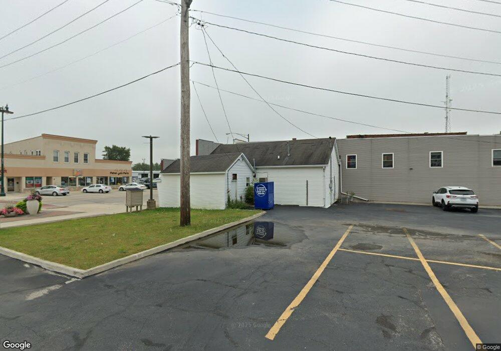
634 S Broadway St Coal City, IL 60416
Estimated Value: $87,000 - $201,000
--
Bed
--
Bath
1,205
Sq Ft
$116/Sq Ft
Est. Value
About This Home
This home is located at 634 S Broadway St, Coal City, IL 60416 and is currently estimated at $139,952, approximately $116 per square foot. 634 S Broadway St is a home located in Grundy County with nearby schools including Coal City Elementary School, Coal City Intermediate School, and Coal City Middle School.
Ownership History
Date
Name
Owned For
Owner Type
Purchase Details
Closed on
Jun 15, 2023
Sold by
B D R Properties Llc
Bought by
Hakey Richard and Hakey Jennifer
Current Estimated Value
Purchase Details
Closed on
May 25, 2022
Sold by
B D R Properties Llc
Bought by
B D R Properties Llc Series 1
Purchase Details
Closed on
Aug 9, 2017
Sold by
Ferrari Kimberly A and Breneman Jill M
Bought by
Bdr Properties Llc
Home Financials for this Owner
Home Financials are based on the most recent Mortgage that was taken out on this home.
Original Mortgage
$88,000
Interest Rate
3.88%
Mortgage Type
Commercial
Create a Home Valuation Report for This Property
The Home Valuation Report is an in-depth analysis detailing your home's value as well as a comparison with similar homes in the area
Home Values in the Area
Average Home Value in this Area
Purchase History
| Date | Buyer | Sale Price | Title Company |
|---|---|---|---|
| Hakey Richard | $70,000 | Fidelity National Title | |
| B D R Properties Llc Series 1 | -- | Black Donald F | |
| Bdr Properties Llc | $110,000 | -- |
Source: Public Records
Mortgage History
| Date | Status | Borrower | Loan Amount |
|---|---|---|---|
| Previous Owner | Bdr Properties Llc | $88,000 |
Source: Public Records
Tax History Compared to Growth
Tax History
| Year | Tax Paid | Tax Assessment Tax Assessment Total Assessment is a certain percentage of the fair market value that is determined by local assessors to be the total taxable value of land and additions on the property. | Land | Improvement |
|---|---|---|---|---|
| 2024 | $1,825 | $25,532 | $7,653 | $17,879 |
| 2023 | $1,698 | $23,755 | $7,120 | $16,635 |
| 2022 | $1,605 | $22,081 | $6,618 | $15,463 |
| 2021 | $1,540 | $20,876 | $6,257 | $14,619 |
| 2020 | $1,479 | $20,106 | $6,026 | $14,080 |
| 2019 | $1,393 | $19,131 | $5,734 | $13,397 |
| 2018 | $1,358 | $18,871 | $5,656 | $13,215 |
| 2017 | $1,271 | $18,083 | $5,420 | $12,663 |
| 2016 | $1,208 | $17,335 | $5,196 | $12,139 |
| 2015 | $564 | $16,741 | $5,018 | $11,723 |
| 2014 | $557 | $16,767 | $5,026 | $11,741 |
| 2013 | $563 | $17,180 | $5,150 | $12,030 |
Source: Public Records
Map
Nearby Homes
- 573-585 S Mazon St
- 120 E Elm St
- 385 S Kankakee St
- 310 W Oak St
- 80 E Spring Rd
- 485 Trotter Dr
- 495 Trotter Dr
- 105 N Kankakee St
- 933 Covey Ln
- 937 Covey Ln
- 929 Covey Ln
- 395 N Kankakee St
- 903 Springhill Dr
- 295 N Lincoln St
- 801 W Daisy Place
- 1060 Regent Ct
- 935 Covey Ln
- Lot 2 Mcardle Rd
- Lot 6 Mcardle Rd
- Lot 1 Mcardle Rd
- 640 S Broadway St
- 644 S Broadway St
- 600 S Broadway St
- 660 S Broadway St
- 60 E Park St
- 605 S Broadway St
- 55 W Maple St
- 695 S Broadway St
- 30 E Blackstone St
- 65 E Park St
- 75 E Park St
- 573 S Mazon St Unit 585
- 50 E Blackstone St
- 700 S Broadway St
- 85 E Park St
- 610 S Mazon St
- 70 E Chestnut St
- 60 E Blackstone St
- 80 E Park St
- 740 S Broadway St