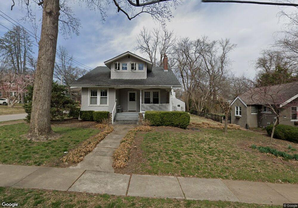
635 Elmwood Ave Saint Louis, MO 63119
Estimated Value: $368,000 - $649,000
4
Beds
1
Bath
1,523
Sq Ft
$320/Sq Ft
Est. Value
About This Home
This home is located at 635 Elmwood Ave, Saint Louis, MO 63119 and is currently estimated at $486,866, approximately $319 per square foot. 635 Elmwood Ave is a home located in St. Louis County with nearby schools including Avery Elementary School, Hixson Middle School, and Webster Groves High School.
Ownership History
Date
Name
Owned For
Owner Type
Purchase Details
Closed on
May 18, 2000
Sold by
Mccudden Sara S
Bought by
The Sara S Mccudden Living Trust
Current Estimated Value
Purchase Details
Closed on
Jul 18, 1997
Sold by
Reed Edwin Ajr & Virginia H Trs and Virginia H
Bought by
Mccudden Sara S
Home Financials for this Owner
Home Financials are based on the most recent Mortgage that was taken out on this home.
Original Mortgage
$110,400
Interest Rate
7.72%
Mortgage Type
Assumption
Create a Home Valuation Report for This Property
The Home Valuation Report is an in-depth analysis detailing your home's value as well as a comparison with similar homes in the area
Home Values in the Area
Average Home Value in this Area
Purchase History
| Date | Buyer | Sale Price | Title Company |
|---|---|---|---|
| The Sara S Mccudden Living Trust | -- | -- | |
| Mccudden Sara S | -- | -- |
Source: Public Records
Mortgage History
| Date | Status | Borrower | Loan Amount |
|---|---|---|---|
| Previous Owner | Mccudden Sara S | $110,400 |
Source: Public Records
Tax History Compared to Growth
Tax History
| Year | Tax Paid | Tax Assessment Tax Assessment Total Assessment is a certain percentage of the fair market value that is determined by local assessors to be the total taxable value of land and additions on the property. | Land | Improvement |
|---|---|---|---|---|
| 2025 | $4,555 | $75,870 | $71,250 | $4,620 |
| 2024 | $4,555 | $65,360 | $44,520 | $20,840 |
| 2023 | $4,533 | $65,360 | $44,520 | $20,840 |
| 2022 | $4,234 | $56,660 | $35,630 | $21,030 |
| 2021 | $4,220 | $56,660 | $35,630 | $21,030 |
| 2020 | $3,810 | $47,600 | $35,630 | $11,970 |
| 2019 | $3,783 | $47,600 | $35,630 | $11,970 |
| 2018 | $4,174 | $46,710 | $24,950 | $21,760 |
| 2017 | $4,146 | $46,710 | $24,950 | $21,760 |
| 2016 | $4,026 | $43,420 | $21,380 | $22,040 |
| 2015 | $4,042 | $43,420 | $21,380 | $22,040 |
| 2014 | $3,685 | $38,490 | $16,320 | $22,170 |
Source: Public Records
Map
Nearby Homes
- 400 Marion Ave
- 946 Newport Ave
- 544 Summit Ave
- 808 Greeley Ave
- 7723 Suffolk Ave
- 554 N Laclede Station Rd
- 570 N Laclede Station Rd
- 7826 Grove Ave
- 619 N Bompart Ave
- 716 Clark Ave
- 4 Saint Charles Place
- 6 Saint Charles Place
- 610 Cornelia Ave
- 940 Brookside Ave
- 25 Saint Charles Place
- 840 Marshall Ave
- 946 Marshall Ave Unit D
- 441 Park Rd
- 5000 Wilshusen Ave
- 1045 Tuxedo Blvd
- 643 Elmwood Ave
- 338 Fairlawn Ave
- 645 Elmwood Ave
- 311 Fairlawn Ave
- 309 Fairlawn Ave
- 313 Fairlawn Ave
- 653 Elmwood Ave
- 636 Elmwood Ave
- 307 Fairlawn Ave
- 640 Elmwood Ave
- 642 Elmwood Ave
- 644 Amelia Ave
- 345 Fairlawn Ave
- 657 Elmwood Ave
- 650 Amelia Ave
- 347 Fairlawn Ave
- 652 Elmwood Ave
- 625 Oakwood Ave
- 654 Amelia Ave
- 615 Oakwood Ave