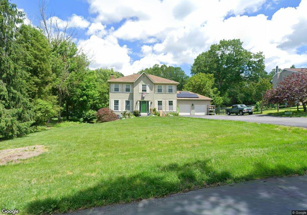
6353 Meadowland Dr Dunkirk, MD 20754
Estimated Value: $580,947 - $646,000
--
Bed
3
Baths
2,172
Sq Ft
$286/Sq Ft
Est. Value
About This Home
This home is located at 6353 Meadowland Dr, Dunkirk, MD 20754 and is currently estimated at $621,737, approximately $286 per square foot. 6353 Meadowland Dr is a home located in Anne Arundel County with nearby schools including Tracey's Elementary School, Southern Middle School, and Southern High School.
Ownership History
Date
Name
Owned For
Owner Type
Purchase Details
Closed on
Jul 28, 2004
Sold by
Wayne Robert A
Bought by
Moody Glynis A and Hardy Jacky L
Current Estimated Value
Purchase Details
Closed on
Jul 31, 1992
Sold by
Stadler Karl F
Bought by
Wayne Robert A
Home Financials for this Owner
Home Financials are based on the most recent Mortgage that was taken out on this home.
Original Mortgage
$202,300
Interest Rate
8.05%
Create a Home Valuation Report for This Property
The Home Valuation Report is an in-depth analysis detailing your home's value as well as a comparison with similar homes in the area
Home Values in the Area
Average Home Value in this Area
Purchase History
| Date | Buyer | Sale Price | Title Company |
|---|---|---|---|
| Moody Glynis A | $420,000 | -- | |
| Wayne Robert A | $214,000 | -- |
Source: Public Records
Mortgage History
| Date | Status | Borrower | Loan Amount |
|---|---|---|---|
| Previous Owner | Wayne Robert A | $202,300 | |
| Closed | Moody Glynis A | -- |
Source: Public Records
Tax History Compared to Growth
Tax History
| Year | Tax Paid | Tax Assessment Tax Assessment Total Assessment is a certain percentage of the fair market value that is determined by local assessors to be the total taxable value of land and additions on the property. | Land | Improvement |
|---|---|---|---|---|
| 2025 | $4,882 | $458,467 | -- | -- |
| 2024 | $4,882 | $430,133 | $0 | $0 |
| 2023 | $4,733 | $401,800 | $141,200 | $260,600 |
| 2022 | $4,441 | $401,800 | $141,200 | $260,600 |
| 2021 | $8,749 | $401,800 | $141,200 | $260,600 |
| 2020 | $4,270 | $402,700 | $156,200 | $246,500 |
| 2019 | $4,202 | $395,933 | $0 | $0 |
| 2018 | $3,946 | $389,167 | $0 | $0 |
| 2017 | $3,960 | $382,400 | $0 | $0 |
| 2016 | -- | $373,933 | $0 | $0 |
| 2015 | -- | $365,467 | $0 | $0 |
| 2014 | -- | $357,000 | $0 | $0 |
Source: Public Records
Map
Nearby Homes
- 6340 Mckendree Rd
- 461 Jewell Rd
- 411 W Mckendree Rd
- 99 Hummingbird Ct
- 6095 Solomons Island Rd
- 0 Fairhaven Rd
- 12761 Carronade Ct
- 12651 Vigilant Ct
- William Plan at The Vineyard
- 6007 Solomons Island Rd
- 5705 Iron Stone Rd
- 75 W Bay Front Rd
- 6690 Old Solomons Island Rd
- 6281 Franklin Gibson Rd
- 60 Friendship Rd
- 531 W Bay Front Rd
- 122 Valley View Farm Ln
- 1920 Aberdeen Dr
- 11216 Lakeview Dr
- 2850 Dunleigh Dr
- 6355 Meadowland Dr
- 6351 Meadowland Dr
- 6354 Meadowland Dr
- 6357 Meadowland Dr
- 286 Jewell Rd
- 6350 Meadowland Dr
- 6349 Meadowland Dr
- 6348 Meadowland Dr
- 6342 Northbrook Dr
- 275 Southdale Ct
- 6358 Northbrook Dr
- 6362 Fieldcrest Ct
- 287 Jewell Rd
- 6346 Northbrook Dr
- 6350 Northbrook Dr
- 276 Southdale Ct
- 6354 Northbrook Dr
- 278 Southdale Ct
- 289 Jewell Rd
- 6338 Northbrook Dr