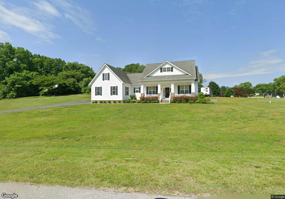
6354 Earl St Owings, MD 20736
Estimated Value: $677,462 - $719,000
--
Bed
1
Bath
2,129
Sq Ft
$331/Sq Ft
Est. Value
About This Home
This home is located at 6354 Earl St, Owings, MD 20736 and is currently estimated at $704,616, approximately $330 per square foot. 6354 Earl St is a home located in Calvert County with nearby schools including Sunderland Elementary School, Northern Middle School, and Northern High School.
Ownership History
Date
Name
Owned For
Owner Type
Purchase Details
Closed on
Jan 30, 2014
Sold by
King Richard F
Bought by
King Richard F and King Elyse C
Current Estimated Value
Purchase Details
Closed on
Jun 25, 2009
Sold by
King Donald F and King Linda T
Bought by
King Richard F
Purchase Details
Closed on
Feb 11, 2002
Sold by
King Edwin F
Bought by
King Donald F and King Linda T
Purchase Details
Closed on
Aug 1, 2001
Sold by
King G Earl
Bought by
King Edwin F
Create a Home Valuation Report for This Property
The Home Valuation Report is an in-depth analysis detailing your home's value as well as a comparison with similar homes in the area
Home Values in the Area
Average Home Value in this Area
Purchase History
| Date | Buyer | Sale Price | Title Company |
|---|---|---|---|
| King Richard F | -- | None Available | |
| King Richard F | -- | -- | |
| King Donald F | -- | -- | |
| King Edwin F | -- | -- |
Source: Public Records
Tax History Compared to Growth
Tax History
| Year | Tax Paid | Tax Assessment Tax Assessment Total Assessment is a certain percentage of the fair market value that is determined by local assessors to be the total taxable value of land and additions on the property. | Land | Improvement |
|---|---|---|---|---|
| 2025 | $5,625 | $542,067 | $0 | $0 |
| 2024 | $5,625 | $501,200 | $167,900 | $333,300 |
| 2023 | $5,139 | $480,033 | $0 | $0 |
| 2022 | $4,917 | $458,867 | $0 | $0 |
| 2021 | $4,584 | $437,700 | $167,900 | $269,800 |
| 2020 | $4,584 | $425,433 | $0 | $0 |
| 2019 | $4,473 | $413,167 | $0 | $0 |
| 2018 | $4,332 | $400,900 | $167,900 | $233,000 |
| 2017 | $4,388 | $400,900 | $0 | $0 |
| 2016 | -- | $400,900 | $0 | $0 |
| 2015 | $2,955 | $407,400 | $0 | $0 |
| 2014 | $2,955 | $250,100 | $0 | $0 |
Source: Public Records
Map
Nearby Homes
- 1965 Lowery Rd
- 2550 Redbud Ln
- 2520 Lower Marlboro Rd
- 6440 Briarwood Dr
- 7120 Bluegrass Way
- 6030 Clairemont Dr
- 5650 Collington Ct
- 1030 Stephen Reid Dr
- 1730 Pinkneys Field Dr
- 360 Hoile Ln
- 3446 Chaneyville Rd
- 215 Hoile Ln
- 550 Carla Dr
- 5460 Solomons Island Rd
- 125 Prospect Dr
- 331 C Jones Rd
- 7425 Danbridge Ln
- 4618 Green Ridge Ct
- 7818 Lake Shore Dr
- 1021 Concord Ct
- 2124 Lower Marlboro Rd
- 6360 Dant Dr
- 6410 Dant Dr
- 2130 Lower Marlboro Rd
- 6300 Earl St
- 6355 Earl St
- 6375 Earl St
- 6305 Earl St
- 2141 Lower Marlboro Rd
- 6350 Dant Dr
- 6270 Earl St
- 6325 Earl St
- 2151 Lower Marlboro Rd
- 6390 Dant Dr
- 6400 Dant Dr
- 2150 Lower Marlboro Rd
- 6380 Dant Dr
- 6295 Earl St
- 2121 Lower Marlboro Rd
- 6275 Earl St