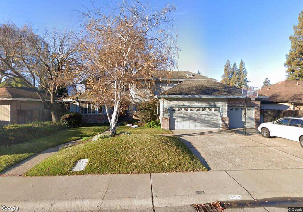
6370 Grangers Dairy Dr Unit D Sacramento, CA 95831
Pocket-Greenhaven NeighborhoodEstimated Value: $810,000 - $895,000
4
Beds
3
Baths
2,456
Sq Ft
$349/Sq Ft
Est. Value
About This Home
This home is located at 6370 Grangers Dairy Dr Unit D, Sacramento, CA 95831 and is currently estimated at $857,618, approximately $349 per square foot. 6370 Grangers Dairy Dr Unit D is a home located in Sacramento County with nearby schools including Genevieve Didion School, Sam Brannan Middle School, and John F. Kennedy High School.
Ownership History
Date
Name
Owned For
Owner Type
Purchase Details
Closed on
Jun 23, 2016
Sold by
Gassaway Scott L and Gassaway Ledith E
Bought by
Quok Matthew and Vuong Lan
Current Estimated Value
Home Financials for this Owner
Home Financials are based on the most recent Mortgage that was taken out on this home.
Original Mortgage
$466,400
Outstanding Balance
$371,203
Interest Rate
3.57%
Mortgage Type
New Conventional
Estimated Equity
$486,415
Create a Home Valuation Report for This Property
The Home Valuation Report is an in-depth analysis detailing your home's value as well as a comparison with similar homes in the area
Home Values in the Area
Average Home Value in this Area
Purchase History
| Date | Buyer | Sale Price | Title Company |
|---|---|---|---|
| Quok Matthew | $583,000 | Placer Title Company |
Source: Public Records
Mortgage History
| Date | Status | Borrower | Loan Amount |
|---|---|---|---|
| Open | Quok Matthew | $466,400 |
Source: Public Records
Tax History Compared to Growth
Tax History
| Year | Tax Paid | Tax Assessment Tax Assessment Total Assessment is a certain percentage of the fair market value that is determined by local assessors to be the total taxable value of land and additions on the property. | Land | Improvement |
|---|---|---|---|---|
| 2025 | $8,195 | $690,146 | $165,728 | $524,418 |
| 2024 | $8,195 | $676,615 | $162,479 | $514,136 |
| 2023 | $7,996 | $663,349 | $159,294 | $504,055 |
| 2022 | $7,878 | $650,343 | $156,171 | $494,172 |
| 2021 | $7,500 | $637,592 | $153,109 | $484,483 |
| 2020 | $7,560 | $631,056 | $151,540 | $479,516 |
| 2019 | $7,400 | $618,683 | $148,569 | $470,114 |
| 2018 | $7,209 | $606,553 | $145,656 | $460,897 |
| 2017 | $7,107 | $594,660 | $142,800 | $451,860 |
| 2016 | $4,397 | $356,790 | $114,379 | $242,411 |
| 2015 | $4,329 | $351,431 | $112,661 | $238,770 |
| 2014 | $4,222 | $344,548 | $110,455 | $234,093 |
Source: Public Records
Map
Nearby Homes
- 6235 Allenport Way
- 0 Riverside Blvd
- 6980 Riverside Blvd
- 487 Twin River Way
- 792 Parklin Ave
- 10 Fleet Ct
- 14 Westlite Ct
- 37 Starlit Cir
- 64 Moonlit Cir
- 7262 Harbor Light Way
- 7232 Bayview Way
- 26 Marina Grande Ct
- 763 La Contenta Way
- 959 Johnfer Way
- 989 Johnfer Way
- 966 Briarcrest Way
- 2205 Davis Rd
- 4057 Southampton St
- 4074 Southampton St
- 3236 Boston Rd
- 6360 Grangers Dairy Dr Unit D
- 6390 Grangers Dairy Dr
- 6389 Faustino Way
- 6405 Faustino Way
- 6350 Grangers Dairy Dr Unit D
- 6350 Grangers Dairy Dr
- 6400 Grangers Dairy Dr Unit D
- 6373 Faustino Way
- 6411 Faustino Way
- 6359 Grangers Dairy Dr
- 6357 Faustino Way
- 6383 Grangers Dairy Dr Unit D
- 6410 Grangers Dairy Dr Unit D
- 6338 Grangers Dairy Dr
- 6417 Faustino Way
- 6406 Faustino Way
- 6353 Grangers Dairy Dr Unit D
- 6401 Grangers Dairy Dr Unit D
- 6414 Faustino Way
- 6398 Faustino Way