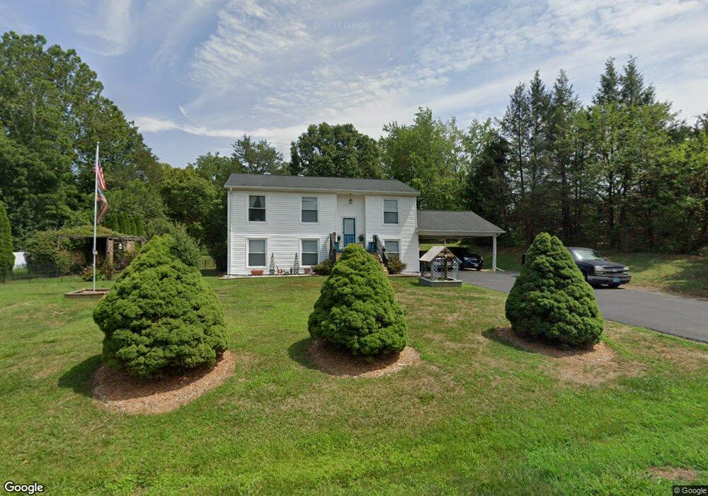
6388 Lancaster Dr Warrenton, VA 20187
Estimated Value: $529,000 - $574,000
4
Beds
3
Baths
1,952
Sq Ft
$286/Sq Ft
Est. Value
About This Home
This home is located at 6388 Lancaster Dr, Warrenton, VA 20187 and is currently estimated at $558,491, approximately $286 per square foot. 6388 Lancaster Dr is a home located in Fauquier County with nearby schools including P.B. Smith Elementary School, Marshall Middle School, and Fauquier High School.
Ownership History
Date
Name
Owned For
Owner Type
Purchase Details
Closed on
May 25, 2005
Sold by
Giampa Nicholas
Bought by
Randolph Gary
Current Estimated Value
Home Financials for this Owner
Home Financials are based on the most recent Mortgage that was taken out on this home.
Original Mortgage
$245,000
Outstanding Balance
$128,564
Interest Rate
5.94%
Mortgage Type
New Conventional
Estimated Equity
$429,927
Purchase Details
Closed on
Jan 21, 2005
Sold by
Bludau Owen
Bought by
Giampa Nicholas
Create a Home Valuation Report for This Property
The Home Valuation Report is an in-depth analysis detailing your home's value as well as a comparison with similar homes in the area
Home Values in the Area
Average Home Value in this Area
Purchase History
| Date | Buyer | Sale Price | Title Company |
|---|---|---|---|
| Randolph Gary | $395,000 | -- | |
| Giampa Nicholas | $257,500 | -- |
Source: Public Records
Mortgage History
| Date | Status | Borrower | Loan Amount |
|---|---|---|---|
| Open | Randolph Gary | $245,000 |
Source: Public Records
Tax History Compared to Growth
Tax History
| Year | Tax Paid | Tax Assessment Tax Assessment Total Assessment is a certain percentage of the fair market value that is determined by local assessors to be the total taxable value of land and additions on the property. | Land | Improvement |
|---|---|---|---|---|
| 2025 | $3,933 | $406,700 | $135,000 | $271,700 |
| 2024 | $3,849 | $406,700 | $135,000 | $271,700 |
| 2023 | $3,686 | $406,700 | $135,000 | $271,700 |
| 2022 | $3,686 | $406,700 | $135,000 | $271,700 |
| 2021 | $2,811 | $281,400 | $120,000 | $161,400 |
| 2020 | $2,811 | $281,400 | $120,000 | $161,400 |
| 2019 | $2,811 | $281,400 | $120,000 | $161,400 |
| 2018 | $2,777 | $281,400 | $120,000 | $161,400 |
| 2016 | $2,449 | $234,400 | $110,000 | $124,400 |
| 2015 | -- | $234,400 | $110,000 | $124,400 |
| 2014 | -- | $234,400 | $110,000 | $124,400 |
Source: Public Records
Map
Nearby Homes
- 7213 Princess Anne Ct
- 6397 Tazewell St
- 7333 Hazelwood Ct
- 6416 Airlie Rd
- 0 Hwy Unit VAFQ2018052
- 0 Airlie Road Lee Hwy Unit VAFQ2018058
- 7241 Blackwell Rd
- 7245 Blackwell Rd
- 7253 Blackwell Rd
- 7038 Beaconsfield Ln
- 7323 Bayfield Ln
- 7631 Movern Ln
- 541 Highland Towne Ln
- LOT 1 Blackwell Rd
- 7176 Homestead Ct
- 315 Winterset Ln
- 6288 Redwinged Blackbird Dr
- 7040 Hi Rock Ridge Rd
- 2 Millfield Dr
- 535 Winchester St
- 6396 Lancaster Dr
- 6400 Nordix Dr
- 6390 Nordix Dr
- 6400 Lancaster Dr
- 6389 Lancaster Dr
- 6410 Nordix Dr
- 7343 Westmoreland Dr
- 6399 Nordix Dr
- 6406 Lancaster Dr
- 7336 Westmoreland Dr
- 6405 Lancaster Dr
- 7333 Westmoreland Dr
- 6416 Nordix Dr
- 6381 Nordix Dr
- 7226 Hunton St
- 6412 Lancaster Dr
- 7215 Marr Dr
- 7332 Westmoreland Dr
- 7229 Hunton St
- 6411 Lancaster Dr